Plaines des Roches
Koordinaten: 20° 7′ S, 57° 42′ O
Plaines des Roches ist eine Ortschaft („Village“) auf Mauritius.
Der Nordteil von Plaines des Roches gehört zum Distrikt Rivière du Rempart, der Südteil liegt im Distrikt Flacq. Bei der Volkszählung 2011 hatte der Ort 4.020 Einwohner (davon 265 im Distrikt Flacq und 3.755 im Distrikt Rivière du Rempart). Beide Teile gehören administrativ zur Village Council Area Plaines des Roches.[1]
Der Ort hat seinen Namen von den Basaltfelsen, die die Gegend prägen (Roche ist das französische WOrt für Fels). Die Felsen stammen aus vulkanischen Aktivitäten vor etwa 25.000 Jahren.
Nach dem Zweiten Weltkrieg bestanden Planungen der Regierung, in Plaines des Roches einen Flugplatz anzulegen. Diese Planungen wurden jedoch nicht weiterverfolgt. Der Ort lebt von der Landwirtschaft, überwiegend dem Anbau von Tabak und Zuckerrohr. 2004 wurden in der Gemeinde 10.401 Tonnen Zuckerrohr geerntet.
In Plaines des Roches befindet sich die Pardooman Shibchurn Government School.
Literatur
- Benjamin Moutou: Pamplemousses - Riviére du Rempart - Quatre siécles d’histoire, 2006, ISBN 978-99903-992-9-5, S. 325
Einzelnachweise
- ↑ Statistics Mauritius: Housing and population census 2011, Volume II: Demographic and fertility characteristics, S. 71-72, statsmauritius.govmu.org (PDF): die Werte für beide Distrikte müssen addiert werden.
Auf dieser Seite verwendete Medien
Autor/Urheber: Yashveer Poonit, Lizenz: CC BY-SA 3.0
The armorial ensigns and supporters of Mauritius are described as:
(a) for arms-
- Quarterly azure and or.
- In the first quarter a lymphad or.
- In the second, 3 palm trees vert.
- In the third, a key in pale the wards downwards gules.
- In the issuant, from the base a pile, and in chief a mullet argent.
(b) for the supporters-
- On the dexter side, a dodo per bend sinister embattled gules and argent, and
- On the sinister side, a sambur deer per bend embattled argent and gules, each supporting a sugar cane erect proper,
(c) Uwe Dedering in der Wikipedia auf Deutsch, CC BY-SA 3.0
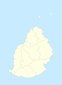
Location map of Mauritius
Equirectangular projection. Stretched by 106.0%. Geographic limits of the map:
- N: -19.7° N
- S: -20.6° N
- W: 57.21° E
- E: 57.91° E


