Pic de Nahouri
| Pic de Nahouri | ||
|---|---|---|
 Der Pic de Nahouri | ||
| Höhe | 447 m | |
| Lage | Burkina Faso | |
| Koordinaten | 11° 4′ 8″ N, 1° 5′ 21″ W | |
| Typ | Inselberg | |
Der Pic de Nahouri ist ein Inselberg südlich der Stadt Pô in Burkina Faso. Er ist 447 m hoch. Ein Gebiet von 836 ha rund um den Berg ist seit 1938 als Forêt Classée du Pic de Nahouri unter Naturschutz gestellt, außerdem ist der Pic de Nahouri ein lokales Naturheiligtum. Vom Pic de Nahouri hat man gegen Süden einen Blick bis nach Ghana.
Seit 2009 findet jährlich ein Halbmarathon von Pô auf den Gipfel statt.[1]
Einzelnachweise
- ↑ Altitude Nahouri Semi-Marathon. Nouvelles du Marathon. In: altitudenahouri.org. Leader des Télécommunications au Burkina Faso, abgerufen am 19. April 2021 (französisch).
Auf dieser Seite verwendete Medien
Autor/Urheber: Uwe Dedering, Lizenz: CC BY-SA 3.0
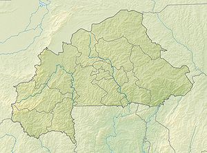
Location map of Burkina Faso Equirectangular projection. Strechted by 102%. Geographic limits of the map:
  * N: 15.5° N
  * S: 9° N
  * W: 6° W
  * E: 3° E
Made with Natural Earth. Free vector and raster map data @ naturalearthdata.com.
Autor/Urheber: Marco Schmidt [1], Lizenz: CC BY-SA 2.5
Pic de Nahouri, Burkina Faso.
Autor/Urheber: Marco Schmidt [1], Lizenz: CC BY-SA 2.5
Pic de Nahouri near Pô in Burkina Faso


