Parks (Arizona)
| Parks | |
|---|---|
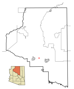
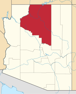
Lage in Arizona | |
| Basisdaten | |
| Staat: | Vereinigte Staaten |
| Bundesstaat: | Arizona |
| County: | Coconino County |
| Koordinaten: | 35° 17′ N, 111° 58′ W |
| Zeitzone: | Mountain Standard Time (UTC−7) |
| Einwohner: | 1.382 (Stand: 2020) |
| Haushalte: | 587 (Stand: 2020) |
| Fläche: | 446,2 km² (ca. 172 mi²) davon 446,2 km² (ca. 172 mi²) Land |
| Bevölkerungsdichte: | 3 Einwohner je km² |
| Höhe: | 2158 m |
| Postleitzahl: | 86018 |
| Vorwahl: | +1 928 |
| FIPS: | 04-53350 |
| GNIS-ID: | 0032699 |
Parks ist ein Census-designated place im Coconino County im US-Bundesstaat Arizona. Das U.S. Census Bureau hat bei der Volkszählung 2020 eine Einwohnerzahl von 1.382[1] auf einer Fläche von 446,2 km² ermittelt. Die Bevölkerungsdichte liegt bei 3 Einwohnern pro km².
Südlich der Stadt verläuft die Interstate 40.
Weblinks
Einzelnachweise
- ↑ Explore Census Data Parks CDP, Arizona. Abgerufen am 21. Oktober 2022.
Auf dieser Seite verwendete Medien
Autor/Urheber: Arkyan, Lizenz: CC BY-SA 3.0
This map shows the incorporated areas and Indian reservations in Coconino County, Arizona, highlighting Parks in red. I created it in Inkscape using data from the Coconino county government website and the US Census Bureau.


