Ocala National Forest
| Ocala National Forest | ||
|---|---|---|
 | ||
| Lage: | Florida, Vereinigte Staaten | |
| Nächste Stadt: | Ocala | |
| Fläche: | 1572 km² | |
| Gründung: | 1908 | |
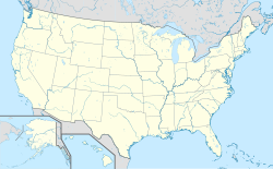
Der Ocala National Forest ist ein Nationalforst im zentralnördlichen US-Bundesstaat Florida, in den Vereinigten Staaten. Er liegt nördlich der Stadt Orlando zwischen den Flüssen des Ocklawaha und dem St. Johns. Der Ocala National Forest erstreckt sich über die Countys Lake County, Marion County und Putnam County, wobei der Großteil des Nationalforsts in Marion County liegt. Der Nationalforst umfasst eine Fläche von 1550 Quadratkilometern. Er wurde 1908 gegründet und wird vom United States Forest Service verwaltet.
Natur
Im Ocala National Forest gibt es das größte zusammenhängende Sand-Kiefern-Vorkommen der Welt. Ein hohes Wasservorkommen prägt den Wald, der mehr als 600 Seen, Flüsse und Quellen beherbergt.[1]
Einzelnachweise
Weblinks
Auf dieser Seite verwendete Medien
Autor/Urheber: TUBS
Location map of the USA (Hawaii and Alaska shown in sidemaps).
Main map: EquiDistantConicProjection : Central parallel :
* N: 37.0° N
Central meridian :
* E: 96.0° W
Standard parallels:
* 1: 32.0° N
* 2: 42.0° N
Made with Natural Earth. Free vector and raster map data @ naturalearthdata.com.
Formulas for x and y:
x = 50.0 + 124.03149777329222 * ((1.9694462586094064-({{{2}}}* pi / 180))
      * sin(0.6010514667026994 * ({{{3}}} + 96) * pi / 180))
y = 50.0 + 1.6155950752393982 * 124.03149777329222 * 0.02613325650382181
      - 1.6155950752393982  * 124.03149777329222 *
     (1.3236744353715044  - (1.9694462586094064-({{{2}}}* pi / 180))
      * cos(0.6010514667026994 * ({{{3}}} + 96) * pi / 180))
Hawaii side map: Equirectangular projection, N/S stretching 107 %. Geographic limits of the map:
- N: 22.4° N
- S: 18.7° N
- W: 160.7° W
- E: 154.6° W
Alaska side map: Equirectangular projection, N/S stretching 210.0 %. Geographic limits of the map:
- N: 72.0° N
- S: 51.0° N
- W: 172.0° E
- E: 129.0° W
Juniper Springs, Ocala National Forest, 2007. Photo by Michael Messina.


