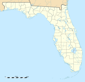
Ocala International Airport
| Ocala International Airport | ||
|---|---|---|
 | ||
| Kenndaten | ||
| ICAO-Code | KOCF | |
| IATA-Code | OCF | |
| Koordinaten | ||
| Höhe über MSL | 27 m (89 ft) | |
| Verkehrsanbindung | ||
| Entfernung vom Stadtzentrum | 8 km westlich von Ocala | |
| Basisdaten | ||
| Terminals | 1 | |
| Start- und Landebahnen | ||
| 18/36 | 2276 m × 46 m Asphalt | |
| 08/26 | 917 m × 15 m Asphalt | |
Der Flughafen Ocala, auch Ocala International Airport genannt, ist der regionale Flughafen der Stadt Ocala im US-Bundesstaat Florida. Der Flughafen dient der allgemeinen Luftfahrt. Er wird derzeit (2022) nicht im Linienverkehr angeflogen. Der nächste Flughafen mit Linienflügen ist der Flughafen der Stadt Gainesville (ca. 50 Kilometer nördlich).
Geschichte
Der Flughafen wurde in den frühen 1960er-Jahren eröffnet. Angeflogen wurde er bis 1987 von Eastern Airlines mit den Zielen Gainesville und Jacksonville.
Sonstiges
Im Terminal gibt es diverse Unternehmen mit Bezug zur Luftfahrt und Autovermietungen.
Weblinks
Auf dieser Seite verwendete Medien
Autor/Urheber: TUBS
Location map of the USA (Hawaii and Alaska shown in sidemaps).
Main map: EquiDistantConicProjection : Central parallel :
* N: 37.0° N
Central meridian :
* E: 96.0° W
Standard parallels:
* 1: 32.0° N
* 2: 42.0° N
Made with Natural Earth. Free vector and raster map data @ naturalearthdata.com.
Formulas for x and y:
x = 50.0 + 124.03149777329222 * ((1.9694462586094064-({{{2}}}* pi / 180))
      * sin(0.6010514667026994 * ({{{3}}} + 96) * pi / 180))
y = 50.0 + 1.6155950752393982 * 124.03149777329222 * 0.02613325650382181
      - 1.6155950752393982  * 124.03149777329222 *
     (1.3236744353715044  - (1.9694462586094064-({{{2}}}* pi / 180))
      * cos(0.6010514667026994 * ({{{3}}} + 96) * pi / 180))
Hawaii side map: Equirectangular projection, N/S stretching 107 %. Geographic limits of the map:
- N: 22.4° N
- S: 18.7° N
- W: 160.7° W
- E: 154.6° W
Alaska side map: Equirectangular projection, N/S stretching 210.0 %. Geographic limits of the map:
- N: 72.0° N
- S: 51.0° N
- W: 172.0° E
- E: 129.0° W
Autor/Urheber: DanTD, Lizenz: CC BY-SA 4.0
Sign between the entrance and exit at the terminal of Ocala International Airport on Southwest 60th Avenue in western Ocala, Florida. Taken from my car at the exit from the terminal.


