Obsidian Cliff
| Obsidian Cliff | ||
|---|---|---|
| National Register of Historic Places | ||
| National Historic Landmark | ||
 Obsidian Cliff | ||
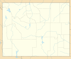
| Lage | Yellowstone-Nationalpark, Park County, Wyoming | |
| Koordinaten | 44° 49′ 8″ N, 110° 43′ 40″ W | |
| Fläche | 14,5 km² | |
| NRHP-Nummer | 96000973 | |
| Daten | ||
| Ins NRHP aufgenommen | 19. Juni 1996 | |
| Als NHL deklariert | 19. Juni 1996 | |
Das Obsidian Cliff ist ein Kliff im Yellowstone-Nationalpark, das aus Obsidian besteht, einem vulkanischen Gesteinsglas. Am 19. Juni 1996 wurde es in die Liste der National Historic Landmarks aufgenommen und damit vom US-Innenministerium als Stätte von besonderer historischer Bedeutung eingestuft sowie als Stätte in das National Register of Historic Places eingetragen.[1]
Das Obsidian Cliff liegt etwa auf halbem Weg zwischen Mammoth Hot Springs und Norris Junction am nördlichen Ende des Beaver Lake. Es befindet sich auf 2250 m über NN und ragt zwischen 45 und 60 Meter über den Obsidian Creek.
Geschichte
Die Bannock und andere Indianervölker verwendeten bereits vor mindestens 11.000 Jahren Obsidian aus dem Kliff für Pfeilspitzen. Als einer der ersten Weißen erwähnte der Trapper Jim Bridger den „gläsernen Berg“. Seine Zuhörer taten diese Schilderung als Lügengeschichte ab.
Den Namen erhielt die Formation von Philetus Walter Norris, dem zweiten Superintendent des Yellowstone-Nationalparkes zwischen 1877 und 1882.
Weblinks
- Obsidian Cliff. Wyoming State Historic Preservation Office, abgerufen am 16. August 2014 (englisch).
- Obsidian Cliff. National Park Service, 23. Juli 2013, abgerufen am 16. August 2014 (englisch).
Einzelnachweise
- ↑ Obsidian Cliff im National Register of Historic Places, abgerufen am 14. März 2020.
Listing of National Historic Landmarks by State: Wyoming. National Park Service, abgerufen am 14. März 2020.
Auf dieser Seite verwendete Medien
Autor/Urheber: James St. John, Lizenz: CC BY 2.0
Obsidian in the Pleistocene of Wyoming, USA.
Obsidian is a glassy-textured, extrusive igneous rock. Glassy-textured rocks have no crystals at all. They form by very rapid cooling of lava or by cooling of high-viscosity lava. Most obsidians form by the latter. Obsidian can be felsic, intermediate, mafic, or alkaline in chemistry. Most are felsic to intermediate.
A famous locality in North America is Obsidian Cliff at Yellowstone, Wyoming. It is a Pleistocene-aged lava flow with the chemistry of rhyolite (= a light-colored, felsic, aphanitic, extrusive igneous rock). The cliff itself shows columnar jointing, which formed by cooling and contraction. The rocks principally range from black-colored, aphyric rhyolitic obsidian to partially devitrified rhyolitic obsidian. Lithophysae are sometimes present. Extremely small, microscopic crystals are present - they can be seen in thin sections. Some samples are reported to have small olivine phenocrysts. Small clusters of crystals, composed of plagioclase feldspar, pyroxene, and olivine, are sometimes present.
Many of the whitish-colored spots and bands running through most Obsidian Cliff rock samples are areas of devitrification. Glass is unstable on geologic times scales and it slowly crystallizes. The light-colored spots and bands are now non-glassy. Spotted, partially devitrified obsidian is known by the rockhound term "snowflake obsidian" (see: <a href="https://www.flickr.com/photos/jsjgeology/16561606417">www.flickr.com/photos/jsjgeology/16561606417</a>). The spots are composed of silica (SiO2), but are not quartz. Rather, they are composed of a polymorph of quartz - cristobalite.
Why does Obsidian Cliff here not look black and glassy? The rocks are weathered, partially devitrified, and considerably lichen-covered. Classic, black, glassy obsidian can be seen in some of the boulders along the road.
Stratigraphy: Roaring Mountain Member, Plateau Rhyolite, Upper Pleistocene, ~59 ka
Locality: Obsidian Cliff, eastern edge of Obsidian Creek Valley, Yellowstone National Park, northwestern Wyoming, USA
Age & some lithologic info. from:
Wooton (2010) - Age and Petrogenesis of the Roaring Mountain Rhyolites, Yellowstone Volcanic Field, Wyoming. M.S. thesis. University of Nevada at Las Vegas. 296 pp.Autor/Urheber: Alexrk, Lizenz: CC BY 3.0
Positionskarte von Wyoming, USA


