North Country Trail

Der North Country National Scenic Trail (NCT) ist ein Fernwanderweg in den Vereinigten Staaten.
Der Wanderweg ist mit etwa 7400 km (in der Endausbaustufe) der längste National Scenic Trail und durchquert sieben Bundesstaaten. Von Crown Point in New York geht es durch Pennsylvania, Ohio, Michigan, Wisconsin, Minnesota zum Lake Sakakawea State Park in North Dakota. Eröffnet wurde er in Teilabschnitten seit 1980.
Der NCT wird vom National Park Service verwaltet, einer Bundesbehörde.
Bilder
- North Country Trail

Ein Abschnitt im Brule River State Forest.

Die Wren Falls in Iron County (Wisconsin).

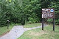
Hinweisschild
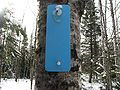
Blaue Wegmarkierung
Trailschild im Copper Falls State Park
Siehe auch
- North Coast Inland Trail
- Offizielle Website
Weblinks
Auf dieser Seite verwendete Medien

Autor/Urheber: Ich, der Urheber dieses Werkes, veröffentliche es unter der folgenden Lizenz:, Lizenz: CC BY-SA 3.0
Diese Datei wurde mit Commonist hochgeladen.

Autor/Urheber: MDuchek, Lizenz: CC BY-SA 3.0
North Country Trail - Wren Falls, Iron County, WI
Autor/Urheber:
- USA_location_map.svg: NordNordWest
- derivative work: Bamyers99 (talk)
Locator map of the United States ("lower 48") with the North Country Trail overlayed. Equirectangular projection, N/S stretching 120 %. Geographic limits of the map:
- N: 49.8° N
- S: 24.2° N
- W: 125.5° W
- E: 66.5° W

Autor/Urheber: MDuchek, Lizenz: CC BY-SA 3.0
The blue blaze marking the path of the North Country Trail — in the northern United States.

Autor/Urheber: MDuchek, Lizenz: CC BY-SA 3.0
A post marking the path of the North Country Trail — in the northern United States.

Autor/Urheber: MDuchek, Lizenz: CC BY-SA 3.0
North Country Trail - Wisconsin, Brule Bog, Douglas Co.