North Beacon Street Bridge
| North Beacon Street Bridge | ||
|---|---|---|
| Die North Beacon Street Bridge im April 2009 | ||
| Überführt | ||
| Querung von | Charles River | |
| Ort | Watertown und Boston, Massachusetts, Vereinigte Staaten | |
| Unterhalten durch | Massachusetts Department of Transportation | |
| Bauwerknummer | MA B16014 | |
| Konstruktion | Bogenbrücke aus Beton | |
| Gesamtlänge | 205,1 ft (62,5 m) | |
| Breite | 54,1 ft (16,5 m) | |
| Längste Stützweite | 75,1 ft (22,9 m) | |
| Fahrzeuge pro Tag | 19.900 (Stand: 1997) | |
| Eröffnung | 1917 | |
| Lage | ||
| Koordinaten | 42° 21′ 34″ N, 71° 9′ 43″ W | |
Die North Beacon Street Bridge ist eine Bogenbrücke im Bundesstaat Massachusetts der Vereinigten Staaten, die den dort als North Beacon Street ausgewiesenen U.S. Highway 20 von Watertown in den Bostoner Stadtteil Brighton über den Charles River führt. Das Bauwerk wurde 1917 errichtet.[1]
Das südliche Ende der Brücke ist zugleich das westliche Ende der Soldiers Field Road, während sich ihr nördliches Ende am westlichen Ende des Greenough Boulevard, einer Verlängerung des Memorial Drive, befindet.
Die North Beacon Street, die über die Brücke führt, ist nicht zu verwechseln mit der bekannten Bostoner Beacon Street.
Siehe auch
Einzelnachweise
- ↑ Charles River Basin Master Plan. (PDF; 1,1 MB) Department of Conservation and Recreation, S. 151, abgerufen am 9. Dezember 2012 (englisch).
Weblinks
| Flussaufwärts Watertown Bridge | Querungen des Charles River North Beacon Street Bridge | Flussabwärts Arsenal Street Bridge |
Auf dieser Seite verwendete Medien
600 mm by 600 mm (24 in by 24 in) Massachusetts Route shield, made to the specifications of the 1996 edition of Construction and Traffic Standard Details (sign M1-5). Uses the Roadgeek 2005 fonts. (United States law does not permit the copyrighting of typeface designs, and the fonts are meant to be copies of a U.S. Government-produced work anyway.) The outside border has a width of 1 (1 mm) and a color of black so it shows up; in reality, signs have no outside border. The specs actually do not show the curve on the outside border, instead making it a perfect square, but all signs I have seen round the corners.
Official highway sign placed along many state highways indicating a corporate boundary. This sign indicates entering the city of Boston.
Autor/Urheber: Alexrk2, Lizenz: CC BY 3.0
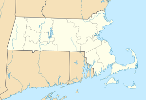
Positionskarte von Massachusetts, USA
Autor/Urheber: Antony-22, Lizenz: CC BY-SA 3.0
The North Beacon Street Bridge over the Charles River, in Watertown, MA and Brighton, Boston, MA, in April 2009.
600 mm × 600 mm (24 in × 24 in) U.S. Highway shield, made to the specifications of the 2004 edition of Standard Highway Signs. (Note that there is a missing "J" label on the left side of the diagram.) Uses the Roadgeek 2005 fonts. (United States law does not permit the copyrighting of typeface designs, and the fonts are meant to be copies of a U.S. Government-produced work anyway.)


