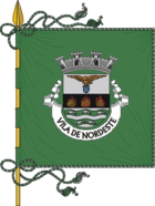
Nordeste
| Nordeste | ||||||
|---|---|---|---|---|---|---|
| ||||||
| Basisdaten | ||||||
| Autonome Region: | Azoren | |||||
| Concelho: | Nordeste | |||||
| Koordinaten: | 37° 50′ N, 25° 9′ W | |||||
| Einwohner: | 1160 (Stand: 19. April 2021)[1] | |||||
| Fläche: | 23,13 km² (Stand: 1. Januar 2010)[2] | |||||
| Bevölkerungsdichte: | 50 Einwohner pro km² | |||||
| Höhe: | 179 m | |||||
| Kreis Nordeste | ||||||
| ||||||
| Einwohner: | 4368 (Stand: 19. April 2021)[3] | |||||
| Fläche: | 101,46 km² (Stand: 1. Januar 2010)[2] | |||||
| Bevölkerungsdichte: | 43 Einwohner pro km² | |||||
| Anzahl der Gemeinden: | 9 | |||||
| Verwaltung | ||||||
| Website: | cmnordeste.pt | |||||
Nordeste () ist ein portugiesischer Ort (Freguesia) auf der Azoreninsel São Miguel, aber auch der gleichnamige Kreis (Município) im Nordosten der Insel.
Die folgenden neun Gemeinden gehören zum Kreis Nordeste:

| Gemeinde | Einwohner (2021) | Fläche km² | Dichte Einw./km² | LAU- Code |
|---|---|---|---|---|
| Achada | 387 | 11,89 | 33 | 420201 |
| Achadinha | 463 | 12,41 | 37 | 420202 |
| Algarvia | 240 | 5,40 | 44 | 420208 |
| Lomba da Fazenda | 749 | 14,77 | 51 | 420203 |
| Nordeste | 1.160 | 23,13 | 50 | 420204 |
| Salga | 484 | 7,71 | 63 | 420206 |
| Santana | 380 | 6,12 | 62 | 420207 |
| Santo António de Nordestinho | 260 | 7,94 | 33 | 420209 |
| São Pedro de Nordestinho | 245 | 12,09 | 20 | 420210 |
| Kreis Nordeste | 4.368 | 101,46 | 43 | 4202 |
In Nordeste gibt es eine Primarschule, eine Realschule, ein Gymnasium und eine Kirche.
| Atlantischer Ozean | ||
| Ribeira Grande |  | Atlantischer Ozean |
| Povoação |
Gemeindeteile
| Gemeindeteil | Geografische Lage | Höhe |
|---|---|---|
| Lomba do Moio | 37° 48′ N, 025° 08′ W | Atlantischer Ozean |
| Lomba da Pedreira | 37° 48′ N, 025° 09′ W | 15 m |
Einzelnachweise
- ↑ www.ine.pt – Indikator Resident population by Place of residence and Sex; Decennial in der Datenbank des Instituto Nacional de Estatística
- ↑ a b Übersicht über Code-Zuordnungen von Freguesias auf epp.eurostat.ec.europa.eu
- ↑ www.ine.pt – Indikator Resident population by Place of residence and Sex; Decennial in der Datenbank des Instituto Nacional de Estatística
Weblinks
Auf dieser Seite verwendete Medien
Azores flag, from the xrmap flag collection 2.7.
The nine stars represent the nine islands which are: São Miguel, São Jorge, Terceira, Santa Maria, Graciosa, Faial, Pico, Flores, and Corvo.
The bird represent the goshawk which the word Azores derived from.
The shield represents the lesser arm of Portugal, of which the Azores is an autonomous region.Autor/Urheber: FilipeFalcão, Lizenz: CC BY-SA 3.0
Name of a municipality of Portugal, with more uses.
Autor/Urheber: User:MWilliams (WMF), Lizenz: CC BY-SA 4.0
OOUI icons volumeUp for LTR languages
Location of the Portuguese municipality of Nordeste within the Azores archipelago.
Made by Afonso Silva.Autor/Urheber: NordNordWest, Lizenz: CC BY-SA 3.0
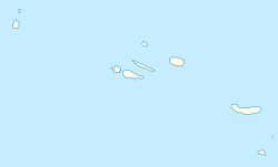
Positionskarte der Azoren, Portugal


