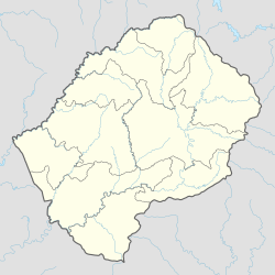
Naturschutzgebiete in Lesotho
(c) Karte: NordNordWest, Lizenz: Creative Commons by-sa-3.0 de |
Nationaler Status der wichtigsten Schutzgebiete: |
Naturschutzgebiete in Lesotho nehmen laut IUCN nur 0,26 Prozent der Landfläche ein.[1]
Schutzgebiete
| Name | Größe (km²) | Proklamation | Besonderheiten | Nationaler Status | IUCN-Kategorie | Lage |
|---|---|---|---|---|---|---|
| Bokong-Naturreservat | 19,72[2] | als Biosphärenreservat vorgeschlagen[3] | 29° 4′ 8,4″ S, 28° 25′ 30″ O | |||
| Botanischer Garten[2] | 0,015 | |||||
| Lets'eng-la-Letsie | 4,34 | 2004 | Ramsar-Gebiet | 30° 18′ 35,2″ S, 28° 9′ 56,4″ O | ||
| Liphofung-Denkmal und Reservat[2] | 0,04 | |||||
| Masitise-Naturreservat[2] | 0,2 | |||||
| Muela-Naturreservat[2] | 0,45 | |||||
| Sehlabathebe-Nationalpark | 64,75–69,52 | 1970 | seit 2013 UNESCO-Welterbe | Nationalpark | IV (Nationalpark) | 29° 54′ 0″ S, 29° 7′ 0″ O |
| Ts’ehlanyane-Nationalpark | 6324,02 bzw. 53[2] | als Biosphärenreservat vorgeschlagen[3] | Nationalpark Naturreservat | 29° 0′ 0″ S, 28° 25′ 0″ O |
Siehe auch
Literatur
- Donald N. McVean: Nature Conservation in Lesotho, International Union for Conservation of Nature and Natural Resources, Morges/Schweiz, 1997. (online abrufbar)
Weblinks
Einzelnachweise
- ↑ Lesotho, Africa. Protectedplanet/IUCN. Abgerufen am 4. Juni 2019. (englisch)
- ↑ a b c d e f 2017 Environment Report. Bureau of Statistics, 2017, S. 20.
- ↑ a b Govt nominates biosphere reserves. In: Sunday Express, 13. März 2018. (englisch)
Auf dieser Seite verwendete Medien
Africa satellite orthographic.jpg
A composed satellite photograph of Africa in orthographic projection. This is NASA "Blue Marble" image applied as a texture on a sphere using Art of Illusion program. The observer is centered at (0° N, 15° E), at Moon distance above the Earth.
A composed satellite photograph of Africa in orthographic projection. This is NASA "Blue Marble" image applied as a texture on a sphere using Art of Illusion program. The observer is centered at (0° N, 15° E), at Moon distance above the Earth.
Yellow pog.svg
Shiny yellow button/marker widget. Used to mark the location on a map.
Shiny yellow button/marker widget. Used to mark the location on a map.
Lesotho adm location map.svg
(c) Karte: NordNordWest, Lizenz: Creative Commons by-sa-3.0 de
Positionskarte von Lesotho
(c) Karte: NordNordWest, Lizenz: Creative Commons by-sa-3.0 de
Positionskarte von Lesotho


