Nationalparks in den Vereinigten Staaten
Die Vereinigten Staaten haben eine Vielzahl von Nationalparks eingerichtet. Weitere Schutzgebiete sind nationale Denkmäler (National Monuments), historische Parks, Gedenkstätten, Erholungsgebiete, Flüsse und Küstenabschnitte. Alle Nationalparks und ein Teil der anderen Schutzgebiete werden vom National Park Service verwaltet, einer Behörde im Geschäftsbereich des US-Innenministeriums.
Zurzeit gibt es 63 Nationalparks mit einer Fläche von 211.273 km² (d. h. etwa die Fläche von Großbritannien). Sie haben vom Kongress der Vereinigten Staaten den Schutzstatus National Park zuerkannt bekommen.
Erst in späteren Jahren wurden Naturschutz und Bildung als weitere Ziele der Gebiete eingeführt, sie stehen heute im Vordergrund. In den Nationalparks wird in der Regel eine große Vielfalt an kulturellen, geologischen oder biologischen Ressourcen unter Schutz gestellt. Jagd und Bergbau sind normalerweise nicht erlaubt. Soweit Nutzungen schon vor der Ausweisung des Parks existierten, kann ihnen Bestandsschutz gewährt werden, so operiert im Death-Valley-Nationalpark (gewidmet 1994) eine Erzmine.
Der Charakter der einzelnen Parks unterscheidet sich stark. Während die abgelegenen Parks in Alaska oder auch der Congaree-Nationalpark in den Sümpfen South Carolinas weitgehend Wildnischarakter haben, leiden Parks in der Nähe von Bevölkerungszentren zumindest in Teilgebieten unter dem Massentourismus, wie das Haupttal des Yosemite-Nationalparks in Zentralkalifornien.
Geschichte
Erste Ideen zu Bewahrung der teilweise noch unberührten Natur wurden schon 1832 vom Maler George Catlin formuliert. Er schlug vor die Großen Ebenen „durch bestimmte weitreichende Maßnahmen des Staates als einen grandiosen Park zu erhalten“. Allerdings sah er die von ihm anvisierten Parks vornehmlich als ungestörte Wohngebiete für die in ihrem Lebensraum bedrohten Ureinwohner.
„Welch ein vorbildlich schönes und überaus abwechslungsreiches Gebiet könnte Amerika so bewahren und zukünftigen Generationen aller Länder präsentieren! Ein Park der Nation mit Mensch und Tier in ihrer ungezähmten und natürlichen Schönheit.“
Eine erste Popularisierung der Beachtung der Natur und des Naturschutzes geht auf Ralph Waldo Emerson und Henry David Thoreau zurück, die in der Natur spirituelle Erbauung suchten. Thoureau erkannte, dass Schutzmaßnahmen für sie nötig waren.
Der damals in der Gegend von Yosemite lebende John Muir, den Emerson 1871 besuchte, setzte sich dann unermüdlich und vehement gegen Holzfäller, Schafzucht und für die Schaffung geschützter Gebiete ein. Er schrieb unter anderem:
„Gott hat für diese Bäume gesorgt, sie vor Sturm und Flut bewahrt, aber er kann sie nicht vor Verrückten bewahren. Nur Uncle Sam kann das.“
Einige kleine, allerdings nicht Bundesbehörden unterstehende Schutzgebiete wie das Yosemite Valley (seit 1864) existierten bereits. Als erster Nationalpark der Vereinigten Staaten und zugleich weltweit wurde der Yellowstone-Nationalpark 1872 gegründet. Die Urkunde nennt als Zweck des Gebietes:
„als öffentlichen Park oder Vergnügungsstätte zum Nutzen und zur Freude der Bevölkerung.“[1]
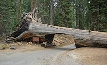
Weiteren Auftrieb erhielt die Nationalparkbewegung durch die Gründung der Naturschutzorganisation Sierra Club durch Muir und andere im Jahr 1892. Kongress und Bundesregierung handelten schließlich aufgrund vieler Kampagnen und Appelle, indem sie der Gründung von Sequoia-, General-Grant- und Yosemite-Nationalpark zustimte, wohl auch weil man sie für „völlig wertloses Gebiet“ hielt. 1899 entstand dann der Mount Rainier National Park.
Einen wichtigen Verbündeten fanden die Naturschützer um Muir dann in Präsident Theodore Roosevelt. Er erweiterte das Gebiet der Staatsforste um 53 Millionen Hektar, richtete ein Netz von Wildschutzgebieten ein und schuf 18 Nationalparks.
Dennoch existierten noch immer keine Parks östlich des Mississippi. Ihrer Gründung standen verschiedene Probleme im Wege. Die östlichen Staaten waren dichter besiedelt als der Westen, und auch die kulturell unerschlossenen Gebiete befanden sich großteils in privater Hand. Außerdem hielt man die Landschaften des Ostens wegen des Fehlens der imposanten Canyons und Berge des Westens für weniger schützenswert. 1916 kauften John D. Rockefeller, Charles William Eliot und andere 2400 Hektar der Insel Mount Desert Island vor der Küste von Maine. Das Gebiet wurde später in erweiterter Form zum Acadia National Park. Rockefeller spendete in den 1920er Jahren auch 5 Millionen Dollar für die Errichtung des Great-Smoky-Mountains-Nationalparks und Shenandoah-Nationalparks in den Appalachen.
Liste
| Nationalpark | Ansicht | Bundesstaat | Gründung | Fläche[2] | Besucher (2018)[3] |
|---|---|---|---|---|---|
| Acadia | 26. Februar 1919 | 198,60 km² | 3.537.575 | ||
| Amerikanisch-Samoa | 31. Oktober 1988 | 33,41 km² | 28.626 | ||
| Arches | 12. November 1971 | 310,31 km² | 1.663.557 | ||
| Badlands | 10. November 1978 | 982,40 km² | 1.008.942 | ||
| Big Bend | 12. Juni 1944 | 3.242,19 km² | 440.091 | ||
| Biscayne | 28. Juni 1980 | 700,00 km² | 469.253 | ||
| Black Canyon of the Gunnison | 21. Oktober 1999 | 124,56 km² | 308.962 | ||
| Bryce Canyon |
| 25. Februar 1928 | 145,02 km² | 2.679.478 | |
| Canyonlands | 12. September 1964 | 1.366,21 km² | 739.449 | ||
| Capitol Reef | 18. Dezember 1971 | 978,95 km² | 1.227.627 | ||
| Carlsbad Caverns | 14. Mai 1930 | 189,26 km² | 465.912 | ||
| Channel Islands | 5. März 1980 | 1.009,94 km² | 366.250 | ||
| Congaree | 10. November 2003 | 107,81 km² | 145.929 | ||
| Crater Lake | 22. Mai 1902 | 741,48 km² | 720.659 | ||
| Cuyahoga Valley | 11. Oktober 2000 | 131,81 km² | 2.096.053 | ||
| Death Valley | 31. Oktober 1994 | 13.649,97 km² | 1.678.660 | ||
| Denali | 26. Februar 1917 | 19.185,79 km² | 594.660 | ||
| Dry Tortugas | 26. Oktober 1992 | 261,84 km² | 56.810 | ||
| Everglades | 30. Mai 1934 | 5.667,78 km² | 597.124 | ||
| Gates of the Arctic | 2. Dezember 1980 | 30.448,13 km² | 9.591 | ||
| Gateway Arch | 22. Februar 2018 | 0,78 km² | 2.016.180 | ||
| Glacier | 11. Mai 1910 | 4.099,98 km² | 2.965.309 | ||
| Glacier Bay | 2. Dezember 1980 | 13.044,57 km² | 597.915 | ||
| Grand Canyon |
| 26. Februar 1919 | 4.862,89 km² | 6.380.495 | |
| Grand Teton | 26. Februar 1929 | 1.254,71 km² | 3.491.151 | ||
| Great Basin | 27. Oktober 1986 | 312,34 km² | 153.094 | ||
| Great Sand Dunes |
| 13. September 2004 | 434,40 km² | 442.905 | |
| Great Smoky Mountains |
| 15. Juni 1934 | 2.114,19 km² | 11.421.200 | |
| Guadalupe Mountains | 15. Oktober 1966 | 349,52 km² | 172.347 | ||
| Haleakalā | 1. August 1916 | 134,62 km² | 1.044.084 | ||
| Hawai'i Volcanoes | 1. August 1916 | 1.317,68 km² | 1.116.891 | ||
| Hot Springs | 4. März 1921 | 22,47 km² | 1.506.887 | ||
| Indiana Dunes | 15. Februar 2019 | 62,11 km² | 1.756.079 | ||
| Isle Royale | 3. April 1940 | 2.313,95 km² | 25.798 | ||
| Joshua Tree | 31. Oktober 1994 | 3.199,59 km² | 2.942.382 | ||
| Katmai | 2. Dezember 1980 | 14.870,29 km² | 37.818 | ||
| Kenai Fjords | 2. Dezember 1980 | 2.709,98 km² | 321.596 | ||
| Kings Canyon | 4. März 1940 | 1.869,25 km² | 699.023 | ||
| Kobuk Valley | 2. Dezember 1980 | 7.084,90 km² | 14.937 | ||
| Lake Clark | 2. Dezember 1980 | 10.602,02 km² | 14.479 | ||
| Lassen Volcanic | 9. August 1916 | 431,35 km² | 499.435 | ||
| Mammoth Cave | 1. Juli 1941 | 218,58 km² | 533.206 | ||
| Mesa Verde |
| 29. Juni 1906 | 212,40 km² | 563.420 | |
| Mount Rainier |
| 2. März 1899 | 956,60 km² | 1.518.491 | |
| New River Gorge | 27. Dezember 2021 | 28,4 km² | |||
| North Cascades | 2. Oktober 1968 | 2.042,78 km² | 30.085 | ||
| Olympic | 29. Juni 1938 | 3.733,83 km² | 3.104.455 | ||
| Petrified Forest | 9. Dezember 1962 | 895,93 km² | 644.922 | ||
| Pinnacles | 10. Januar 2013 | 107,99 km² | 222.152 | ||
| Redwood | 2. Oktober 1968 | 562,51 km² | 482.536 | ||
| Rocky Mountain | 26. Januar 1915 | 1.075,68 km² | 4.590.493 | ||
| Saguaro | 14. Oktober 1994 | 371,16 km² | 957.405 | ||
| Sequoia | 25. September 1890 | 1.635,18 km² | 1.229.594 | ||
| Shenandoah | 26. Dezember 1935 | 806,27 km² | 1.264.880 | ||
| Theodore Roosevelt | 10. November 1978 | 285,09 km² | 749.389 | ||
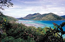
| Virgin Islands | 2. August 1956 | 60,48 km² | 112.287 | ||
| Voyageurs | 8. Januar 1971 | 883,02 km² | 239.656 | ||
| White Sands | 18. Januar 1933 | 581,7 km² | 603.008 | ||
| Wind Cave | 9. Januar 1903 | 137,48 km² | 656.397 | ||
| Wrangell–St. Elias | 2. Dezember 1980 | 53.320 km² | 79.450 | ||
| Yellowstone | 1. März 1872 | 8.983,17 km² | 4.115.000 | ||
| Yosemite | 1. Oktober 1890 | 3.082,68 km² | 4.009.436 | ||
| Zion | 19. November 1919 | 595,87 km² | 4.320.033 |
Aufgelöste Nationalparks
| Nationalpark | gegründet | aufgelöst | Kommentar |
|---|---|---|---|
| Abraham-Lincoln-Nationalpark | 17. Juli 1916 | 11. August 1939 | umgewandelt in Abraham Lincoln Birthplace National Historic Site |
| Fort-McHenry-Nationalpark | 3. März 1925 | 11. August 1939 | umgewandelt in Fort McHenry National Monument and Historic Shrine |
| Hawaii-Nationalpark | 1. August 1916 | 13. September 1960 | aufgeteilt in Hawaiʻi-Volcanoes-Nationalpark und Haleakalā-Nationalpark |
| Mackinac-Nationalpark | 15. April 1875 | dem Staat Michigan am 2. März übereignet, Status als State Park seit dem 31. Mai 1895 | jetzt Mackinac Island State Park |
| Platt-Nationalpark | 29. Juni 1906 | 17. März 1976 | jetzt Chickasaw National Recreation Area |
| Sullys-Hill-Nationalpark | 27. April 1904 | 3. März 1931 | jetzt Sullys Hill National Game Preserve |
Weitere Schutzgebiete in den USA
Die National Monuments haben einen geringeren Schutzstatus als die Nationalparks und sind in der Regel kleinere bis sehr kleine Schutzgebiete.
National Historical Parks, National Historic Sites, National Memorials und Battlefields beinhalten historische Plätze, Denkmäler und Schlachtfelder. Oft sind das einzelne Gebäude oder kleinere Regionen, die eine historische Bedeutung haben.
National Recreation Areas, Seashores and Trails sind Erholungsgebiete, besondere Seen, Flüsse, Küstenabschnitte und Straßen, sowie Wanderwege. Wild and Scenic Rivers sind vor massiven Eingriffen geschützt, ihr Erholungs- und Landschaftswert soll erhalten bleiben.
National Preserves würden die Voraussetzung für eine Ausweisung als Nationalpark erfüllen, in ihnen ist aber Bergbau, die Förderung von Erdöl/-gas sowie meistens die Jagd zulässig. Wilderness Areas sind von menschlichen Eingriffen unbeeinflusst. Besucher dürfen sich nur zu Fuß oder gegebenenfalls im Kanu und per Pferd bewegen.
National Wildlife Refuges sind Naturschutzgebiete die unter der Verwaltung des United States Fish and Wildlife Service stehen. Außerdem gibt es in den USA bundesstaatliche Nationalforste (National Forest), die vom US Forest Service verwaltet werden. In ihnen sind meist nur kleine Bereiche als Schutzgebiete ausgewiesen, der größte Teil der National Forests wird kommerziell durch die Forstwirtschaft genutzt.
Sonstiges
Neben dem National Park Service, dem U.S. Fish and Wildlife Service und dem US Forest Service sind auch das Bureau of Land Management, die Verwaltungen der Indianerreservate und andere bundesstaatliche und lokale Institutionen für die Verwaltung einzelner Parks zuständig. Der bekannteste von Indianern verwaltete Park ist das Monument Valley.
Zusätzlich zu den aufgelisteten, von der Bundesregierung verwalteten, unterhalten die einzelnen Bundesstaaten als State Parks bezeichnete Naturschutzgebiete.
Siehe auch
Literatur
- Lynn Ross-Bryant: Pilgrimage to the National Parks: Religion and Nature in the United States. Routledge, London 2012, ISBN 978-0-415-89380-0.
- Philippe Bourseiller: Die Nationalparks der USA, Knesebeck; Auflage 1 (August 2006), ISBN 3-89660-393-0.
- National Geographic Society: National Geographic's Guide to the National Parks of the United States. 3. Aufl. National Geographic, 2001, ISBN 0-7922-7028-2.
- Christian Heeb & Walter Herdich: Reise durch die Nationalparks der USA, Stürtz; 2000, ISBN 3-8003-0980-7.
Weblinks
- Homepage (englisch)
Einzelnachweise
- ↑ National Park Service: About us – history: "as a public park or pleasuring ground for the benefit and enjoyment of the people"
- ↑ AcreageReports - Land and Water Conservation Fund (U.S. National Park Service). Abgerufen am 18. April 2019 (englisch).
- ↑ Stats Report Viewer. Abgerufen am 18. April 2019.
Auf dieser Seite verwendete Medien
Autor/Urheber: The State of Utah, Lizenz:
The flag of Utah (2024-present). This is the final design submitted for consideration to be adopted as a new state flag of Utah. The design evokes images of snowy mountains and red rocks to represent the geography of Utah, the beehive represents "Industry" (the state's slogan) and Utah's nickname as "the Beehive State".
(c) I, Blinutne, CC BY-SA 3.0
Ocanaluftee Overlook, along Newfound Gap Road in the Great Smoky Mountains National Park, is seen here during Autumn 2006.
Autor/Urheber: Murray Foubister, Lizenz: CC BY-SA 2.0
Saguaro Nat. Park
Autor/Urheber: CarlCarlsonIV, Lizenz: CC BY-SA 4.0
This picture, taken from Hunter Peak in Guadalupe Mountains National Park, captures Guadalupe Peak in the center-left of the frame.
Autor/Urheber: Niagara66, Lizenz: CC BY-SA 4.0
Death Valley National Park, California
Autor/Urheber:
- derivative work: User:Maps and stuff (cropped to 2.5:1 ratio, eliminating sign and stone structure on right while centering on lake; increased brightness in dark areas; saved as a high quality JPG)
Crater Lake on a clear day from Watchman Lookout Station
Autor/Urheber: Diliff, Lizenz: CC BY-SA 3.0
Zion Canyon at sunset in Zion National Park as seen from Angels Landing looking south.
Alatna River, Alaska
(c) bogdanstepniak, CC BY 3.0
Great Sand Dunes National Park
Autor/Urheber: Daniel Schwen, Lizenz: CC BY-SA 4.0
Diese Grafik wurde mit Hugin erstellt.
Autor/Urheber: JaGa, Lizenz: CC BY-SA 4.0
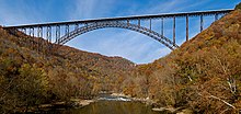
The New River Gorge Bridge in Fayetteville, West Virginia is a steel arch bridge that carries US 19 over the New River. It opened in 1977 and is the longest and highest steel arch bridge in the Western Hemisphere at 3030 ft (924 m) long and 876 ft (267 m) high. The bridge hosts Bridge Day, an annual event in which it closes to vehicles, and participants are allowed to BASE jump to the valley floor below.
Autor/Urheber: Ekrem Canli, Lizenz: CC BY-SA 4.0
Haleakalā crater in Haleakalā National Park
Autor/Urheber: Joe Parks from Berkeley, CA, Lizenz: CC BY 2.0
Lassen and Eagle Peaks reflect in the calm morning waters of Lake Helen, Lassen Volcanic National Park.
Flag of Oregon (obverse): The flag was adopted by the state on February 26, 1925.[1] The state seal was decided in 1903.[2][3]
Autor/Urheber: Tom Hilton, Lizenz: CC BY 2.0
View along Copper Creek Trail, Kings Canyon National Park, California
The classic view of Canyonlands National Park from the Green River Overlook, in the Island in the Sky district, Utah, USA.
The flag of Minnesota, since May 11, 2024.
Rotunda Room, Mammoth Höhle im Mammoth Cave National Park, Kentucky
Autor/Urheber: Michael Schweppe, Lizenz: CC BY-SA 2.0
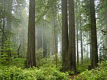
Coast Redwood forest and understory plants — in Redwood National Park, California.
"Lost Horse Valley features the park's iconic Joshua trees and rock outcrops."
Virgin Islands National Park
View of the Little Missouri River flowing through Theodore Roosevelt National Park in the U.S. state of North Dakota
Autor/Urheber: Western Arctic National Parklands, Lizenz: CC BY 2.0
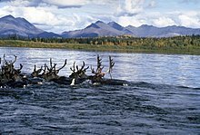
Big hooves for paddles and hollow hair for bouyancy make caribou good swimmers. That's important, because they have to swim across the Kobuk River twice as year as they migrate north in the spring and then south in the fall (as in this photo).
Caribou swimming a riverThe John Moulton Barn on Mormon Row at the base of the Grand Tetons, Wyoming.
Autor/Urheber: Thomson200, Lizenz: CC0
Never Summer Mountains viewed from the Gore Range Overlook
(c) Jsoo1 aus der englischsprachigen Wikipedia, CC BY-SA 3.0
View of Badlands National Park. en:Category:Images of South Dakota
Wind Cave National Park
Autor/Urheber: Niagara66, Lizenz: CC BY-SA 4.0
Brandywine Falls, Cuyahoga Valley National Park, Ohio
Autor/Urheber: Murray Foubister, Lizenz: CC BY-SA 2.0
White Sands National Monument - New Mexico...dawn in the desert...a new day begins..cool at first, but soon..!!!
Autor/Urheber: NealVickers, Lizenz: CC BY-SA 4.0
The walls of Black Canyon of the Gunnison National Park in western Colorado are so deep they can be overwhelming. The canyons carved by millions of years by the Gunnison River feature some of the steepest cliffs, oldest rock, and craggiest spires on the continent. Some of the crevices along the 12 miles of the canyon are twice as high as the Empire State Building and so narrow that regions of the canyon on see about 33 minutes of direct sunlight per day.
Autor/Urheber: Ken Lund from Las Vegas, Nevada, USA, Lizenz: CC BY-SA 2.0
The thermal springs of Hot Springs National Park are situated in the Ouachita Mountains of outer Arkansas. The springs emerge in a gap between Hot Springs Mountain and West Mountain in an area about 1,500 feet (460 m) long by 400 feet (120 m) wide at altitudes from 576 to 683 feet (208 m). The springs predominantly are composed of hot water from thousands of feet underground mixed with some shallow cold ground water. Currently, there are 43 thermal springs in the park that are presumed to be flowing. Thermal water from 33 of the thermal springs is collected and monitored at a central reservoir, which distributes the combined discharge for public use and consumption. Rock types in the area include shale units which generally impede ground-water movement, while fractured chert, novaculite, and sandstone units generally support ground-water movement.
The water comes from rain which falls in mountains to the north and northeast. Flowing downward through cracked rock at about one foot a year, the meteoric water migrates to estimated minimum depths of 4,500 to 7,500 ft (2,300 m) and achieves high temperatures in the deep section of the flow path before rising along fault and fracture conduits. Under artesian pressure, the thermal waters rise and emerge through the Hot Springs Sandstone between the traces of two thrust faults, along several northeast-trending lineaments. Some rainwater from near the springs mixes with the deep hot water before discharge. The trip down takes about 4,000 years while the hot water takes about a year to reach the surface.
The heat comes from the natural heating of rocks as depth increases. The composition of the water indicates it is heated rainwater which has not approached a magmatic source, so no volcanic action is involved in the formation of these hot springs. The result is the mildly alkaline, pleasant tasting solution with dissolved calcium carbonate.
The exposed rock types in the vicinity of the thermal springs are sedimentary rocks of Mississippian to Ordovician age, with the exception of younger igneous rocks (Cretaceous age) exposed in two small areas about 6 and 11 miles (18 km) southeast of the thermal springs (Potash Sulphur Spring and Magnet Cove, respectively), and in many very small dikes and sills. Most dikes are less than 5 ft (1.5 m) wide. There have been 80 dikes noted about 4 miles (6.4 km) southeast of Hot Springs, on and near the Ouachita River. There is no indication that igneous rock occurs where the thermal springs discharge.
en.wikipedia.org/wiki/Hot_Springs_National_ParkLearn more about glaciers and glacier research in Alaska's national parks at www.nps.gov/akso/nature/environment/glaciers.cfm. NPS Photo
This is a simple dot (currently red) for overlaying on locator maps. I created this transparent GIF file myself.
Autor/Urheber: Yinan Chen, Lizenz: Public Domain
Animals, and scenes in the Everglades. Note that not all pictures I took in the Everglades are in this Album. Many went into the animals and plants categories. A quiet pond with many lillies
Autor/Urheber: Niagara66, Lizenz: CC BY-SA 4.0
Big Bend National Park, Texas
West Beach, Indiana Dunes National Lakeshore, Portage, IN, USA
Flag of California. This version is designed to accurately depict the standard print of the bear as well as adhere to the official flag code regarding the size, position and proportion of the bear, the colors of the flag, and the position and size of the star.
(c) Doss Imaging, CC BY 3.0
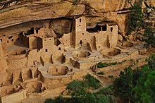
Extreme Makeover; Mesa Verde Edition
(c) Stan Shebs, CC BY-SA 3.0
Aerial photo of Mount Rainier from the west
(c) Tenji, CC BY-SA 3.0
Grand Canyon, Blick vom Cape Solitude nach Norden; Marble Canyon - USA
Autor/Urheber: Rich Murphy from Sedro Woolley, Washington, USA, Lizenz: CC BY 2.0
Mount Shuksan, Washington, United States. The location of the shot is easily accessed by auto all year long.
Autor/Urheber: Diliff, Lizenz: CC BY-SA 3.0
Half Dome as viewed from Glacier Point, Yosemite National Park, California, United States.
Autor/Urheber: Wsiegmund, Lizenz: CC BY 2.5
Hurricane Ridge
- Description: Coast Range Subalpine Fir groves in meadow. Abies lasiocarpa
- Viewpoint location: About 0.1 km north of Point 5471' near the Klahhane Ridge Trail/Meadow Loop Trails junction and close to the Hurricane Ridge Visitor Center in Olympic National Park, Washington, USA.
- Viewpoint elevation: 5400'
- View direction: South southeast
- Camera: Canon PowerShot S110
- Photographer: Walter Siegmund ©2005 Walter Siegmund
Flag of the State of Nevada. The flag is described in Nevada Revised Statutes Chapter 235, Sec. 20 as follows: The body of the flag must be of solid cobalt blue. On the field in the upper left quarter thereof must be two sprays of Sagebrush with the stems crossed at the bottom to form a half wreath. Within the sprays must be a five-pointed silver star with one point up. The word “Nevada” must also be inscribed below the star and above the sprays, in a semicircular pattern with the letters spaced apart in equal increments, in the same style of letters as the words “Battle Born.” Above the wreath, and touching the tips thereof, must be a scroll bearing the words “Battle Born.” The scroll and the word “Nevada” must be golden-yellow. The lettering on the scroll must be black-colored sans serif gothic capital letters.
(c) Brocken Inaglory, CC BY-SA 3.0
Grand Prismatic Spring and Midway Geyser Basin
NPS | N. Lewis
(c) Janquen aus der englischsprachigen Wikipedia, CC BY-SA 3.0
Glacier Bay taken by myself in September 2004. Quentin Goodman
(c) I, Jonathan Zander, CC BY-SA 3.0
Foto von Hoodoos im Bryce Schlucht-Nationalpark, Utah, USA.
Autor/Urheber: Diego Delso , Lizenz: CC BY-SA 4.0
Sequoia National Park, California, USA
Autor/Urheber: Originally uploaded English Wikipedia by en:User:Papayoung and en:User:Ilmari Karonen.
Base versions this one is derived from: originally created by en:User:Wapcaplet, Lizenz: CC BY-SA 3.0
This image is abstracted from Image:Map_of_USA_with_state_names.svg (GFDL).
Autor/Urheber: G. Edward Johnson, Lizenz: CC BY-SA 3.0
Looking up at Bass Harbor Head Light as seen from the shore, in Acadia National Park, Maine, USA
Autor/Urheber: Kumar Appaiah, Lizenz: CC BY-SA 2.0
A log of wood that has been transformed into a colourful mineral.
Pola Islands just off the coast of Tutuila Island, American Samoa.
Autor/Urheber: Richard Gangemi, Lizenz: CC BY-SA 4.0
Aerial View of the Dry Tortugas National Park and Fort Jefferson
Autor/Urheber: Mountain walrus, Lizenz: CC BY-SA 3.0
Grinnell Glacier, August 2012
Wilder Küstenabschnitt der Channel Islands, Kalifornien - Channel Islands National Park
Autor/Urheber: Wolfgang Staudt, Lizenz: CC BY 2.0
Capitol Reef National Park is a United States National Park, in south-central Utah.


