Nationalparks in Mosambik
In Mosambik gibt es sieben Nationalparks.
| Name | Gründung | Größe [ha] | Provinz | Karte | Ansicht | |
|---|---|---|---|---|---|---|
| Nationalpark Banhine (Parque Nacional de Banhine) | 1972 | 700.000 | Gaza |
| ||
| Nationalpark Bazaruto (Parque Nacional de Bazaruto) | 2001 | 143.000 | Inhambane |
|  | |
| Nationalpark Gorongosa (Parque Nacional da Gorongosa) | 1960 | 537.000 | Sofala |
|  | |
| Nationalpark Limpopo (Parque Nacional do Limpopo) | 2001 | 1.000.000 | Gaza |
| ||
| Nationalpark Maputo (Parque Nacional de Maputo)[1] | 2022 | Maputo |
| |||
| Nationalpark Quirimbas (Parque Nacional das Quirimbas) | 2002 | 750.639 | Cabo Delgado |
|  | |
| Nationalpark Zinave (Parque Nacional do Zinave) | 1972 | 500.000 | Inhambane |
|
Einzelnachweise
- ↑ UNESCO: Maputo National Park (formerly Ponto d’ Ouro Partial Marine Reserve – POPMR). auf www.whc.unesco.org (englisch).
Auf dieser Seite verwendete Medien
Africa satellite orthographic.jpg
A composed satellite photograph of Africa in orthographic projection. This is NASA "Blue Marble" image applied as a texture on a sphere using Art of Illusion program. The observer is centered at (0° N, 15° E), at Moon distance above the Earth.
A composed satellite photograph of Africa in orthographic projection. This is NASA "Blue Marble" image applied as a texture on a sphere using Art of Illusion program. The observer is centered at (0° N, 15° E), at Moon distance above the Earth.
Medjumbe Lighthouse.jpg
Autor/Urheber: Chris Chilton from Guernsey, Lizenz: CC BY 2.0
Was built in the 30's apparently, worked for 3 months, broke down and has been there ever since without working...
Autor/Urheber: Chris Chilton from Guernsey, Lizenz: CC BY 2.0
Was built in the 30's apparently, worked for 3 months, broke down and has been there ever since without working...
Bazaruto-Island-East-Coast-From-South.jpg
Autor/Urheber: Bjørn Christian Tørrissen, Lizenz: CC BY-SA 3.0
A view from the top of a large dune near the southern end of Bazaruto Island, north towards the east coast. Between the dunes there are pools/lakes with large salt-water crocodiles in them.
Autor/Urheber: Bjørn Christian Tørrissen, Lizenz: CC BY-SA 3.0
A view from the top of a large dune near the southern end of Bazaruto Island, north towards the east coast. Between the dunes there are pools/lakes with large salt-water crocodiles in them.
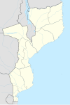
Mozambique adm location map.svg
(c) Karte: NordNordWest, Lizenz: Creative Commons by-sa-3.0 de
Positionskarte von Mosambik
(c) Karte: NordNordWest, Lizenz: Creative Commons by-sa-3.0 de
Positionskarte von Mosambik


