National Register of Historic Places in Puerto Rico

Das National Register of Historic Places in Puerto Rico ist Teil des nationalen Denkmalschutzprogramms der Vereinigten Staaten (Bauwerke, Objekte, Stätten und historische Distrikte).
Liste
Diese Liste enthält alle historischen Distrikte des National Register of Historic Places (NRHP).
Anzahl der Objekte und historischen Distrikte
   |
|    | ||||||||||||||||||||||||||||||||||||||||||||||||||||||||||||||||||||||||||||||||||||||||||||||||||||||||||||||||||||||||||||||||||||||||||||||||||||||||||||||||||||||||||||||||||||||||||||||||||||||||||||||||||||||||||||||||||||||||||||||||||||||||||||||||||||||||||||||||||||||||||||||||||||||||||||||||||||||||||||||||
- Puente Arenas: Cayey und Cidra
- Puente La Liendre: Cayey und Cidra
- Puente Plata: Bayamón und Naranjito
- Puente de Añasco: Añasco und Mayagüez
- San Juan National Historic Site: San Juan und Toa Baja
- Puente Silva: Hormigueros und Cabo Rojo
Siehe auch
- National Historic Landmarks in Puerto Rico
- National Register of Historic Places
- Geschichte Puerto Ricos
Weblinks
- Puerto Rico State Historic Preservation Office (Seite nicht mehr abrufbar, festgestellt im November 2019. Suche in Webarchiven.) (spanisch)
- National Park Service, National Register of Historic Places site (Seite nicht mehr abrufbar, festgestellt im November 2019. Suche in Webarchiven.)
Auf dieser Seite verwendete Medien
Autor/Urheber: Der ursprünglich hochladende Benutzer war Jbermudez in der Wikipedia auf Englisch, Lizenz: CC BY 2.5
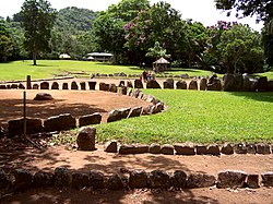
a view of the park
Los Morrillos Lighthouse, Cabo Rojo Puerto Rico. circa 2005
Autor/Urheber: unknown, Lizenz: CC BY-SA 3.0
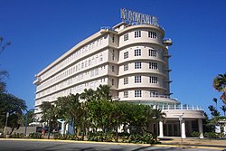
Normandie Hotel as seen from Munoz Rivera Avenue. Picture Author: Javier Rodriguez Galarza, from San Juan, PR.
Autor/Urheber: Jaro Nemčok, Lizenz: CC BY-SA 3.0
Fort Conde de Mirasol above the town of Isabel Segunda, Vieques, Puerto Rico
Autor/Urheber:
- USA Puerto Rico location map.svg: NordNordWest
- abgeleitetes Werk Kmusser (Diskussion)
Positionskarte von Puerto Rico, USA
(c) Marine 69-71 at en.wikipedia, CC BY-SA 3.0
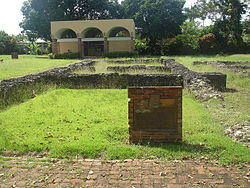
Ruins of Juan Ponce de Leon's residence at Caparra in Puerto Rico
Autor/Urheber: Jmoliver, Lizenz: CC BY-SA 3.0
The Porta Coeli Convent church, in the San Germán Historic District, San Germán, Puerto Rico.


