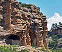
National Monuments in den Vereinigten Staaten
National Monument heißen in den Vereinigten Staaten durch die Bundesregierung ausgewiesene Schutzgebiete oder Gedenkstätten, die überwiegend vom National Park Service, einer dem Innenministerium unterstehenden Behörde, verwaltet werden. Sie können wertvolle Naturräume oder historisch bedeutende Einrichtungen bewahren. Insbesondere im Westen der Vereinigten Staaten liegen auch historische Bauten in wertvollen Ökosystemen, so dass beide Typen kombiniert sind.
Beschreibung
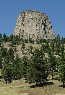
National Monuments können durch den Kongress oder im Gegensatz zu Nationalparks oder Memorials auch ohne Zustimmung des Kongresses vom Präsidenten per Presidential Proclamation errichtet werden. Rechtsgrundlage ist der Antiquities Act (Pub.L. 59–209) von 1906. Theodore Roosevelt machte erstmals von dieser Möglichkeit Gebrauch, als er am 24. September 1906 den Devils Tower in Wyoming auf diese Art schützte. Er war der Auffassung, dass dieser zerstört werden könne, bevor der Kongress das Gebiet endlich zu einem Nationalpark erklären würde. Bis 2022 wurden 158 natur- und denkmalschutzbedürftige Orte zum United States National Monument erklärt; das weltweit bekannteste ist die Freiheitsstatue vor der Stadt New York. Die weitaus größere Anzahl solcher Schutzgebiete befinden sich jedoch im Westen der Vereinigten Staaten – geballt im Bundesstaat Arizona.
Der Großteil der National Monuments werden vom National Park Service verwaltet, zahlreiche Schutzgebiete fallen aber auch unter die Aufsicht anderer Ämter. Hierzu zählt insbesondere das Bureau of Land Management (Landverwaltungsamt), dem auch das landflächenmäßig größte Nationalmonument außerhalb Alaskas – Grand Staircase-Escalante – untersteht. Auch der US Forest Service sowie der US Fish and Wildlife Service sind mit der Verwaltung von einer größeren Anzahl von National Monuments betraut. Dazu gibt es noch die Betreuung durch andere US-Behörden. Einzelne werden auch von zwei Behörden gemeinsam betreut.
Obwohl finanziell gegenüber den großen Nationalparks nachrangig berücksichtigt, haben National Monuments hinsichtlich Attraktivität und Größe nicht zwingend eine geringere Bedeutung als Nationalparks. Vielmehr weisen einige von ihnen alle Merkmale eines Nationalparks auf und erfahren bisweilen – wie die Great Sand Dunes in Colorado – auch eine entsprechende „Aufwertung“. In der Regel kennzeichnet ein Nationalmonument jedoch, dass in ihm eine geringere Anzahl natürlicher Ressourcen geschützt werden, als in Nationalparks.
Geschichte

Die Nationalmonumente der Vereinigten Staaten sind das Ergebnis eines Gesetzes aus dem Jahr 1906, das dem Zweck diente, prähistorische Bauwerke und Handwerkszeug von Indianern in den westlichen Staaten der USA zu schützen. Das so genannte „Altertümer-Gesetz“ (Antiquities Act) regelte die Legitimation von archäologischen Untersuchungen und stellte unerlaubte Plünderungen und Zerstörungen solcher Stätten unter Strafe. Es gestattete zudem dem US-Präsidenten, historische Wahrzeichen, historische und prähistorische Bauwerke sowie andere Objekte mit geschichtlicher oder wissenschaftlicher Bedeutung eigenmächtig unter den staatlichen Schutz eines Nationalmonuments zu stellen.
Von diesen Nationalmonumenten wurde erwartet, dass sie kleine prähistorische Stätten mit kulturellem Hintergrund schützen. Doch die Passage „Objekte von … wissenschaftlicher Bedeutung“ aus dem Antiquities Act nahm Präsident Theodore Roosevelt drei Monate später zum Anlass, den so genannten Devils Tower (Teufelsturm) aus naturwissenschaftlichen Gründen zu schützen und ihn zum ersten US-Nationalmonument zu erklären. Im gleichen Jahr wurde das Gesetz mit der Errichtung des Petrified-Forest-Nationalmonuments (heute Nationalpark) bereits zum zweiten Mal zweckentfremdet. Der ursprüngliche Gedanke von kleinen kulturellen Stätten war somit schnell überholt.
Im Jahr 1908 griff Roosevelt abermals auf den Antiquities Act zurück, um nun den Grand Canyon zum Nationalmonument zu erklären – mit rund 3.200 km² ein sehr großes „Objekt von wissenschaftlicher Bedeutung“. 1918 folgte unter Präsident Woodrow Wilson dann das Katmai-Nationalmonument, das zuerst etwas mehr als 4.000 km², später – nach einer Erweiterung – sogar rund 11.000 km² umfasste. Grand Canyon, Petrified Forest und Katmai gehörten zu den zahlreichen Nationalmonumenten, die später vom Kongress zu Nationalparks erklärt wurden.
Im Kongress gab es keinen ernsthaften Widerstand gegen die Nutzung des Antiquities Act zur Errichtung neuer Nationalmonumente – insbesondere in Arizona und Alaska, die zeitweilig als einzige Territorien im Kongress nicht repräsentiert waren. Erst mit der Errichtung des Jackson-Hole-Nationalmonuments durch Präsident Franklin D. Roosevelt 1943 regte sich im Kongress erstmals ernsthafter Widerstand. Nachdem das Vorhaben, den Grand-Teton-Nationalpark (Wyoming) um ein von John D. Rockefeller, Jr. erworbenes Land zu erweitern, am Widerstand des Kongresses scheiterte, bediente sich der Präsident kurzerhand des Antiquities Act und erklärte das Gebiet zum Nationalmonument. Der häufige Nutzung des Altertümer-Gesetzes zur Errichtung neuer Schutzgebiete unter Umgehung des Kongresses lösten derartige Proteste aus, dass US-Präsidenten in der Folgezeit seltener von dieser Möglichkeit Gebrauch machten. Richard Nixon und Gerald Ford, wiesen überhaupt keine National Monuments aus. Dies änderte sich mit der Präsidentschaft von Jimmy Carter wieder. Carter wies 16 National Monuments aus. Ronald Reagan und George H. W. Bush wiesen dann keine neuen Gebiete. Bill Clinton wies 19 National Monuments aus und damit mehr als die 18 von Theodore Roosevelt. George W. Bush wies dann sechs aus. Barack Obama wies mit 26 National Monuments die größte Anzahl aller Präsidenten aus.[1]
Zwischen 1930 und 1950 wurden die 8 National Monuments Papago Saguaro National Monument, Lewis and Clark Cavern National Monument, Wheeler National Monument, Holy Cross National Monument, Old Kasaan National Monument, Castle Pinckney National Monument, Verendrye National Monument und Fossil Cycad National Monument aufgehoben und nicht zu Nationalparks aufgewertet, sondern in andere Trägerschaft und Schutzkategorien überführt.[2] Das größte Nationalmonument außerhalb Alaskas ist Grand Staircase-Escalante im südlichen Utah und wurde 1996 durch Bill Clinton gegründet. Er traf damit eine anfangs kritisch betrachtete Entscheidung und abermals gab es Forderungen, die alleinige Verfügungsgewalt des Präsidenten einzuschränken.
Am 24. August 2017 legte US-Innenminister Ryan Zinke das Ergebnis einer von US-Präsident Donald Trump beauftragten Überprüfung der 27 in den letzten beiden Jahrzehnten ernannten, größeren National Monuments vor. Demnach solle die Fläche von sechs National Monuments zum Teil deutlich reduziert werden, um dort etwa Bergbau, Holzeinschlag oder Fischerei zu ermöglichen, nämlich die National Monuments Bears Ears National Monument, Grand Staircase-Escalante National Monument, Gold Butte National Monument, Cascade-Siskiyou National Monument, Pacific Remote Islands Marine National Monument sowie Rose Atoll National Monument. Sieben weitere National Monuments sollten zwar nicht verkleinert, kommerzielle Nutzungen aber wieder ermöglicht werden.[3] Am 4. Dezember 2017 ordnete Präsident Donald Trump per Presidential Proclamation an, die Schutzfläche des Grand Staircase-Escalante National Monument nahezu zu halbieren und die des Bears Ears National Monument um 85 Prozent zu reduzieren. Als Begründung gab er an, dass die ursprüngliche Grenzziehung nicht den Anforderungen der gesetzlichen Grundlage entsprochen hätte und wesentlich zu groß wäre.[4] In der Geschichte der USA wurden sechzehn National Monumente von US-Präsidenten achtzehnmal in der Flächengröße reduziert. Von 1962 bis 2017 kam es zu keiner Flächenreduzierung mehr.[1] Trumps Flächenreduzierung der beiden National Monumente war die größte Flächenreduzierung der US-Geschichte. Es wurden Klagen gegen diese Reduzierungen eingereicht. Sie wurden von den fünf örtlichen Indianerstämmen, dem Outdoor-Bekleidungsunternehmen Patagonia und verschiedenen Natur- und Umweltschutzverbänden eingereicht. Laut der Klagen sind die Flächenreduzierungen von Trump rechtswidrig.[5] Am 8. Oktober 2021 nahm Präsident Joe Biden mit einer Presidential Proclamation die Flächenreduzierung vom Grand Staircase-Escalante National Monument und vom Bears Ears National Monument durch Trump zurück.[6]
Präsident Donald Trump wies durch eine Presidential Proclamation 2018 das Camp Nelson National Monument aus. Am 12. März 2019 wurden mit Unterzeichnung des Kongress-Gesetzes John D. Dingell, Jr. Conservation, Management, and Recreation Act durch Präsident Trump vier weitere National Monumente ausgewiesen.[7]
Status und Ausstattung
Aus touristischer Sicht spielen die Unterschiede zwischen Nationalparks und -monumenten keine große Rolle. Viele der populärsten – vom National Park Service betreuten – Nationalmonumente bieten die gleiche Infrastruktur wie Nationalparks und können auch mit dem Nationalpark-Pass besucht werden. Auch der Schutzstatus der Gebiete unterscheidet sich formal nicht. Alle Gebiete des National Park Service unterliegen derselben gesetzlichen Grundlage, dem Organic Act. In Monuments unter der Verwaltung anderer Behörden, insbesondere des Bureau of Land Management, ist jedoch häufig die Jagd zulässig, die in Monuments des National Park Service ausgeschlossen ist.
Überblick
| National Monument | Ansicht | Bundesstaat | Gründung[8] | Fläche |
|---|---|---|---|---|
| Admiralty Island | Alaska | 1. Dezember 1978 | 4.127,2 km² | |
| African Burial Ground | New York | 27. Februar 2006 | 0,001 km² | |
| Agate Fossil Beds | Nebraska | 14. Juni 1997 | 12,4 km² | |
| Agua Fria |  | Arizona | 11. Januar 2000 | 287,2 km² |
| Aleutian Islands World War II | Alaska | 5. Dezember 2008 | 20,0 km² | |
| Alibates Flint Quarries | Texas | 31. August 1965 | 5,5 km² | |
| Aniakchak | Alaska | 1. Dezember 1978 | 555,1 km² | |
| Avi Kwa Ame National Monument | (c) Stan Shebs, CC BY-SA 3.0 | Nevada | 21. März 2023 | 2047 km² |
| Aztec Ruins | New Mexico | 24. Januar 1923 | 1,3 km² | |
| Baaj Nwaavjo I’tah Kukveni – Ancestral Footprints of the Grand Canyon National Monument | Arizona | 8. August 2023 | 3.713,5 km² | |
| Bandelier | New Mexico | 11. Februar 1916 | 136,3 km² | |
| Basin and Range | Nevada | 10. Juli 2015 | 2.847,3 km² | |
| Bears Ears | Utah | 28. Dezember 2016 | 817,0 km² | |
| Belmont-Paul Women’s Equality | Washington, D.C. | 12. April 2016 | 0,001 km² | |
| Berryessa Snow Mountain | Kalifornien | 10. Juli 2015 | 1.338,6 km² | |
| Birmingham Civil Rights | Alabama | 12. Januar 2017 | 0,004 km² | |
| Booker T. Washington |  | Virginia | 2. April 1956 | 1,0 km² |
| Browns Canyon | Colorado | 19. Februar 2015 | 87,4 km² | |
| Buck Island Reef | Amerikanische Jungferninseln | 28. Dezember 1961 | 77,0 km² | |
| Cabrillo |  | Kalifornien | 14. Oktober 1913 | 0,6 km² |
| California Coastal | Kalifornien | 11. Januar 2000 | 10,6 km² | |
| Camp Hale - Continental Divide National Monument |  | Colorado | 12. Oktober 2022 | 21,8 ha |
| Camp Nelson Heritage | 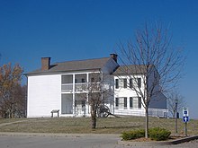 | Kentucky | 26. Oktober 2018 | 1,5 km² |
| Canyon De Chelly | Arizona | 1. April 1931 | 339,3 km² | |
| Canyons of the Ancients | Colorado | 9. Juni 2000 | 713,7 km² | |
| Capulin Volcano | New Mexico | 9. August 1916 | 3,2 km² | |
| Carrizo Plain | Kalifornien | 17. Januar 2001 | 854,1 km² | |
| Casa Grande Ruins | Arizona | 3. August 1918 | 1,9 km² | |
| Cascade-Siskiyou | Oregon | 9. Juni 2000 | 264,4 km² | |
| Castillo de San Marcos |  | Florida | 15. Oktober 1924 | 0,1 km² |
| Castle Clinton |  | New York | 12. August 1946 | 0,004 km² |
| Castle Mountains |  | Kalifornien | 12. Februar 2016 | 85,1 km² |
| Castner Range National Monument |  | Texas | 21. März 2023 | 27 km² |
| Cedar Breaks | Utah | 22. August 1933 | 24,9 km² | |
| Cesar E. Chaves |  | Kalifornien | 8. Oktober 2012 | 0,5 km² |
| Charles Young Buffalo Soldiers |  | Ohio | 25. März 2013 | 0,2 km² |
| Chimney Rock |  | Colorado | 21. November 2012 | 19,1 km² |
| Chiricahua |  | Arizona | 18. April 1924 | 48,7 km² |
| Colorado | Colorado | 24. Mai 1911 | 83,1 km² | |
| Craters of the Moon | Idaho | 2. Mai 1924 | 216,3 km² | |
| Devils Postpile |  | Kalifornien | 6. Juli 1911 | 3,2 km² |
| Devils Tower |  | Wyoming | 24. September 1906 | 5,5 km² |
| Dinosaur |  | Colorado, Utah | 4. Oktober 1915 | 851,0 km² |
| Effigy Mounds |  | Iowa | 25. Oktober 1949 | 10,2 km² |
| El Malpais |  | New Mexico | 31. Dezember 1987 | 462,7 km² |
| El Morro |  | New Mexico | 8. Dezember 1906 | 5,2 km² |
| Emmett Till and Mamie Till-Mobley National Monument | 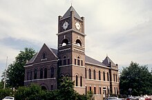 | Illinois, Mississippi | 25. Juli 2023 | 0,023 km² |
| Florissant Fossil Beds |  | Colorado | 20. August 1969 | 25,5 km² |
| Fort Frederica | Georgia | 26. Mai 1936 | 1,2 km² | |
| Fort Matanzas |  | Florida | 15. Oktober 1924 | 1,2 km² |
| Fort McHenry | Maryland | 3. März 1925 | 0,2 km² | |
| Fort Monroe | 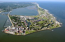 | Virginia | 1. November 2011 | 1,5 km² |
| Fort Ord |  | Kalifornien | 20. April 2012 | 59,3 km² |
| Fort Pulaski | 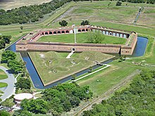 | Georgia | 15. Oktober 1924 | 22,8 km² |
| Fort Stanwix | 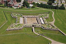 | New York | 21. August 1935 | 0,1 km² |
| Fort Union |  | New Mexico | 5. April 1956 | 2,9 km² |
| Fossil Butte |  | Wyoming | 23. Oktober 1972 | 33,2 km² |
| Freedom Riders |  | Alabama | 12. Januar 2017 | 0,02 km² |
| George Washington Birthplace |  | Virginia | 23. Januar 1930 | 2,6 km² |
| George Washington Carver |  | Missouri | 14. Juli 1943 | 0,8 km² |
| Giant Sequoia | Kalifornien | 15. April 2000 | 1.427,0 km² | |
| Gila Cliff Dwellings |  | New Mexico | 16. November 1907 | 2,2 km² |
| Gold Butte |  | Nevada | 28. Dezember 2016 | 1.201,7 km² |
| Governors Island |  | New York | 19. Januar 2001 | 0,1 km² |
| Grand Canyon-Parashant | Arizona | 11. Januar 2000 | 4.132,0 km² | |
| Grand Portage |  | Minnesota | 27. Januar 1960 | 2,9 km² |
| Grand Staircase-Escalante | Utah | 18. September 1996 | 7.689 km² | |
| Hagerman Fossil Beds | 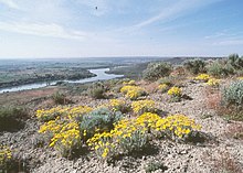 | Idaho | 18. November 1988 | 17,6 km² |
| Hanford Reach |  | Washington | 9. Juni 2000 | 768,9 km² |
| Hohokam Pima |  | Arizona | 21. Oktober 1972 | 6,8 km² |
| Hovenweep |  | Colorado, Utah | 2. März 1923 | 3,2 km² |
| Ironwood Forest | Arizona | 9. Juni 2000 | 522,3 km² | |
| Jewel Cave | South Dakota | 7. Februar 1908 | 5,2 km² | |
| John Day Fossil Beds | Oregon | 26. Oktober 1974 | 56,9 km² | |
| Jurassic |  | Utah | 12. März 2019 | 3,4 km² |
| Kap Krusenstern | Alaska | 1. Dezember 1978 | 2.626,8 km² | |
| Kasha-Katuwe Tent Rocks | New Mexico | 17. Januar 2001 | 18,8 km² | |
| Katahdin Woods and Waters | Maine | 24. Oktober 2016 | 354,4 km² | |
| Lava Beds |  | Kalifornien | 21. November 1925 | 189,0 km² |
| Little Bighorn Battlefield |  | Montana | 1. Juli 1940 | 3,1 km² |
| Marianas Trench Marine |  | Nördliche Marianen, Guam | 6. Januar 2009 | 247.172,6 km² |
| Medgar and Myrlie Evers Home | 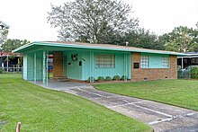 | Mississippi | 12. März 2019 | 0,74 km² |
| Military Working Dog Teams | Texas | 28. Oktober 2013 | ? | |
| Mill Springs Battlefield |  | Kentucky | 12. März 2019 | 5,9 km² |
| Misty Fjords | Alaska | 1. Dezember 1978 | 9.283,3 km² | |
| Mojave Trails |  | Kalifornien | 12. Februar 2016 | 6.475,0 km² |
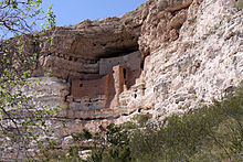
| Montezuma Castle | Arizona | 8. Dezember 1906 | 4,1 km² | |
| Mount St. Helens | Washington | 27. August 1982 | 458,1 km² | |
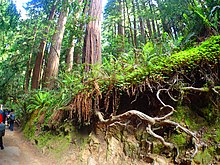
| Muir Woods | Kalifornien | 9. Januar 1908 | 2,2 km² | |
| Natural Bridges | Utah | 16. April 1908 | 30,9 km² | |
| Navajo | Arizona | 20. März 1909 | 1,5 km² | |
| Newberry | Oregon | 5. November 1990 | 232,0 km² | |
| Northeast Canyons and Seamounts Marine | Massachusetts | 15. September 2016 | 12.724,6 km² | |
| Oregon Caves |  | Oregon | 12. Juli 1909 | 18,4 km² |
| Organ Mountains-Desert Peaks |  | New Mexico | 21. Mai 2014 | 1.697,8 km² |
| Organ Pipe Cactus |  | Arizona | 13. April 1937 | 1.338,3 km² |
| Pacific Remote Islands Marine |  | US Minor Outlying Islands | 6. Januar 2009 | 1.270.477,6 km² |
| Papahānaumokuākea Marine | Hawaii | 15. Juni 2006 | 1.508.864,7 km² | |
| Petroglyph |  | New Mexico | 27. Juni 1990 | 29,2 km² |
| Pipe Spring |  | Arizona | 31. Mai 1923 | 0,2 km² |
| Pipestone |  | Minnesota | 25. August 1937 | 1,1 km² |
| Pompeys Pillar | 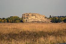 | Montana | 17. Januar 2001 | 0,2 km² |
| Poverty Point |  | Louisiana | 31. Oktober 1988 | 3,7 km² |
| Prehistoric Trackways |  | New Mexico | 30. März 2009 | 21,4 km² |
| President Lincoln and Soldiers’ Home |  | Washington, D.C. | 7. Juli 2000 | 0,01 km² |
| Rainbow Bridge | Utah | 30. Mai 1910 | 0,6 km² | |
| Rose Atoll |  | Amerikanisch-Samoa | 6. Januar 2009 | 34.839,6 km² |
| Russell Cave |  | Alabama | 11. Mai 1961 | 1,3 km² |
| Río Grande del Norte | New Mexico | 25. März 2013 | 982,2 km² | |
| Saint Francis Dam Disaster |  | Kalifornien | 12. März 2019 | 1,4 km² |
| Salinas Pueblo Missions |  | New Mexico | 1. November 1909 | 4,3 km² |
| San Gabriel Mountains |  | Kalifornien | 10. Oktober 2014 | 1.397,1 km² |
| San Juan Islands |  | Washington | 25. März 2013 | 3,9 km² |
| Sand to Snow | Kalifornien | 12. Februar 2016 | 623,2 km² | |
| Santa Rosa and San Jacinto Mountains |  | Kalifornien | 24. Oktober 2000 | 1.133,2 km² |
| Scotts Bluff | 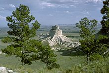 | Nebraska | 12. Dezember 1919 | 12,2 km² |
| Sonoran Desert |  | Arizona | 17. Januar 2001 | 1.968,4 km² |
| Statue of Liberty | New York | 15. Oktober 1924 | 0,2 km² | |
| Stonewall |  | New York | 24. Juni 2016 | 0,03 km² |
| Sunset Crater Volcano | 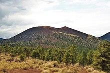 | Arizona | 26. Mai 1930 | 12,3 km² |
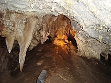
| Timpanogos Cave | (c) A J Butler, CC BY 3.0 | Utah | 14. Oktober 1922 | 1,0 km² |
| Tonto |  | Arizona | 19. Dezember 1907 | 4,5 km² |
| Tule Lake |  | Kalifornien | 5. Dezember 2008 | 5,629 km² |
| Tule Springs Fossil Beds |  | Nevada | 19. Dezember 2014 | 91,7 km² |
| Tuzigoot |  | Arizona | 25. Juli 1939 | 3,3 km² |
| Upper Missouri River Breaks | Montana | 17. Januar 2001 | 1.527,1 km² | |
| Vermilion Cliffs | Arizona | 9. November 2000 | 1.131,4 km² | |
| Virgin Islands Coral Reef | Amerikanische Jungferninseln | 17. Januar 2001 | 51,4 km² | |
| Waco Mammoth |
| Texas | 10. Juli 2015 | 0,4 km² |
| Walnut Canyon | Arizona | 30. November 1915 | 14,3 km² | |
| Wupatki | Arizona | 9. Dezember 1924 | 143,3 km² | |
| Yucca House | Colorado | 19. Dezember 1919 | 0,1 km² |
Siehe auch
- Nationale Naturmonumente in Deutschland
- Bundesinventar der Landschaften und Naturdenkmäler von nationaler Bedeutung in der Schweiz
Weblinks
- National Park Service (englisch)
- Bureau of Land Management (englisch)
- U.S. Forest Service (englisch)
- U.S. Fish and Wildlife Service (englisch)
Belege
- ↑ a b „Antiquities Act 1906–2006: Maps, facts and figures“. nps.gov. Liste US National Park Service über Ausweisungen, Flächen-Vergrößerungen und Verkleinerungen.
- ↑ FORMER NATIONAL PARK SYSTEM UNITS: AN ANALYSIS
- ↑ Carolin Wahnbaeck: „Trumps Attacke auf die Naturschutzgebiete“, Spiegel Online vom 10. Oktober 2017
- ↑ Presidential Proclamation Modifying the Grand Staircase-Escalante National Monument. In: Whitehouse.gov. 4. Dezember 2017, abgerufen am 4. Dezember 2017.
- ↑ Keith Schneider, Trump dramatically shrinks two national monuments in Utah, assailing rule by 'distant bureaucrats'Los Angeles Times vom 7. Dezember 2017.
- ↑ FACT SHEET: President Biden Restores Protections for Three National Monuments and Renews American Leadership to Steward Lands, Waters, and Cultural Resources
- ↑ John D. Dingell, Jr. Conservation, Management, and Recreation Act
- ↑ NPS Archeology Program: Antiquities Act Centennial. Abgerufen am 19. April 2019.
Auf dieser Seite verwendete Medien
Autor/Urheber: Edibobb, Lizenz: CC BY 3.0
Aerial photo of Fort Pulaski, Georgia, April 2002
Capulin Volcano National Monument, New Mexico. Capulin Mountain, a huge cinder cone which last erupted between 58,000 to 62,000 years ago, rises more than 1,000 feet above its base.
Windfall harbour, a natural harbour in Admiralty Island National Monument, Alaska
(c) Larry D. Moore, CC BY 4.0
Mammoth remains at the Waco Mammoth National Monument. Mammoth Q is a bull mammoth. Mammoths R and T were juveniles. Mammoth T was buried 68,000 years ago. Mammoth Q and R were buried 15,000 years later.
The Fort Ord National Monument holds some of the last undeveloped natural wildlands on the Monterey Peninsula. Located on the former Fort Ord military base, the Bureau of Land Management (BLM) protects and manages 35 species of rare plants and animals along with their native coastal habitats. Habitat preservation and conservation are primary missions for the Fort Ord Public Lands but there are also more than 86 miles of trails for the public to explore on foot, bike or horseback.
For more information please visit: www.blm.gov/ca/st/en/fo/hollister/fort_ord/index.html
Photo: Bob Wick, BLM California(c) Sirrobin33 aus der englischsprachigen Wikipedia, CC BY-SA 3.0
Exterior of Casa Grande National Monument. Picture taken 3/28/06.
Autor/Urheber: Jud McCranie, Lizenz: CC BY-SA 4.0
Medgar Evers House, Jackson Mississippi, U.S.
Located at the crossroads of the Cascade, Klamath, and Siskiyou mountain ranges, scientists have long recognized the outstanding ecological values of the Cascade-Siskiyou National Monument. The convergence of three geologically distinct mountain ranges resulted in an area with remarkable biological diversity. The Pacific Crest National Scenic Trail meanders 19 miles through the monument, offering challenging hikes with stunning views.
Photo by Bob Wick, BLMAutor/Urheber: Jeffrey Beall, Lizenz: CC BY 3.0
Chimney Rock National Monument, located in Archuleta County, Colorado.
Autor/Urheber: Daniel Schwen, Lizenz: CC BY-SA 3.0
Felsenbehausung im Walnut Canyon National Monument
Autor/Urheber: jill, jellidonut... whatever from Raleigh, NC, USA, Lizenz: CC BY-SA 2.0
Lava Beds National Monument, California, USA, 9/22/2007
Green turtles are commonly observed at Palmyra Atoll National Wildlife Refuge.
Betatakin Cliff Dwellings at Navajo National Monument in Arizona, United States
Hovenweep Castle
Autor/Urheber: BruceandLetty, Lizenz: CC BY 2.0
Hohokam Pima National Monument — a Hohokam cultural site, in Pinal County, Arizona.
- Currently closed to the public.
Photo of Gold Butte National Monument
Autor/Urheber: Jason Hickey, Lizenz: CC BY 2.0
The Rainbow Bridge National Monument
Autor/Urheber: RyannElizabeth, Lizenz: CC BY-SA 4.0
View into the main rooms from the trail leading to the dwellings.
- Image title: World war 2 plane wreckage
- Image from Public domain images website, http://www.public-domain-image.com/full-image/miscellaneous-public-domain-images-pictures/world-war-2-plane-wreckage.jpg.html
Scotts Bluff National Monument, Nebraska, USA. The limestone mesa ois called Dome Rock. Photo taken from the main bluff.
Caldera of Aniakchak Volcano, Aniakchak National Monument and Preserve, Alaska, USA. View from NE rim across Surprise Lake to Half Cone.
Autor/Urheber: Richie Diesterheft from Chicago, IL, USA, Lizenz: CC BY 2.0
La Ventana Arch
Corals were also diverse, but composition and abundance of corals differed between the north and south side of the seamount. We observed this colony of Jasonisis, a bamboo coral, with numerous crinoid associates.
Detail of a Paleozoic track in Prehistoric Trackways National Monument, New Mexico.
(c) ScottyBoy900Q aus der englischsprachigen Wikipedia, CC BY-SA 3.0
main gate of Fort McHenry, Maryland, USA
President Obama signs proclamation declaring the Berryessa Snow Mountain National Monument in Northern California. Public lands managed by the Bureau of Land Management and Forest Service in the new National Monument are some of the most scenic and biologically diverse landscapes in northern California. They range from rolling, oak-studded hillsides to steep creek canyons and ridgelines with expansive views.
Autor/Urheber: W. Bulach, Lizenz: CC BY-SA 4.0
Canyon de Chelly National Monument (USA Arizona – Navajoland): Eine steilwandige Schlucht in dem Colorado Plateau. Spider Rocks, etwa 240 Meter hohe Felsnadeln.
Autor/Urheber: Fredlyfish4, Lizenz: CC BY-SA 3.0
The entrance to Russell Cave in Russell Cave National Monument, Alabama.
(c) Stan Shebs, CC BY-SA 3.0
Rock spires on Spirit Mountain, Newberry Mountains, southern Nevada
San Juan Islands National Monument
The amazing San Juan Islands of Washington state offer a plethora of incredible sights, exciting recreation opportunities, and memories for a lifetime.
To learn more about your public lands on the San Juans and to plan a warm weather visit to this uniquely beautiful locale, visit <a href="http://www.blm.gov/or/resources/recreation/sanjuans/" rel="nofollow">www.blm.gov/or/resources/recreation/sanjuans/</a>
Photo by Jeff Clark, BLMHurricane Hole, Virgin Islands Coral Reef National Monument, USVI
Autor/Urheber: Burley Packwood, Lizenz: CC BY-SA 4.0
Pipe Spring National Monument in northern Arizona
Karte Marianas Trench Marine National Monument
Autor/Urheber: Brian Zinnel, Lizenz: CC BY-SA 4.0
Sep 2005 - Grand Portage, Minnesota. Great Lodge at Grand Portage National Monument.
(c) Photo: Gordon Leggett / Wikimedia Commons, CC BY-SA 4.0
Independence Monument at Colorado National Monument, located west of Grand Junction, Colorado USA on November 9, 2012.
The Upper Missouri River National Monument in Montana. Photo by Bureau of Land Management.
Visitor Center of the Mill Springs Battlefield in Nancy, Kentucky.
February's #nationalconservationlands, BLM Winter Bucket List, Grand Canyon-Parashant National Monument in Arizona for Its Dark Sky Park Status
The Grand Canyon-Parashant National Monument is a vast remote landscape where the only nighttime light comes from the stars. The International Dark Sky Association (IDA) recognized the unspoiled quality of its pristine and breathtaking night skies with an official IDA designation as “Parashant International Night Sky Province,” joining an elite group of other international Night Sky Places around the globe.
Twenty-two organizations throughout the southwestern United States supported the Grand Canyon-Parashant National Monument’s nomination for IDA’s “Dark Sky Park” status, including the scientific community. Its pristine “Gold Tier” night sky view creates prime research and discovery opportunities.
The scenery continues to impress during the day at this rugged corner of northern Arizona, with views stretching from the lower portion of the Grand Canyon to the pine clad peaks of Mount Trumbull and Mount Logan Wilderness Areas. Grand Canyon-Parashant National Monument is jointly managed by the Bureau of Land Management and the National Park Service.
Photos by Bob Wick, BLMFort Monroe, Virginia, from the Air US Army Photo
Autor/Urheber: Burley Packwood, Lizenz: CC BY-SA 4.0
Pueblo ruin at Tuzigoot National Monument
Archaeological mound at Yucca House National Monument, in Montezuma County, Colorado. 37°15′1″N 108°41′11″W / 37.25028°N 108.68639°W
Managed jointly by the BLM and National Park Service, Craters of the Moon National Monument is a uniquely preserved volcanic landscape whose central focus is the Great Rift, a 62-mile long crack in the Earth’s crust. Craters, cinder coves, lava tubes, deep cracks and vast lava fields form a strangely beautiful volcanic sea on central Idaho’s Snake River Plain.
Local legends made references to the landscape resembling the surface of the moon. In fact, the second group of astronauts to walk on the moon visited Craters of the Moon in 1969 to study the volcanic geology and to explore an unusual and harsh environment in preparation for their trip to space.
Researchers continue to study the area - particularly the caves within the monument and nearby BLM Areas of Critical Environmental Concern. A number of the caves provide hibernation habitat for Townsend’s big-eared bats, a sensitive species. And they provide a great learning resource for local students.Rising abruptly from the desert floor, the Santa Rosa and San Jacinto Mountains National Monument reaches an elevation of 10,834 feet at the summit of Mount San Jacinto. Providing a picturesque backdrop to local communities, the national monument significantly contributes to the Coachella Valley’s lure as a popular resort and retirement community.
The 280,000 acre monument is known as a great backcountry destination, with beautiful views and solitude from its readily-accessible trails. The monument also provides unique desert experiences for visitors, like nighttime “scorpion hunts” and dune discovery.
The BLM California manages four of the 21 national monuments within the BLM’s National Conservation Lands. These national monuments encompass landscapes of tremendous beauty and diversity, from rugged California coastline to vividly-hued desert canyons.
Photo by Bob Wick, BLMPipestone National Monument, Minnesota, USA. A quarry pit, where catlinite for the sacred pipes is quarried by hand
Autor/Urheber: Eric T Gunther , Lizenz: CC BY 3.0
Rear entrance to the Lincoln Cottage, September 2018
Sand to Snow shares a common boundary with Joshua Tree National Park, which in turn connects to Mojave Trails National Monument—the largest new addition at 1.6 million acres. Lava flows and mountains spread across this tract of the Mojave Desert. The focal point is the sand dunes; in particular, the remote and nearly pristine Cadiz Dunes that formed from the sand of dry lake beds. The second photograph above shows the ground-based view of dunes within the monument. Despite the remoteness of this monument, the area is well traveled. The corridor connects the deserts of the southwest to the Pacific Coast and has been travelled by people for thousands of years. The Southern Pacific railroad and Route 66 are the most famous byways through this desert landscape.
Autor/Urheber: William Warby, Lizenz: CC BY 2.0
Statue of Liberty (more formally, Liberty Enlightening the World, and more colloquially, Lady Liberty) is a structure located on Liberty Island in New York Harbor, presented to the United States on the centennial of the signing of the American Declaration of Independence as a gift from France. It was designed by Frédéric Bartholdi and gets its green coloring from patination of the outer copper covering. The statue is world-renowned for being the first thing sea-borne visitors, immigrants, and returning Americans see upon entering New York Harbor and has been known as a beacon of freedom to much of the world. It earned UNESCO World Heritage Site status in 1984.
Autor/Urheber: Brian W. Schaller, Lizenz: FAL
Mount St. Helens National Volcanic Monument, Washington, USA
(c) Bubba73 in der Wikipedia auf Englisch, CC BY-SA 3.0
Fort Frederica magazine
Autor/Urheber: en:User:Nationalparks (Talk), Lizenz: CC BY-SA 2.5
Fort Union, New Mexico, USA
During his return trip to St. Louis, William Clark of the Lewis and Clark Expedition climbed the Pillar and carved his signature and the date in the sandstone. Clark wrote, “This rock I ascended and from it’s top had a most extensive view in every direction on the Northerly Side of the river high romantic Clifts approach & jut over the water for Some distance both above and below...I marked my name and the day of the month and year."
This historic carving on the sandstone butte that Clark called a “remarkable rock” has inspired generations of visitors for more than 100 years.
Pompeys Pillar in Montana was proclaimed a national monument in January 2001. Prior to its monument status, it was a designated national historic landmark in 1965. It is located along the Lewis and Clark National Historic Trail.
Learn more: www.blm.gov/mt/st/en/fo/billings_field_office/pompeyspill...
Photo: Bob Wick, BLMAutor/Urheber: John Fowler from Placitas, NM, USA, Lizenz: CC BY 2.0
Yesterday I went out to Petroglyph National Monument, on the west side of Albuquerque. It's a nice place for a walk.
Autor/Urheber: DXR, Lizenz: CC BY-SA 4.0
A southeast view of Devils Tower, Wyoming
Autor/Urheber: BriYYZ from Toronto, Canada, Lizenz: CC BY-SA 2.0
Remains of San Gregorio, a 17th century Spanish Franciscan mission established at Abó Pueblo, a regional trading and pottery centre. Part of the Salinas Pueblo Missions National Monument. The mounds in the foreground are the remians of pueblos that existed in the community before the Spanish arrived.
2012 file PHOTO, new Sand to Snow National Monument, CA
Autor/Urheber: APK, Lizenz: CC BY-SA 4.0
Red Butte as viewed from Arizona State Route 64.
Tallahatchie County Courthouse in Sumner, Mississippi, United States
Taking its name from one of the longest living trees in the Arizona desert, the 129,000-acre Ironwood Forest National Monument is a true Sonoran Desert showcase. Keeping company with the ironwood trees are mesquite, palo verde, creosote, and saguaro, blanketing the monument floor beneath rugged mountain ranges named Silver Bell, Waterman and Sawtooth. In between, desert valleys lay quietly to complete the setting.Elevations here range from 1,800 to more than 4,200 feet. Three areas within the monument, the Los Robles Archeological District, the Mission of Santa Ana del Chiquiburitac and the Cocoraque Butte Archeological District, are listed on the National Register of Historic Places.
Learn more about Ironwood Forest NM: www.blm.gov/az/st/en/prog/blm_special_areas/natmon/ironwo...
Photo: Bob Wick, BLM CaliforniaAutor/Urheber: Tomas Castelazo, Lizenz: CC BY-SA 3.0
Montezuma´s castle in Arizona, from the Sinagua culture dating to 1000 years ago.
Autor/Urheber: Famartin, Lizenz: CC BY-SA 3.0
Panorama from an overlook on California State Route 180 near the southwestern edge of Giant Sequoia National Monument
Autor/Urheber: U.S. Department of the Interior, Lizenz: CC BY-SA 2.0
3325
Lava Butte in Newberry National Volcanic Monument, Oregon
Autor/Urheber: Daniel Martin, Lizenz: CC BY 3.0
The two snow-covered peaks are Mount San Antonio (aka Mt. Baldy) on the left and West Baldy on the right. Pine and Dawson are the two peaks to the left. In the distance, on the right, are Cucamonga Peak and Bighorn Peak. The dark peak in the midground right is Iron Mountain and the light-colored low peak in the center is Ross Mountain.
Title: A.G. Gaston Motel, Birmingham, Alabama
Physical description: 1 photograph : digital, TIFF file, color.
Notes: A.G. Gaston, the millionaire black businessman, bailed Martin Luther King, Jr., out of a Birmingham jail in 1963. Reverend King stayed at the A.G. Gaston Motel during his visits to plan the Civil Rights protests.; Title, date, subject note, and keywords provided by the photographer.; Gift; George F. Landegger; 2010; (DLC/PP-2010:090).; Credit line: The George F. Landegger Collection of Alabama Photographs in Carol M. Highsmith's America, Library of Congress, Prints and Photographs Division.; Forms part of: George F. Landegger Collection of Alabama Photographs in Carol M. Highsmith's America Project in the Carol M. Highsmith Archive.Fort Stanwix National Monument, Rome, NY, USA. Original Caption: And bird's eye view of the grounds of Fort Stanwix National Monument.
February #conservationlands15 Social Media Takeover: What is a National Monument?
The Antiquities Act of 1906 was signed into law by Theodore Roosevelt, for “… the protection of objects of historic and scientific interest” through the designation of national monuments by the President and Congress. National monuments are one of the types of specially-designated areas that make up the BLM’s National Conservation Lands.
Some of the earliest national monuments included Devils Tower, the Grand Canyon, and Death Valley. They were initially protected by the War Department, then later by the National Park Service. More recently, the BLM and other Federal agencies have retained stewardship responsibilities for national monuments on public lands. In fact, the BLM manages more acres of national monuments in the continental U. S. than any other agency. This includes the largest land-based national monument, the Grand Staircase-Escalante National Monument in Utah featured here.
National monuments under the BLM’s stewardship have yielded numerous scientific discoveries, ranging from fossils of previously unknown dinosaurs to new theories about prehistoric cultures. They provide places to view some of America’s darkest night skies, most unique wildlife, and treasured archaeological resources. In total, twenty BLM-managed national monuments, covering over five million acres, are found throughout the western U. S. and offer endless opportunities for discovery.
Photos and description by Bob Wick, BLMToday’s #conservationlands15 Top 15: Places on National Conservation Lands for Night Sky Viewing
The stars really do come out at night on BLM’s National Conservation Lands – and lots of them! Far from city lights, these landscapes offer some of the most outstanding viewing opportunities anywhere. Viewing night skies in some of these remote locations takes some planning. It’s important to contact the local BLM office (linked for each location) to obtain information on camping rules and current road conditions. Here are 15 of the best areas:
Alaska
- 1 Steese National Conservation Area: Drive out the Steese Highway for some of the best northern lights viewing anywhere. Don’t expect to see this amazing light show in summer – the midnight sun makes the sky too bright!
Arizona
- 2 Just beyond the glow of the City lights of Phoenix, the Sonoran Desert National Monument offers great dark skies to the south, where the milky arcs across the sky.
- 3 The high elevations near Mount Trumbell and Mount Logan offer expansive vistas in the Grand Canyon Parashant National Monument whose outstanding night sky viewing opportunities have resulted in its “International Night Sky Province” designation.
California
- 4 Several Wilderness Study Areas in the Eastern Sierra, including Slinkard (on Monitor Pass) and the Bodie Hills (near Bridgeport), are a world apart from California’s urban coastal areas and contain some of the darkest skies in the golden state.
- 5 California Coastal National Monument: Although clear skies are difficult to predict along the fogbound coast, the Big Sur, Mendocino Coast and King Range Coast are all far from city lights so you can see stars over the ocean.
Colorado
- 6 Canyons of the Ancients National Monument: Its easy to contemplate how “the ancient ones” studied the stars in this vast desert landscape near the four corners. Contact the Anasazi Heritage Center for ideas on camping/viewing locations.
- 7 Alpine Loop: This BLM backcountry byway runs near the Uncompagre Wilderness and both Handies Peak and Redcloud Peak Wilderness Study Areas. The thin air at 11,000 feet seems to make the stars here appear extra crisp.
Idaho
- 8 Morley Nelson Snake River Birds of Prey National Conservation Area: Just a stone’s throw from Boise, this area is truly on the edge of civilization. Overlooks along the north rim of the Snake River Canyon offer great viewing of the dark skies to the south.
Montana
- 9 Upper Missouri River Breaks National Monument and Wild and Scenic River: Nothing is more relaxing than floating down a river and sleeping under the stars here in Big Sky Country at night.
Nevada
- 10 Black Rock Desert High Rock Canyon Emigrant Trail National Conservation Area: Just avoid the last week of August when Burning Man lights up the playa, and you’ll be treated to some of the darkest skies in the U.S.
New Mexico
- 11 Rio Grande Del Norte National Monument and Wild and Scenic River: Vast volcanic tablelands above the narrow gorge of the river and crisp high elevation rocky mountain skies offer excellent viewing opportunities.
Oregon
- 12 Steens Mountain Wilderness: Southeast Oregon’s highest peak offers hiking, camping and a scenic drive to the high elevation viewing areas.
Utah
- 13 Grand Staircase-Escalante National Monument: From spectacular Grand Staircase of cliffs and terraces to the wonders of the Escalante River canyons, the monument offers nearly 1.9 million acres to starwatch and explore.
Washington
- 14 Juniper Dunes Wilderness: Enjoy the open skies and rolling dunes here in the southeast part of the state.
Wyoming
- 15 South Pass – California-Oregon-Pony Express and Mormon Emigrant Trails: Its easy to imagine the feeling of vastness that the emigrants found here in the mid-1800s as they rested under the stars before hitching up the oxen to continue their arduous trek.
Hagerman Fossil Beds National Monument, Idaho, USA. View over Snake River
Autor/Urheber: Rudydale, Lizenz: CC BY-SA 4.0
Exposed root system of a giant redwood tree
Autor/Urheber: Julius Rückert., Lizenz: CC BY-SA 3.0
Kasha-Katuwe Tent Rocks National Monument, New Mexiko, Vereinigte Staaten von Amerika.
Autor/Urheber: Cooper (Diskussion · Beiträge), Cooper.ch (Diskussion · Beiträge) on Commons, Lizenz: CC BY-SA 3.0
Devils Postpile National Monument, San Joaquin River Valley, California, United States
Autor/Urheber: John Fowler from Placitas, NM, USA, Lizenz: CC BY 2.0
View from Cottonwood Cove looking north past the Teepees across the Paria Plateau, in Coyote Buttes South, Vermilion Cliffs National Monument, Arizona.
Castillo_de_San_Marcos.jpg
BLM Winter Bucket List #25: Agua Fria National Monument, Arizona, for a Natural and Historic Getaway near Superbowl 49
The 70,900-acre Agua Fria National Monument, a part of the BLM’s National Conservation Lands, is approximately 40 miles north of Phoenix, just a short drive from Superbowl 49 central next week.
The area is located on a high mesa semi-desert grassland, cut by the canyon of the Agua Fria River and other ribbons of valuable riparian forest. The diversity of vegetative communities, topographic features, and a dormant volcano decorates the landscape with a big rocky, basaltic plateau. The Agua Fria River canyon cuts through this plateau exposing precambrian rock along the canyon walls, offering one of the most significant systems of prehistoric sites in the American Southwest. In addition to the rich record of human history, the monument contains outstanding wildlife and biological resources.
This habitat provides visitors with a wide variety of activities within the monument, from exploring cultural sites to viewing wildlife to hiking scenic trails. The monument is a great natural and historic getaway less than an hour from the city.
Photos by BLMer Bob WickAutor/Urheber: ALAN SCHMIERER, Lizenz: CC0
THE CARRIZO PLAIN
Autor/Urheber: Ser Amantio di Nicolao, Lizenz: CC BY-SA 4.0
Freedom Riders National Monument, Anniston, Alabama
Autor/Urheber: Artotem from Here, There, and..., Lizenz: CC BY 2.0
in Bandelier National Monument.
www.artotems.com- Location Agate Fossil BedsNational Monument
- Description During the 1890s, scientists rediscovered what the Lakota Sioux already knew - bones preserved in one of the most complete Miocene mammal sites in the world. Agate is a landscape that reflects many players – from early animals roaming the valleys and hills, to tribal nations calling the High Plains home, to explorers and ranchers passing through or settling in the American West.
Autor/Urheber: Pretzelpaws, Lizenz: CC BY-SA 3.0
Balanced rock in Chiricahua National Monument. Tree at left foreground is Pinus discolor. Taken with a Casio QV-3000EX camera.
A view of the Tule Lake War Relocation Center
- Horse Mountain is in the background — in Modoc County, northeastern California.
- Densho Encyclopedia: "Between April and August of 1942, Lee shot nearly 600 images of Japanese Americans in California, Oregon, and Idaho. … Between June and July, he took four color photographs of Tule Lake before moving on to Oregon."
Autor/Urheber: BLM Nevada, Lizenz: CC BY 2.0
BLM Photo Bob Wick
Ute Mountain (10, 093 ft) and the upper Rio Grande gorge
Autor/Urheber: Bill Rand, Lizenz: CC BY 2.0
Looking north across Constitution Avenue NW at the Sewall-Belmont House and Museum, with the Hart Senate Office Building behind it.
This green sea turtle and Hawaiian monk seal are exhausted from all the celebrating! Both of these at-risk species find safe haven in the Papahānaumokuākea Marine National Monument, which protects more than 580,000 square miles of ocean and atolls in the Northwestern Hawaiian Islands. (Photo: Mark Sullivan/NOAA, under NMFS Research Permit #10137)
Autor/Urheber: 1025wil, Lizenz: CC BY-SA 3.0
Last Stand Hill overlooking Little Bighorn River and Location of the Native American encampment on June 25, 1876. Photo taken November 2011.
Camp Nelson Civil War Heritage Park's Oliver Perry House/"White House" in Jessamine County
(c) Zarxos in der Wikipedia auf Englisch, CC BY-SA 2.5
Picture taken by me (Zarxos) in the Misty Fjords National Monument, Alaska, July 2005. Mixed forest dominated by Picea sitchensis.
Autor/Urheber: Der-wuppertaler, Lizenz: CC BY-SA 3.0
Statue of Juan Rodriguez Cabrillo, the first European who reached the US west coast, at Point Loma in San Diego
Autor/Urheber: Daniel Case, Lizenz: CC BY-SA 3.0
Stonewall Inn, birthplace of the modern gay-rights movement, festooned with gay-pride banners and flags the weekend after Gay Pride Day
Autor/Urheber: Bobak Ha'Eri, Lizenz: CC BY 3.0
National Chavez Center, on the campus of the United Farm Workers National Headquarters, Keene, California, USA.
- Location George Washington Birthplace National Monument
- Description George Washington, America’s first and greatest hero, was crucial to the establishment of the United States as a nation founded on the principles of liberty. George Washington Birthplace preserves the heart of the Washington lands and a memorial plantation. Here, in the peace and beauty of this place untouched by time, the staunch character of our hero comes to the imagination.
Oceanographers deploy a CREWS buoy inside an atoll. American Samoa, Rose Atoll.
Autor/Urheber: Western Arctic National Parklands, Lizenz: CC BY 2.0
A unnamed river snakes its way through the tundra in southeast Cape Krusenstern National Monument. Rivers are so numerous and remote in Cape Krusenstern and other WEAR parks that the U.S. Geological Survey has not named many of them.
Effigy Mounds National Monument entrance sign north of Marquette, Iowa. The sign design and text are public domain works of the United States Federal Government, National Park Service.
Autor/Urheber: Adamw1987, Lizenz: CC BY-SA 4.0
Landels Hill Big Creek Reserve from Gamboa Point, Cabrillo Highway, CA (California Coastal National Monument CCNM)
Autor/Urheber: Bureau of Land Management, Lizenz: CC BY 2.0
The Browns Canyon National Monument in Colorado will protect a stunning section of Colorado’s upper Arkansas River Valley. Located in Chaffee County near the town of Salida, Colorado, the 21,586-acre monument features rugged granite cliffs, colorful rock outcroppings, and mountain vistas that are home to a diversity of plants and wildlife, including bighorn sheep and golden eagles. Members of Congress, local elected officials, conservation advocates, and community members have worked for more than a decade to protect the area, which hosts world-class recreational opportunities that attract visitors from around the globe for hiking, whitewater rafting, hunting and fishing. In addition to supporting this vibrant outdoor recreation economy, the designation will protect the critical watershed and honor existing water rights and uses, such as grazing and hunting. The monument will be cooperatively managed by the Department of the Interior’s Bureau of Land Management and USDA’s National Forest Service.
Learn more: www.blm.gov/co/st/en/fo/rgfo/browns_canyon_national.html
Photos by Bob Wick, BLMAutor/Urheber: David Lamfrom, Lizenz: CC BY-SA 3.0
The Castle Mountains range and Johua tree (Yucca brevifolia) woodland, in the Eastern Mojave Desert and within Castle Mountains National Monument (est. 2016), San Bernardino County, California.
Autor/Urheber: Groknix, Lizenz: CC BY-SA 3.0
Snow on Franklin Mountains in El Paso, TX looking Northwest from Hondo Pass and Eclipse St.
Autor/Urheber: Bart Everson, Lizenz: CC BY 2.0
"Poverty Point" archaeological site, Louisiana. "Bird Mound".
Autor/Urheber: Mikesanchez1109, Lizenz: CC BY-SA 3.0
Sunset Crater Volcano from the cinder hills
Autor/Urheber: Rationalobserver, Lizenz: CC BY-SA 4.0
The central room block of Aztec Ruins National Monument
Autor/Urheber: Didier Descouens, Lizenz: CC BY-SA 4.0
Priscacara liops
- Fundort: Fossil-Lake, Wyoming, USA
- Zeitalter : Eozän - 55,8 Millionen Jahren und dauerte bis vor etwa 33,9 Millionen Jahren
- Größe: 11.5cm
Autor/Urheber: Chris Light, Lizenz: CC BY-SA 4.0
Front Range from Florissant Fossil Beds NM
Alibates Flint Quarries National Monument, Texas, USA - Hills in the National Monument
The Organ Mountains-Desert Peaks National Monument in New Mexico was established on May 21, 2014, by Presidential Proclamation, and is managed by the Bureau of Land Management. The Monument includes 496,330 acres, and was established to protect significant prehistoric, historic, geologic, and biologic resources of scientific interest. The National Monument includes three distinct regions: Organ Mountains, Desert Peaks, and Potrillo Mountains.
Learn more and plan your visit: on.doi.gov/1i5rYAW
Photo: Bob Wick, Wilderness SpecialistTule Springs Fossil Beds National Monument
Autor/Urheber: NatalieMaynor from Jackson, Mississippi, USA, Lizenz: CC BY 2.0
This is a replica of the smokehouse in Booker T. Washington's childhood.
Photographed by Doug Dolde at the John Day Fossil Beds in Oregon. More images from this location at http://www.painted-with-light.com
Ruined tower, Canyons of the Ancients National Monument, BLM Colorado. Hovenweep style Painted Hand Pueblo, Great Pueblo period: AD 1100 to 1300
Front and western side of the Colonel Charles Young House, located along U.S. Route 42 between Xenia and Wilberforce in Xenia Township, Greene County, Ohio, United States. Built in 1864, it has been declared a National Historic Landmark.
Natürliche Brücke Owachomo, Natural Bridges National Monument, Utah, USA
Autor/Urheber: Murray Foubister, Lizenz: CC BY-SA 2.0
Inside Jewel Cave National Monument...
Taken from the top of Jenny Lind Rock, this view shows the confluence of the Green and Yampa rivers at the base of Steamboat Rock in Echo Park. The rocky summit in the background is Harpers Corner.
Autor/Urheber: Bernard Gagnon, Lizenz: CC BY-SA 3.0
Lower Cliff Dwelling and desert habitat — Tonto National Monument Archeological District, Roosevelt, Arizona.
Autor/Urheber: Reinhard Dietrich, Lizenz: CC0
African Burial Ground National Monument, New York City
Autor/Urheber: Don Graham from Redlands, CA, USA - God bless it!, Lizenz: CC BY-SA 2.0
(1 in a multiple picture album) When the wagon trains encountered an impediment to their progress they called it a 'break'. Early settlers mistook the Utah junipers, found at lower elevations, for Cedar trees. Thus, the name Cedar Breaks was given. Prior to this, the Paiutes named the Cedar Breaks amphitheater 'Circle of Painted Cliffs' or 'un-cap-i-un-ump.' There was a forest fire burning to the west which accounts for the haze.
Many folks going to Bryce National Park don't take time to stop at this national monument but there should, especially in the morning.Autor/Urheber: Saginaw66, Lizenz: CC BY-SA 3.0
Fort Matanzas river view.jpg
Autor/Urheber: Burley Packwood, Lizenz: CC BY-SA 4.0
Organ Pipe Cactus at Organ Pipe Cactus National Monument
Autor/Urheber: Joel Mills, Lizenz: CC BY-SA 3.0
El Morro National Monument in New Mexico, US.
Autor/Urheber: Konrad Summers from Santa Clarita (Valencia) , California, USA, Lizenz: CC BY-SA 2.0
This photograph shows the remains of the base of the St. Francis Dam. After its collapse in 1928 the remaining blocks, including what had been the the large center section which had remained standing, were blasted and jack hammered. This was done in order to discourage sightseers and to avoid additional accidents after a teen fell to his death after ascending the remaining standing block of the concrete dam. Nevertheless, some of the steps that defined the face of the curved concrete gravity dam are visible in the foreground of these remains. This image differs from the original digital photograph; the contrast and color saturation have been modestly enhanced.
Note: It would be interesting to learn from someone who knows whether or not the foreground piece that shows the steps is the remains of the block that remained standing after the collapse."A bust of George Washington Carver by Audrey Corwin in 1952."


