Liste der Historic Civil Engineering Landmarks
In der Liste der historischen Meilensteine der Ingenieurbaukunst, englisch List of Historic Civil Engineering Landmarks, sind die von der American Society of Civil Engineers (ASCE) bezeichneten Meilensteine des Bauingenieurwesens aufgeführt. Das Projekt zur Bezeichnung der Meilensteine begann 1964. Die Auszeichnung wird an Projekte, Bauwerke und Orte in den USA als National Historic Civil Engineering Landmarks (deutsch Nationale historische Ingenieurbaukunst-Meilensteine), und in der übrigen Welt als International Historic Civil Engineering Landmarks (deutsch Internationale historische Ingenieurbaukunst-Meilensteine), vergeben. 2013 waren mehr als 250 Baudenkmäler in der Liste aufgeführt.[1][2] Die von den lokalen Sektionen des ASCE bezeichneten Meilensteine auf der Ebene einzelner US-Bundesstaaten oder auf lokaler Ebene sind hier nicht aufgeführt.
Einzelnachweise
- ↑ Historic Civil Engineering Landmark Program. ASCE, abgerufen am 30. Oktober 2019 (englisch).
- ↑ R. Rhoden: Lake Pontchartrain Causeway named National Historic Civil Engineering Landmark. In: The Times-Picayune. 8. November 2013, abgerufen am 17. November 2013 (englisch).
- ↑ Die Statue of Liberty steht auf Liberty Island. Die Insel ist im Besitz der Bundesregierung der Vereinigten Staaten, wobei die Gerichtsbarkeit aufgrund eines zwischenstaatlichen Vertrages von 1834 beim Bundesstaat New York liegt.
Auf dieser Seite verwendete Medien
Flagge des Vereinigten Königreichs in der Proportion 3:5, ausschließlich an Land verwendet. Auf See beträgt das richtige Verhältnis 1:2.
Flagge des Vereinigten Königreichs in der Proportion 3:5, ausschließlich an Land verwendet. Auf See beträgt das richtige Verhältnis 1:2.
Flag of Canada introduced in 1965, using Pantone colors. This design replaced the Canadian Red Ensign design.
Flag of Australia, when congruence with this colour chart is required (i.e. when a "less bright" version is needed).
See Flag of Australia.svg for main file information.Flagge Portugals, entworfen von Columbano Bordalo Pinheiro (1857-1929), offiziell von der portugiesischen Regierung am 30. Juni 1911 als Staatsflagge angenommen (in Verwendung bereits seit ungefähr November 1910).
Die quadratische Nationalfahne der Schweiz, in transparentem rechteckigem (2:3) Feld.
Das Bild dieser Flagge lässt sich leicht mit einem Rahmen versehen
Man sagt, dass der grüne Teil die Mehrheit der katholischen Einwohner des Landes repräsentiert, der orange Teil die Minderheit der protestantischen, und die weiße Mitte den Frieden und die Harmonie zwischen beiden.
Verwendete Farbe: National flag | South African Government and Pantone Color Picker
| Grün | gerendert als RGB 0 119 73 | Pantone 3415 C |
| Gelb | gerendert als RGB 255 184 28 | Pantone 1235 C |
| Rot | gerendert als RGB 224 60 49 | Pantone 179 C |
| Blau | gerendert als RGB 0 20 137 | Pantone Reflex Blue C |
| Weiß | gerendert als RGB 255 255 255 | |
| Schwarz | gerendert als RGB 0 0 0 |
Columbia-Wrightsville Bridge between Columbia and Wrightsville, Pennsylvania. Taken summer 1997 by Joseph Elliott, "3/4 view from southwest".
Great Falls of the Passaic River after 8 inches (200 mm) of rain drenched Northern New Jersey the second week of April 2007.
Looking westward on Court Avenue in Bellefontaine, Ohio, United States. The street, which is listed on the National Register of Historic Places, is recognized for being the first concrete-paved street in the country.
High Bridge, Kentucky.
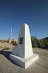
Streetside view of the Beginning Point of the U.S. Public Land Survey, a monument marking the site that served as the basis for the entire Public Land Survey System — the system by which most of the United States, outside of the original colonies, was surveyed. Located on the Ohio/Pennsylvania border east of downtown East Liverpool, Ohio, it is split between the city of East Liverpool and the borough of Ohioville in Beaver County, Pennsylvania. Erected in 1881 by a joint commission of Ohio and Pennsylvania surveyors, the monument was declared a National Historic Landmark in 1966. The road on which it lies is Ohio State Route 39 and Pennsylvania Route 68.
(c) Elkman aus der englischsprachigen Wikipedia, CC BY-SA 3.0
Picture of the Peavey-Haglin Experimental Concrete Grain Elevator in St. Louis Park, Minnesota, in April 2006.
Williamsburg Bridge spanning over the East River in New York City.
Autor/Urheber: User Leonard G. on en.wikipedia, Lizenz: CC SA 1.0
The 1929 Navajo Bridge at left, and the 1995 Navajo Bridge at right.
- These bridges cross the Colorado River at Marble Canyon. The Echo Cliffs are in the backround, to the east.
- The original bridge was the highest in the world at the time, replacing the Lee's Ferry crossing on the river. It was the only bridge crossing the Colorado River for over 600 miles. Despite the sparsely populated region, over 5,000 people attended the dedication.
- Original Bridge, at left
- Dedicated: June 14-15, 1929
- Construction cost: $390 thousand
- Total length: 834 ft (254 m)
- Steel arch length: 616 ft (188 m)
- Arch rise: 90 ft (27.4 m)
- Height above river: 467 ft (142 m)
- Width of the roadway: 18 ft (5.5 m)
- Amount of steel: 2.4 million lbs (1,089,000 kg)
- Amount of concrete: 500 cu yds (385 m3
- Amount of steel reinforcement: 8,200 lbs (3,700 kg)
- New Bridge, at right
- The main pin was set October 14, 1994, after seven months of construction.
- Construction cost $14.7 million
- Total length: 909 ft (277 m)
- Steel arch length: 726 ft (221 m)
- Arch rise 90: ft (27.4 m)
- Height above river: 470 ft (143 m)
- Width of the roadway: 44 ft (13.4 m)
- Amount of steel: 2.4 million lbs (1,089,000 kg)
- Amount of concrete: 1,790 cu yds (1370 m3
- Amount of steel reinforcement: 3.9 million lbs (1,769,000 kg)
- Credits
- Two panel composite image with third image of bridge shadow by en:User:Leonard G.
Sewall's Bridge & Country Club, York, ME; from a 1908 postcard. The wooden trestle bridge was built in 1761, and named for Major Samuel Sewall, Jr., the civil engineer who designed and constructed it.
Bailey Island Bridge (Bailey Island, Maine, June 2005, Kyle MacLea)
(c) Michel Van den Berghe, CC BY-SA 2.0
The Forth & Clyde Canal near to Bonnybridge and Larbert.
The spillway of Kentucky Dam in the 1940s. The dam, owned and operated by the Tennessee Valley Authority, is located in northwestern Kentucky, USA. The spillway is the largest in the TVA system, having a total discharge of over 1 million cubic feet per second.
Drydock Number One, Norfolk Naval Shipyard, Portsmouth, Virginia
(c) Elkman aus der englischsprachigen Wikipedia, CC BY-SA 3.0
A river-level view of the Stone Arch Bridge in Minneapolis, taken October 16, 2005. The very far left of the picture shows a small portion of the red metal bridgework where two of the stone arches were removed to build the lock and dam.
Autor/Urheber: Ymblanter, Lizenz: CC BY-SA 3.0
Ascutney Mill Dam, Windsor, Vermont
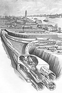
Streckennetz der Interborough Rapid Transit Corporation nach Vertrag eins und zwei (Contract No. 1 and No. 2).
Die Manhattaner Hochbahnen sind blau, die neue U-Bahn rot eingezeichnet.
Autor/Urheber: Daniel Case, Lizenz: CC BY-SA 3.0
William E. Ward House, believed to be the first building in the United States built entirely of reinforced concrete, on the state line between Rye Brook, NY (the left window of the main block and the wing) and Greenwich, CT (the rest of the main block and tower), USA
Autor/Urheber: Walter Siegmund, Lizenz: CC BY 2.5
Lake Washington; Interstate 90; Lacey V. Murrow Memorial Bridge and Mount Baker Tunnel; Seattle, Washington
(c) Chris English, CC BY-SA 3.0
Near Velarde, NM: U.S. Geological Survey Rio Grande Embudo Gaging Station, 2011
"Incline" portion of the Granite Railway, Pine Hill Quarry to Neponset River, Quincy, Norfolk County, Massachusetts
(c) Bravesfan8456 in der Wikipedia auf Englisch, CC BY-SA 3.0
Author: Brian Young (bravesfan8456)
Taken: 8/25/08, Washington, DC
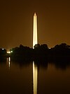
Description: Washington Monument at night from the Jefferson Memorial, reflecting in the Tidal Basin.Autor/Urheber: UpstateNYer, Lizenz: CC BY-SA 3.0
Troy Building on the campus of Rensselaer Polytechnic Institute in Troy, New York, United States
Autor/Urheber: Flickr user dhReno, Lizenz: CC BY-SA 2.0
Marlette Lake near Carson City, Nevada. The lake formerly served as a water supply for the silver mines in Virginia City, Nevada.
Autor/Urheber: Sean Lamb at en.wikipedia, Lizenz: CC BY-SA 2.0
A Santa Fe Railroad train negotiates en:Tehachapi Loop eastbound. It crosses over itself at tunnel 9 in this en:April en:1987 photo.
(c) Ross, CC BY-SA 2.0
Botanic railway station, Belfast. The tracks leading from Botanic towards Belfast Central Station.
Maria Pia Bridge in Porto, Portugal
Victoria Falls Bridge over Zambesi, between Zambia (far bank) & Rhodesia (now Zimbabwe) in 1975.
Atlantic City Convention Hall, On Boardwalk, West of Mississippi Avenue, Atlantic City (Atlantic County, New Jesey). (cropped)
Autor/Urheber: This photo (C) Lars Aronsson, Lizenz: CC SA 1.0
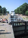
Bergs slussar, Berg, near Linköping, Sweden.
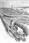
A 1909 diagram, as though looking northeast, of the Hudson and Manhattan Railroad (now PATH).
Autor/Urheber: Henry Schenk Tanner, Lizenz: CC0
Excerpt of 1833 South Carolina transportation map showing 136 mile route of rail road from Charleston to Hamburg, built and operated by the South Carolina Canal and Rail Road Company
Autor/Urheber: Kent Wang from Austin, TX, USA, Lizenz: CC BY-SA 2.0
JP Morgan Chase Building, Houston, Texas, not to be confused with the JPMorgan Chase Tower in the same city. The building has the headquarters of the Houston operations of JPMorgan Chase Bank, and the building was formerly the headquarters of Texas Commerce Bank
McNeil Street Pumping Station, McNeil Street & Cross Bayou, Shreveport (Caddo Parish, Louisiana)
|
Dieses Bild zeigt ein Objekt, das im National Register of Historic Places der Vereinigten Staaten verzeichnet ist. Die Referenznummer lautet 80001707. |
Autor/Urheber: Max13902, Lizenz: CC BY-SA 4.0
Utica Memorial Arena, Utica, New York after its 2015 renovation
Autor/Urheber: Magnus the Great, Lizenz: CC BY-SA 3.0
Dieses Gebäude ist in der Base Mérimée, einer Datenbank des französischen Kulturministeriums über das architektonische Erbe Frankreichs, aufgeführt, unter der Angabe PA00088685
Divided back postcard of a train exiting the west portal of the Hoosac Tunnel, postmarked 1911
Second New Hampshire Turnpike Bridge, Fullers Tannery, Hillsboro, Hillsborough County, NH
Davis Island Dam & Lock No. 1, Ohio River, mile 4.7 on right bank, Pittsburgh vicinity, Allegheny County, PA
Autor/Urheber: Rhodin, Lizenz: CC BY-SA 4.0
Chain of Rocks Water Purification Plant as seen from the The Chain of Rocks Bridge
Photo of the old Folsom Powerhouse on the American River, at Folsom Powerhouse State Historic Park, California, USA. By M.Mierzwa in June 2006 and released to the public domain. MCalamari 16:42, 21 September 2006 (UTC)
Autor/Urheber: Aude, Lizenz: CC BY-SA 2.5
Traveling through the Holland Tunnel, from Manhattan to New Jersey.
Satellite image of Cleveland Hopkins International Airport (2004-2005). USGS Image satellite via NASA World Wind.
The Eads Bridge over the Mississippi River under construction in St. Louis, Missouri, in 1874 or earlier.
A view of the Pennsylvania Turnpike at an overpass.
Plan of the City of Savannah, Georgia, USA. 1770.
Waterways Experiment Station, Hydraulics Laboratory, Halls Ferry Road, 2 miles south of I-20, in Vicksburg, Warren County, Mississippi.
- YAZOO BACKWATER PUMPING STATION MODEL of the YAZOO RIVER BASIN — (Model scale: 1' = 26').
- Historic American Engineering Record images of Mississippi.
Autor/Urheber: Daderot, Lizenz: CC BY-SA 4.0
Remnants of the Shawsheen River Aqueduct, Middlesex Canal, Wilmington, Massachusetts. Photograph taken by Daderot, September 2005.
Autor/Urheber: Der ursprünglich hochladende Benutzer war Jeffness in der Wikipedia auf Englisch, Lizenz: CC BY-SA 2.5
A picture of the Mackinac Bridge. The photo was taken from the southern shore of the Lower Peninsula facing St Ignace. The picture shows the Mackinac Bridge. This photo was taken by the submitter on April 28, 2007.
Orthoimage of the Horseshoe Curve in Blair County, Pennsylvania, outside of Altoona.
Wheeling Suspension Bridge over the Ohio River — West Virginia, eastern United States.
Autor/Urheber: Seattleretro, Lizenz: CC BY-SA 3.0
West Portal, Cascade Tunnel, Scenic, WA, United States
For use with the article w:Mullan Road, this photo shows one of the few remaining stretches of the road which follow the original route and are still in service.
- Library of Congress - Copyright 1899 - TITLE: City Hall, Philadelphia, Pa. - CALL NUMBER: U.S. GEOG FILE - Pennsylvania--Philadelphia [item] [P&P] - REPRODUCTION NUMBER: LC-USZ62-74155 (b&w film copy neg.) - RIGHTS INFORMATION: No known restrictions on publication. - MEDIUM: 1 photographic print. - CREATED/PUBLISHED: c1899. - NOTES: Photo copyrighted by R. Newell & Son. - This record contains unverified, old data from caption card.
REPOSITORY: Library of Congress Prints and Photographs Division Washington, D.C. 20540 USA
DIGITAL ID: (b&w film copy neg.) cph 3b21427 http://hdl.loc.gov/loc.pnp/cph.3b21427
CONTROL #: 2003675074Section of a map showing the Territory of Florida created by the US Army Corps of Engineers, published in 1839. Collection of Library of Congress Geography and Map Division, Washington, D.C. King's Road from St. Augustine, Florida to Ft. Barrington, Georgia is marked in red. Only Florida section visible.
Autor/Urheber: Brock Brannen, Lizenz: CC BY 2.5
The Golden Gate Bridge and San Francisco, CA at sunset. This photo was taken from the Marin Headlands
(c) Mick Knapton aus der englischsprachigen Wikipedia, CC BY-SA 3.0
The Conwy Railway Bridge. Personal photograph taken by Mick Knapton on 12th June 2004
Autor/Urheber: Daderot, Lizenz: CC0
Lawrence Experiment Station, 37 Shattuck Street, Lawrence, Massachusetts, USA. The world's first trial station for drinking water purification and sewage treatment.
Mississippi River Lock and Dam number 19 with Keokuk Rail Bridge and Keokuk-Hamilton Bridge downstream.
Queensboro Bridge from Long Island City
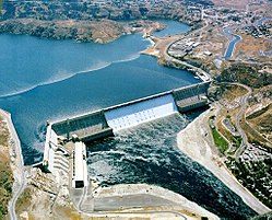
Grand Coulee Dam.
Autor/Urheber: Robert Raderschatt, Lizenz: CC BY-SA 3.0
Eine der bekanntesten Bauten der Spätantike: die Hagia Sophia (Baubeginn 325), nach einem Brand wieder neu errichtet unter Justinian I.
Die steinerne Bogenbrücke an der Frankford Avenue in Holmesburg, Philadelphia, Pennsylvania. Erbaut 1697. Seit 1997 unter Denkmalschutz.
Autor/Urheber: Jkan997, Lizenz: CC BY 3.0
Map of Yukon Railway route
Legend:
- 1000mm gauge tracks
- 1445mm gauge tracks
- major roads
- country border
Trestle on Central Pacific Railroad, by Carleton E. Watkins. Negative, 1868-1870; print, about 1880 Albumen print 8 1/16 x 12 3/8 in.
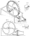
Drawings of Pelton water wheel (Pelton turbine)
A short tunnel on Going-to-the-Sun Road near Logan Pass.
Photo taken with a Panasonic Lumix DMC-FZ20 in Glacier National Park, Montana, USA.
Autor/Urheber: Cacophony, Lizenz: CC BY-SA 3.0
The Isaac Lee Patterson Bridge viewed from the southeast.
Eads South Pass Navigation Works: Bird's-eye view of the Jetties
Map of Alaska Highway (in red) showing surrounding main highways and towns.
Autor/Urheber: JJ Harrison (https://www.jjharrison.com.au/), Lizenz: CC BY-SA 3.0
Sydney Harbour Bridge from Circular Quay, Sydney, New South Wales, Australia.
Autor/Urheber: Brian Stansberry, Lizenz: CC BY 3.0
Norris Dam in Anderson County, Tennessee, in the southeastern United States. This view is from the West Overlook, looking northeast.
(c) Stubbleboy, CC BY-SA 3.0
Aerial photograph of Hoover Dam with New Bridge under construction
The Cortland Street Drawbridge in Chicago.
Hangar 9 stands as the only World War I era aircraft hangar listed in the National Register of Historic Places. Hangar 9 was built as a "temporary" structure in 1918 when Brooks Field was established as a training base for the Air Service of the Army Signal Corps.
Postcard of Sweetwater Dam at Sweetwater Reservoir on the Sweetwater River in San Diego, California. Store Web page states: "Description: 1907 R.P.O. postmark / Size: 3-1/2 x 5-1/2""
Postcard of the west end St. Clair River Tunnel in Port Huron, Michigan, United States. The east end is in Sarnia, Ontario, Canada.
The tunnel was designated a Civil Engineering Landmark by both the Canadian and the American Societies of Civil Engineers (CSCE and ASCE) in 1991. The tunnel is a designated US National Historic Landmark, and is listed on the US National Register of Historic Places (NRHP).
NRHP reference number 70000684
The Zhaozhou Bridge was built by the architect Li Chun from 595 to 605 AD, during the Chinese Sui Dynasty. It is the world's oldest fully-stone, open-spandrel, segmental arch bridge.
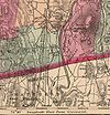
Map showing the location of the "Borden Base Line" running north/south between South Deerfield and Hatfield, Massachusetts, USA, here indicated as the "Base Line of the Mass. Trigonometrical Survey". This was the baseline for the first geodetic survey in the United States. This line was surveyed in 1831 to an accuracy of better than 1 part in 5 million by Simeon Borden.
(c) Jpo aus der englischsprachigen Wikipedia, CC BY-SA 3.0
Railroad bridge over Cape Cod Canal, Bourne, Massachusetts, USA.
Memphis, 1985
- Memphis & Arkansas Bridge, left
- Memphis Bridge, center
- Harahan Bridge, right
- (Hernando de Soto Bridge is some 2 miles / 3 km further upstream.)
(Caption corrected to correct name of Memphis & Arkansas Bridge per its nameplate. --RBBrittain 05:38, 6 August 2007 (UTC) ) (Caption corrected as to Hernando de Soto Bridge. --AHert (Diskussion) 16:43, 31 March 2015 (UTC))
This picture does not have anything to do with the "Hernando de Soto Bridge".
That bridge is considerably farther to the north, and it is a much, much more modern bridge.47.215.183.159 06:00, 24 August 2017 (UTC)
This image was found at the Library of Congress HAER archive entry with the original caption: "1. OVERALL VIEW OF BRIDGE (CENTER). VIEW TO SOUTHWEST. HAER TENN,79-MEMPH,19-1"
It is a part of the Historic American Engineering Record collection of photos. Image taken by Clayton B. Fraser, August 1985.
Note found on caption page
These photographs are Government material and are not subject to copyright. However, the courtesy of a credit line identifying the Historic American Engineering Record and the photographer would be appreciated.
- Hernando de Soto Bridge
Autor/Urheber:
- Original date: 17th June 2004
Menai Suspension Bridge.jpg
Autor/Urheber: John Phelan, Lizenz: CC BY 3.0
Interstate 95 northbound, from the ME Route 101 overpass, Kittery Maine
Alvord Lake Bridge — in San Francisco, California.
- This was the first reinforced concrete bridge in the United States.
- Looking east, in Golden Gate Park.
- A National Historic Civil Engineering Landmark.
- Historic American Engineering Record—HAER image.
Autor/Urheber: Wikipedia member Ebedgert, Lizenz: CC0
This photograph was taken by Wikipedia member Ebedgert.
Autor/Urheber: Scu ba, Lizenz: CC BY-SA 4.0
Old Fritz Lab, the original 1909 portion of the lab, prior to it's expansion. First civil engineering laboratory in a college in the United States
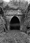
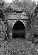
View of portal of Blue Ridge Tunnel (Crozet Tunnel), of the Blue Ridge Railroad. Located near U.S. Route 250 at Rockfish Gap, Afton vicinity, Nelson County, VA. Built 1850-1858. Photo retouched to remove black border.
Minot's Ledge Lighthouse in a storm
(c) Mediawerkz at en.wikipedia, CC BY-SA 3.0
View of the Bridgeport Covered Bridge — near French Corral, Nevada County, California.
- Built over the South Fork of the Yuba River in 1862, and renovated in 1996.
- A National Historic Civil Engineering Landmark.
Jones Island Sewage Plant in Milwaukee
Duck Creek Aqueduct
Autor/Urheber: MWyattB, Lizenz: CC BY-SA 4.0
Long ago, the Hohokam Indian Tribe built a series of canals throughout what is now the greater Phoenix area. After standing the test of time, these canals have been restored, and put to use for modern day inhabitants of central Arizona. These canals are listed as 164 under the List of Historic Civil Engineering Landmarks.
Ellicott's Stone at Bucks, Alabama, United States. This boundary marker was placed on April 10, 1799 by a joint U.S.-Spanish survey party, headed by Andrew Ellicott, on the border between the United States and Spanish West Florida. It was added to the National Register of Historic Places on 11 April 1973. This side (south) reads:
Autor/Urheber: Royalbroil, Lizenz: CC BY-SA 3.0
The w:Paper Discovery Center in w:Appleton, Wisconsin, along the w:Fox River (Wisconsin). The parking lot and building were the location for the w:Vulcan Street Plant, listed as a w:Historic Mechanical Engineering Landmarks. It was the site of the first hydroelectric power to run the Edison light system for a house.
View of the Afsluitdijk with the Wadden Sea on the left and the IJsselmeer on the right.
Autor/Urheber: William Warby, Lizenz: CC BY 2.0
Statue of Liberty (more formally, Liberty Enlightening the World, and more colloquially, Lady Liberty) is a structure located on Liberty Island in New York Harbor, presented to the United States on the centennial of the signing of the American Declaration of Independence as a gift from France. It was designed by Frédéric Bartholdi and gets its green coloring from patination of the outer copper covering. The statue is world-renowned for being the first thing sea-borne visitors, immigrants, and returning Americans see upon entering New York Harbor and has been known as a beacon of freedom to much of the world. It earned UNESCO World Heritage Site status in 1984.
(c) I, Elizabeth Thomsen, CC BY-SA 3.0
Photograph of the Moseley Arch, Merrimack College, North Andover, Massachusetts
Autor/Urheber: McGhiever, Lizenz: CC BY-SA 3.0
Far View Reservoir, Mesa Verde National Park, Colorado, USA. This Ancestral Puebloan mesa-top reservoir was built and used between AD 750 and AD 1180 and is one of four reservoirs that are part of the Prehistoric Mesa Verde Reservoirs, a Historic Civil Engineering Landmark. The stone walls were built to retain dredged sediment.
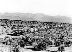
Two Holt 45 gas crawling-type ("caterpillar") tractors team up to pull a long wagon train in the Mojave Desert during construction of the Los Angeles Aqueduct in 1909.
Autor/Urheber: Manuel González Olaechea y Franco, Lizenz: CC BY-SA 3.0
Aquädukt von Segovia (Spanien)
Autor/Urheber: Original uploader was Daderot at en.wikipedia, Lizenz: CC BY-SA 3.0
A summer day on the Charles River Esplanade, Boston, Massachusetts. Photograph taken by me, July 2005.
w:en:Category:Images of Boston, Massachusetts
w:en:nl:Afbeelding:Charles River Esplanade, Boston, Massachusetts.JPGPhotograph of Building #71, Watertown Arsenal, Watertown, Massachusetts, USA.
The Blue Ridge Parkway snakes around Grandfather Mountain near the Linn Cove Viaduct at Mile Marker 304.
Photo taken with a Panasonic Lumix DMC-FZ50 in Avery County, NC, USA.
Gunnison Tunnel opening street display (Montrose, Colorado)
Pennsylvania Railroad, Rockville Bridge, Spanning Susquehanna River, North of I-81 Bridge, Rockville, Dauphin County, PA
Photo of the San Jacinto Monument taken from the Battleship Texas in Fall 2006. The Fred Hartman Bridge is visible in the background.
Aerial view of the Barbour's Cut area on the Houston Ship Channel in Houston, Texas, USA. This area is a large container terminal. This photograph appears to have been taken before the Fred Hartman Bridge was built, or when the bridge was under construction. In a present-day photograph, the bridge should be clearly visible at top right.
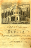
Title page of Blake's Collection of Duetts for Two Flutes, Clarinets, or Violins published by George E. Blake in Philadelphia circa 1807. The engraving, one of possibly the only examples of Blake's non-musical engravings, shows the building (designed by Benjamin Latrobe) that housed Philadelphia's water works, one of the first such systems in the country.
Choate Bridge, Spanning Ipswich River at South Main Street, Ipswich, Essex County, MA
Hiram M. Chittenden Locks
(c) Elkman aus der englischsprachigen Wikipedia, CC BY-SA 3.0
South elevation of the en:Seventh Street Improvement Arches in en:St. Paul, Minnesota.
Hydro plant in Michigan, USA
Looking downstream along the Muskingum River Canal at Zanesville, Ohio, United States. Constructed in 1841, the Zanesville waterfront portion of the canal is listed on the National Register of Historic Places. Photo is taken from the former canal towpath — now a footpath — on the riverside bank of the canal.
View of west side of Carrollton Viaduct in Baltimore, Maryland. Completed in 1829 by Baltimore and Ohio Railroad. Image cropped.
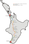
Map of North Island New Zealand, North Island Main Trunk Line
Portland Head Light
16. LOOKING DOWN INCLINED PLANE 7 WEST. FLUME THAT CARRIES WATER TO PENSTOCK IS VISIBLE AT RIGHT. WATER POWER WAS USED TO OPERATE LIFTING MACHINERY. - Morris Canal, Bowerstown, Washington Township, Warren County, NJ
Autor/Urheber: Kirkpatrick (talk), Lizenz: CC BY-SA 3.0
The Walnut Street Bridge during the Flood of 2004.
George Washington Bridge from New Jersey
Autor/Urheber: Fcb981 ; Eric Baetscher (attribution required), Lizenz: CC BY-SA 3.0
Grand Central terminal in New York, NY
Autor/Urheber:
- F. E. COMPTON AND COMPANY, 1914 (PD-US-1923)
- Derivative work: This user has left wikipedia at en.wikipedia
Chicago Sanitary and Ship Canal (at the time named the Chicago Drainage Canal) being built. This image has been extracted, rotated, retouched and resaved from The New Student's Reference Work.
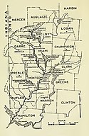
Miami Valley, Ohio: "Map of Miami river drainage area showing location of proposed retarding basins".
Park Street Station, Boston, Massachusetts, USA, circa 1898.
Autor/Urheber: Der ursprünglich hochladende Benutzer war Luxomni in der Wikipedia auf Englisch, Lizenz: CC BY-SA 3.0
Picture of train exiting the six-mile-long Moffat Tunnel at Winter Park, Colorado. This is an original picture by Christopher Ness shot October 5, 2004 and released under the GFDL..
The eastern entrance to the Chesapeake & Delaware Canal at Reedy Point, Delaware. Fort Dupont State park is at the right. The Reedy Point Bridge, carrying Delaware State Route 9, is visible in the distance. The U.S. Army Corps of Engineers hopper dredge McFarland is exiting the channel. View is to the east. The channel entrance is located on the Delaware River in New Castle County, Delaware, USA.
- IMO Number: 7739856
- MMSI Number: 338997000
- Callsign: AEGB
- Length: 100 m
- Beam: 24 m
Fort Peck Dam spillway construction (1986). Gate piers No. 3-9 completed. Pouring No. 10. Fort Peck, northeastern Montana.
(c) The Pennsylvania Bureau of State Parks, CC BY-SA 3.0
The former Kinzua Bridge at Kinzua Bridge State Park in McKean County, Pennsylvania, United States
A lithograph of Druid Lake made by A. Hoen and Company as part of their Baltimore City Water Works series. Druid Lake, A. Hoen, ca. 1880, MdHS, H264.4
Watervliet Arsenal Museum at Watervliet Aresnal, Watervliet, New York, the oldest continuously operating arsenal in the U.S. and a National Historic Landmark. This is Building 38 at the Arsenal and is called the "Iron Building".
Autor/Urheber: Dmadeo, Lizenz: CC BY-SA 3.0
Potomac Canal historic district, Great Falls, VA
Autor/Urheber: Der ursprünglich hochladende Benutzer war Conversion script in der Wikipedia auf Englisch, Lizenz: CC BY-SA 3.0
(Telford's suspension bridge in Conwy, North Wales)
Autor/Urheber: Florian Pépellin, Lizenz: CC BY-SA 3.0
Newark Airport, NJ. Foreground: Terminal C; background: The borough of Manhattan.
Engraving print of the inside of Isambard Kingdom Brunel's train-shed at Bristol Temple Meads railway station in the UK. Image shows a Great Western Railway 2-2-2 locomotive waiting by the platform.
Keeseville Stone Bridge, Keeseville, New York (built 1843)
Autor/Urheber: Eric Guinther (en:User:Marshman), Lizenz: CC BY-SA 3.0
South structure of Bonneville Dam on the lower Columbia River, Washington, USA
(c) Dav5nyc at the English Wikipedia, CC BY-SA 3.0
Triborough Bridge from Astoria Park, Queens.
Dry Dock 1 - Boston Naval Yard, Charlestown, Boston, Massachusetts. A civil engineering landmark.
A hand-colored lithograph of the Niagara Suspension Bridge, showing the Niagara Falls in the background and the Maid of the Mist in the waters below. The architecture of the bridge is visible in this picture.
Autor/Urheber: Andrew massyn, Lizenz: CC BY-SA 3.0
Woodhead Dam
2nd Street Bridge information sign in Allegan, MI. author: user-pagan22, no copyright laws applicable
craigellachie bridge side on
One of three photos collectively captioned "Bringing Cedar River water to Seattle. / This shows work in hand by Pacific Bridge Company." The photo is individually captioned "Headworks intake and wing dam".
Autor/Urheber: Justin Doub, Lizenz: CC BY 2.0
Dorton Arena in Raleigh, North Carolina.
Autor/Urheber: Angela Davies, Lizenz: CC BY-SA 4.0
The Stanley Hydraulics Laboratory at University of Iowa. The building is situated on the Iowa River. In 2005, the Hydraulics Lab was designated as a National Historic Civil Engineering Landmark by the American Society of Civil Engineers.
(c) Millbrooky in der Wikipedia auf Englisch, CC BY 3.0
A view of the River des Peres in St. Louis from Lansdowne Ave. looking south.
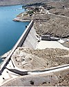
Elephant Butte Dam near Truth or Consequences, New Mexico
Blenheim Bridge, spanning Schoharie Creek, River Road (now bypassed), North Blenheim, Schoharie County, NY.
Autor/Urheber: Ben Stanfield from Rockville, MD, USA, Lizenz: CC BY-SA 2.0
The view from Crown Point.
Canal system in Lowell, Massachusetts. Map as of 1975.
Waterworks, Monocacy Creek vicinity, Bethlehem (Northampton County, Pennsylvania)
- A Historic American Buildings Survey—HABS image. (cropped)
Watercolor Rendering of Cabin John Bridge Scaffolding, Washington Aqueduct. Captain M.C. Meigs, Chief Engineer; Alfred L. Rives, Assistant Engineer, Delineator. (Also called Union Arch Bridge. Location: Cabin John, Maryland.) Archived by U.S. National Park Service, Historic American Engineering Record.
Incline 6 trail and recreated tracks at Allegheny Portage National Historic Site
Autor/Urheber: Der ursprünglich hochladende Benutzer war Decumanus in der Wikipedia auf Englisch, Lizenz: CC BY-SA 3.0
Mount Washington Cog Railway (taken Sept. 22, 2004) &169l; 2004 Matthew Trump
Autor/Urheber: Der ursprünglich hochladende Benutzer war Jcmurphy in der Wikipedia auf Englisch, Lizenz: CC BY-SA 3.0
Ardnacrusha hydroelectric power plant, Ireland
Pergola in parkway of The Paseo, Kansas City, Missouri
Autor/Urheber: Julie Anne Workman, Lizenz: CC BY-SA 3.0
Dieses Gebäude ist in der Base Mérimée, einer Datenbank des französischen Kulturministeriums über das architektonische Erbe Frankreichs, aufgeführt, unter der Angabe PA00088801
Phare d'Eddystone Rocks au large de Plymouth
- Lieu : Manche Ouest, 8 Milles au Sud de la baie de Plymouth
- Date : 2005
- Auteur : photo personnelle
Southern (downstream) side of the Cornish-Windsor Covered Bridge, which spans the end of the Zoarville Bridge, which spans the Connecticut River between Cornish, New Hampshire and Windsor, Vermont, in the United States. Built in 1866, it is listed on the National Register of Historic Places.
(c) Mfwills in der Wikipedia auf Englisch, CC BY 3.0
Looking northwest at Poughkeepsie Railroad Bridge from Waryas Park
Autor/Urheber: Der ursprünglich hochladende Benutzer war Decumanus in der Wikipedia auf Englisch, Lizenz: CC BY-SA 3.0
Bayonne Bridge as seen from Port Richmond, Staten Island © 2004 Matthew Trump
Front face of the B reactor at the Hanford site. Image #N1D0029049 at http://www5.hanford.gov/ddrs/index.cfm.
Bunker Hill Bridge, Spanning Lyle Creek, bypassed section of Island Fo, Claremont vicinity, Catawba County, NC
The western front of the United States Capitol. The Neoclassical style building is in Washington, D.C., on Capitol Hill, at the east end of the National Mall. The Capitol was designated a National Historic Landmark in 1960.
Autor/Urheber: Igors Jefimovs, Lizenz: CC BY 3.0
George Vancouver statue in King's Lynn, Norfolk
(c) Larry D. Moore, CC BY 4.0
A typical marker placed along the route of the Old San Antonio Road (aka Kings Highway or Camino Real) in 1918. This one located about 4 miles west of Bastrop, Texas, United States on Texas State Highway 71.
Manhattan Bridge from Fulton Landing Park
Autor/Urheber:
문화재청 (공공누리 제1유형)
bifyu (a flickr user), Lizenz: CC BY-SA 3.0A view of the west gate of Hwaseong Fortress and its accompanying watch tower.
Autor/Urheber: Robert Nunnally, Lizenz: CC BY 2.0
A picture of the Denison Dam and hydroelectric power plant.
Interior of the Montgomery Bell Tunnel, located near White Bluff in Cheatham County, Tennessee, United States. Built by slave labor as a water diversion tunnel in 1819, it was the first significant tunnel in the United States. Now a part of Harpeth River State Park, it has been designated a National Historic Landmark.
Autor/Urheber: icelight from Boston, MA, US, Lizenz: CC BY 2.0
View of Machu Picchu from a short way above the site, hiking towards the Dawn Gate.
Cumbres and Toltec Scenic Railroad with trains
|
Dieses Bild zeigt ein Objekt, das im National Register of Historic Places der Vereinigten Staaten verzeichnet ist. Die Referenznummer lautet 73000462. |
Autor/Urheber: Searchme, Lizenz: CC BY-SA 3.0
Atrium and dome of the West Baden Springs Hotel (built 1901) — in West Baden, Indiana.
Two cutaways of the hydroelectric plant at Snoqualmie Falls, from brochure Seattle and the Orient (1900). Together they are captioned in the brochure as "The Snoqualmie Power Co."; the upper illustration is captioned "Diagram of Headworks" and the lower "Subterranean machinery chamber of the Snoqualmie Power Co."
Tennessee State Capitol in Nashville, Tennessee
Autor/Urheber: Photo by and (c)2006 Derek Ramsey (Ram-Man), Lizenz: CC BY-SA 2.5
A photograph of Roebling's Delaware Aqueduct showing the bridge from the side.
| |||
Autor/Urheber: Pedro Jacob, Lizenz: CC BY-SA 3.0
Full moon over Santiago de Querétaro, México.
- October, 2010.
Old Post Office, Merchant & Bethel Streets, Honolulu, Honolulu County, HI
Autor/Urheber: Steve L. Martin, Lizenz: CC BY 2.0
Monumento Nacional Arqueologico Guayabo is probably the largest archaeological site in Costa Rica.
The "Old" Bidwell Bar Bridge — originally spanning the Feather River, in Butte County, California.
- Relocated beside Lake Oroville, after construction of the Oroville Dam and submersion of the site by Lake Oroville.
- Built in 1855, it is first steel suspension bridge in California, a National Historic Civil Engineering Landmark, and a California Historical Landmark.
Autor/Urheber: Smallbones, Lizenz: CC0
National Historic Landmark Union Canal Tunnel on the NRHP since October 1, 1974. Located west of Lebanon off Pennsylvania Route 72 in a park that can be accessed from Tunnel Hill Road or from the other side Union Canal Road, North Lebanon Township, Lebanon County, Pennsylvania. This is the south portal (canal comes in from the east and takes a 90 degree turn north at the tunnel). The light at the end of the tunnel, 700+ feet away, can be seen in this photo.
A sailboat on the Great Dismal Swamp Canal.
Autor/Urheber: SeanMack, Lizenz: CC BY 2.5
Mundaring Weir in the Darling Range, Perth, WA. Taken by me SeanMack.
Roosevelt Dam and lake, Arizona. The original dam did not meet the standards for a "maximum credible earthquake" [1]
Cotter Bridge, Spanning White River at U.S. Highway 62, Cotter, Baxter County, AR.
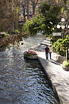
The Espada aqueduct crossing Piedras creek in San Antonio.
Autor/Urheber: User:Sébastien Savard, Lizenz: CC BY-SA 2.5
Pont de Québec vu du Parc aquarium du Québec (ville de Québec, Québec, Canada); A view of the Quebec Bridge from the Parc Aquarium du Québec (Quebec city, Quebec, Canada)
Autor/Urheber: Totoro!, Lizenz: CC BY 2.0
Malleco Viaduct, a railway bridge located in central Chile, passing through the Malleco River valley (Araucanía Region, Chile)
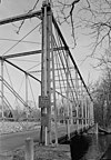
Fink Through-Truss Bridge, Hunterdon County Government Complex (moved to), Flemington vicinity, Hunterdon County, NJ
Map of Camino Real de Adentro of the Spanish Viceroyalty of New Spain:
- Trail route runs between Mexico City in Colonial Mexico, and Santa Fe and San Juan in Colonial New Mexico (Santa Fe De Nuevo México province).
- Present day nations/borders are shown.
The Starrucca Viaduct near Lanesboro, Pennsylvania, as seen in a photo from 1920.
Die Zeremonie des Schlagens des letzten Nagels (golden spike) auf dem Promontory Summit, Utah am 10. Mai 1869; bei der Vollendung der First Transcontinental Railroad. Samuel S. Montague, Central Pacific Railroad (links) und Grenville M. Dodge, Union Pacific Railroad (rechts) schütteln die Hände.
Autor/Urheber: Der ursprünglich hochladende Benutzer war Citynoise in der Wikipedia auf Englisch, Lizenz: CC BY-SA 2.5
Map showing the route of the historic National Road — at its greatest completion in 1839.
exterior view of the Carter H. Harrison Water Intake Crib two miles from the shore in Lake Michigan, 1910.
The Huey P. Long Bridge, just west of New Orleans, Louisiana. Photo was taken from the eastbound Amtrak Sunset Limited on November 11, 2007, as the train started over the bridge.
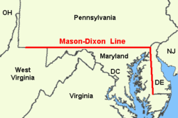
Extent of the original Mason–Dixon line. Mason and Dixon were prevented from finishing the western portion of the line due to a potential conflict with American Indians. The line was later extended (by others) to the Ohio River and not only established the Pennsylvania-Maryland/Virginia border, but also the border between Marshall and Wetzel Counties (now in West Virginia).
(c) Shreeg88 in der Wikipedia auf Englisch, CC BY 2.5
The north wall of the Castillo de San Marcos. Taken By Victor Patel
(c) Lordkinbote in der Wikipedia auf Englisch (Robert A. Estremo), CC BY-SA 2.0
MCAS Tustin hangar No. 2.
Easton Free Bridge
Durange and Silverton Narrow Gauge Railroad at Silverton.
Smithfield Street Bridge
(c) Cmh aus der englischsprachigen Wikipedia, CC BY-SA 3.0
Image by Colin Henein.
Autor/Urheber: Rocky Mt. View Co., Glenn L. Gebhardt Mgr. 360 Lamar St., Denver, Colorado 80226, Lizenz: CC BY-SA 2.0
Place: South Platte River, southwest of Deckers, Colorado
Description/Caption: V-751 Cheeseman Lake and Dam, Deckers, Colo. Source of Denver's Water Supply 1926
Medium: Real Photo Postcard (RPPC)
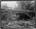
Cite as: CO-A-0046, WaterArchives.orgDunlap's Creek Bridge, Spanning Dunlap's Creek, Brownsville, Fayette County, PA
Dunlap's Creek Bridge was the first cast iron, metal arch bridge in the United States. It was designed by Richard Delafield and built by the United States Army Corps of Engineers.[1] Constructed from 1836 to 1839 on the National Road in Brownsville, Pennsylvania enroute to the Brownsville Bridge to Washington County, PA, it remains in use today. It is listed on the National Register of Historic Places and is a National Historic Civil Engineering Landmark (1978).

It is located in the Brownsville Commercial Historic District and supports lower Market Street, the local main thoroughfare and lower town 'main street'. Facing north from Dunlap's Creek, looking up Market Street and along the eastward direction of National Road, the town and street layout forms the shape of a huge check-mark, climbing for several city blocks, then bending sharply more than 90 degrees and climbing the ridge of the drainage divide between the two tributary valleys to far off Cumberland, Maryland at the head of the Potomac River and the port of Baltimore, Maryland. This made each of these municipalities a key overland waypoint on the near-west Emigrant Trail as Americans began colonizing the midwest.
• Due to the steep sides of the Monongahela River valley, there is only room for two short streets parallel to the river's shore and graded mild enough to be comfortable to walk before the terrain rises too steeply for business traffic. BOTH are visible in this view. The square concrete arch is actually a building foundation, the other lower street is visible in the far distance.
• Background: Two right bank large tributary streams of the Monongahela River drainage basin along the west side of the Allegheny Mountains barrier range, Redstone Creek and Dunlap's Creek, created conditions that formed a valuable ramp-like sloped terrain enabling Amerindians (for centuries) and colonials to reach a ford (crossing) the wide barrier of the Monongahela. Descending between the two small rivers, Nemacolin's Trail/the National Pike path has to cross Dunbar street to reach the ford on the upstream side of the confluence. The same two creeks and cross-river flats of West Brownsville, Pennsylvania became centers of river boat construction, giving Brownsville a historic edge as a industrial and outfitting center in near-western communities keeping it larger than Pittsburgh into the 1850s.
Exterior view of the Goodyear Airdock.
Autor/Urheber: chief_huddleston, Lizenz: CC BY 2.0
Former NP Hi-Line Bridge at Valley City, North Dakota.
Autor/Urheber: Autor/-in unbekannt, Lizenz: CC BY 2.5
Banaue Rice Terraces in the Philippines Where Traditional Landraces Have Been Grown for Thousands of Years.
Waldo-Hancock Bridge, Spanning Penobscot River at U.S. Route 1, Bucksport vicinity, Hancock County, ME. 4.
View from east bank of Penobscot, looking north with Bucksport in background.
|
Dieses Bild zeigt ein Objekt, das im National Register of Historic Places der Vereinigten Staaten verzeichnet ist. Die Referenznummer lautet 85001267. |
The Bollman Truss Railroad Bridge at Savage, Maryland following 1983-84 Rehabilitation by WM&A.
Autor/Urheber: Jrozwado, Lizenz: CC BY-SA 4.0
|
Dieses Bild zeigt ein Objekt, das im National Register of Historic Places der Vereinigten Staaten verzeichnet ist. Die Referenznummer lautet 82002333. |


