Nassau County (New York)
 | |
| Verwaltung | |
|---|---|
| US-Bundesstaat: | New York |
| Verwaltungssitz: | Mineola |
| Gründung: | 1898 |
| Gebildet aus: | Queens County |
| Vorwahl: | 001 516 |
| Demographie | |
| Einwohner: | 1.395.774 (Stand: 2020) |
| Bevölkerungsdichte: | 1.881,1 Einwohner/km2 |
| Geographie | |
| Fläche gesamt: | 1173 km² |
| Wasserfläche: | 431 km² |
| Karte | |
 | |
| Website: www.co.nassau.ny.us | |
Nassau County[2] ist ein County im Bundesstaat New York der Vereinigten Staaten. Es zählt zu den Vorort-Regionen von New York City und hatte bei der Volkszählung im Jahr 2020 1.395.774 Einwohner und eine Bevölkerungsdichte von 1.881,1 Einwohnern pro Quadratkilometer.[3] Der Verwaltungssitz (County Seat) ist Mineola. Nassau County liegt auf der Insel Long Island und wurde 1898 aus dem östlichen Teil von Queens County gebildet, weil die Bewohner gegen die Eingemeindung nach New York City stimmten. Nassau County besteht aus 3 Towns und 2 Cities.
Geschichte

Benannt wurde es nach Wilhelm III. von Oranien-Nassau, König von England.
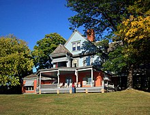
Im County liegt eine National Historic Site, die Sagamore Hill National Historic Site. Drei Orte haben den Status einer National Historic Landmark, die Sloop Christeen, die Fort Massapeag Archeological Site und das John Philip Sousa House.[4] 139 Bauwerke und Stätten des Countys sind insgesamt im National Register of Historic Places eingetragen (Stand 17. Februar 2018).[5]
Geographie
Das County hat eine Fläche von 1.173 Quadratkilometern, wovon 431 Quadratkilometer Wasserfläche sind. Es grenzt im Westen an den New Yorker Stadtteil Queens und im Osten an Suffolk County. Gemeinsam mit dem Suffolk County wird es von den Einwohnern nicht ganz korrekt als Long Island bezeichnet – in Unterscheidung zu den zwar ebenfalls auf der Insel beheimateten, aber zu New York City gehörenden Stadtteilen Queens und Brooklyn. Das County ist dicht besiedelt und fast durchgehend bebaut. Es gehört zu den einkommenstärksten und sichersten Countys in den Vereinigten Staaten.
- Long Island (Bundesstaaten farbig)
- Nassau County (rot) und Suffolk County (blau und hellblau) sowie Brooklyn und Queens (N.Y. City, orange) im Westen
Ortschaften
Nassau County besteht aus zwei Städten, die als cities bezeichnet werden, Glen Cove und Long Beach, sowie aus drei Gebietseinheiten, die man towns nennt:
In den Towns gibt es zahlreiche Ortschaften, die entweder villages („Dörfer“) oder hamlets („Weiler“) heißen:
|
|
|
|
|
Einzelnachweise
- ↑ Auszug aus dem National Register of Historic Places - Nr. 78001863 Abgerufen am 8. Juni 2011
- ↑ Nassau County (New York). In: Geographic Names Information System. United States Geological Survey, United States Department of the Interior, abgerufen am 5. September 2024 (englisch).
- ↑ Quickfacts: Nassau County, New York (Englisch)
- ↑ Listing of National Historic Landmarks by State: New York. National Park Service, abgerufen am 17. Februar 2018.
- ↑ Suchmaske Datenbank im National Register Information System. National Park Service, abgerufen am 17. Februar 2018.
Weblinks
Koordinaten: 40° 44′ N, 73° 35′ W
Auf dieser Seite verwendete Medien
Autor/Urheber: Timo Forchheim = Tzign, Lizenz: CC BY-SA 3.0
Map of Long Island, NY
This is a locator map showing Nassau County in New York. For more information, see Commons:United States county locator maps.
(c) English Wikipedia Benutzer Daniel Case, CC BY-SA 3.0
Front cottage of Wild Bank, John Philip Sousa's estate in Sands Point, NY, USA. The main house is shielded by trees and cannot easily be seen from the front gate.
Autor/Urheber: Schwalbe from german Wikipedia, Lizenz: CC BY-SA 3.0
Sagamore Hill, der frühere Wohnsitz von Theodore Roosevelt
Autor/Urheber: NuclearVacuum, Lizenz: CC BY-SA 3.0
A map of Long Island based on statehood proposals.
Autor/Urheber: DanTD, Lizenz: CC BY-SA 3.0
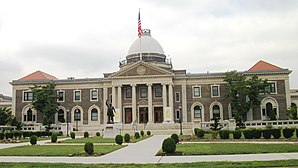
The Old Nassau County Court House in Garden City, New York near Mineola, New York.


