Nashville Street Circuit
Adresse: | ||
| 36° 9′ 44″ N, 86° 46′ 28″ W | ||
| Streckenart: | temporäre Rennstrecke | |
|---|---|---|
| Architekt: | Tony Cotman / NZR Consulting | |
| Eröffnung: | 8. August 2021 | |
| Zeitzone: | UTC−6 | |
| 2021–2023 | ||
 | ||
| Streckendaten | ||
| Wichtige Veranstaltungen: | IndyCar Series IndyLight Series | |
| Streckenlänge: | 3,49 km (2,17 mi) | |
| Kurven: | 11 (7 links; 4 rechts) | |
| Rekorde | ||
| Streckenrekord: (IndyCar) | 1:15.7491 min (Scott McLaughlin, Chip Ganassi Racing, 2022) | |
| https://musiccitygp.com/ | ||
Der Nashville Street Circuit – auch Music City Grand Prix Course – ist eine temporäre Motorsport-Rennstrecke der IndyCar Series im Bundesstaat Tennessee (USA). Der Kurs ist 3,49 Kilometer lang, was 2,17 Meilen entspricht.
Geschichte
Die Rennstrecke führt am Stadion der Tennessee Titans (NFL) vorbei und über die Korean War Veterans Memorial Bridge in die Innenstadt. Die Rennstrecke ist die einzige weltweit, die ein so großes Gewässer wie den Fluss Cumberland River überquert.
Die Startlinie befindet sich auf der Memorial Bridge, während die Ziellinie sich auf Höhe des Nissan Stadiums befindet, wo auch die Boxenanlage untergebracht ist.
Veranstaltungen
Einmal im Jahr wird der Stadtkurs eingerichtet für ein Rennen der IndyCar Series. Da Nashville als Zentrum für die Country Music gilt und der Spitzname der Stadt Music City ist, wird das Rennen Big Machine Music City Grand Prix genannt. Im Jahr 2021 wurde das Rennen zum ersten Mal ausgetragen[1] und fand daraufhin auch in den kommenden 2 Jahren auf dem Kurs statt.
2024 wurde wegen des Ausbaus des Stadions zunächst eine umfangreiche Umgestaltung des Kurses in Erwägung gezogen. Der als Saisonabschluss geplante Event wurde letztendlich auf den Nashville Superspeedway verlegt.
Im Rahmenprogramm traten die GT America Series, die Trans-Am-Serie und die Stadium Super Trucks an.
Statistik
Sieger IndyCar Series
| Saison | Datum | Fahrer | Team | Chassis | Motor | Renndistanz | Zeit | Durchschnitt km/h (mph) | |
|---|---|---|---|---|---|---|---|---|---|
| Runden | km (mi) | ||||||||
| 2021 | 8. August | Chip Ganassi Racing | Dallara | Honda | 80 | 279,4 (173,6 mi) | 2:18.50 | 116,849 (72,607) | |
| 2022 | 7. August | Chip Ganassi Racing | Dallara | Honda | 80 | 279,4 (173,6 mi) | 2:06.24 | 128,335 (79,744) | |
| 2023 | 6. August | Andretti Autosport | Dallara | Honda | 80 | 279,4 (173,6 mi) | 1:58.02 | 137,431 (85,396) | |
Weblinks
- Offizielle Seite: https://musiccitygp.com/
- Nashville Street Circuit auf Rennstreckendatenbank Racing-Circuits.Info
- Nashville-Nissan Stadium auf Motorsport-Datenbank Motorsportmagazine.com
- Music City Grand Prix Course auf Ergebnisdatenbank The Third Turn
Einzelnachweise
- ↑ indycar.com: Big Machine Music Grand Prix, abgerufen am 20. August 2022
Auf dieser Seite verwendete Medien
Autor/Urheber: TUBS
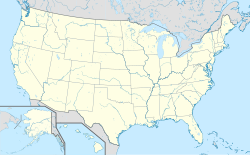
Location map of the USA (Hawaii and Alaska shown in sidemaps).
Main map: EquiDistantConicProjection : Central parallel :
* N: 37.0° N
Central meridian :
* E: 96.0° W
Standard parallels:
* 1: 32.0° N
* 2: 42.0° N
Made with Natural Earth. Free vector and raster map data @ naturalearthdata.com.
Formulas for x and y:
x = 50.0 + 124.03149777329222 * ((1.9694462586094064-({{{2}}}* pi / 180))
      * sin(0.6010514667026994 * ({{{3}}} + 96) * pi / 180))
y = 50.0 + 1.6155950752393982 * 124.03149777329222 * 0.02613325650382181
      - 1.6155950752393982  * 124.03149777329222 *
     (1.3236744353715044  - (1.9694462586094064-({{{2}}}* pi / 180))
      * cos(0.6010514667026994 * ({{{3}}} + 96) * pi / 180))
Hawaii side map: Equirectangular projection, N/S stretching 107 %. Geographic limits of the map:
- N: 22.4° N
- S: 18.7° N
- W: 160.7° W
- E: 154.6° W
Alaska side map: Equirectangular projection, N/S stretching 210.0 %. Geographic limits of the map:
- N: 72.0° N
- S: 51.0° N
- W: 172.0° E
- E: 129.0° W
Spacer image


