Nanda Khat
| Nanda Khat | ||
|---|---|---|
This file is not in the public domain. Therefore you are requested to use the following next to the image if you reuse this file: © Yann Forget / Wikimedia Commons, CC BY-SA 4.0 Nanda Khat von Wachham aus gesehen | ||
| Höhe | 6611 m | |
| Lage | Uttarakhand (Indien) | |
| Gebirge | Nanda-Devi-Gruppe (Garhwal-Himalaya) | |
| Dominanz | 2,4 km → Panwali Dwar | |
| Schartenhöhe | 240 m | |
| Koordinaten | 30° 18′ 3″ N, 79° 58′ 36″ O | |
| Erstbesteigung | 1931 durch Hugh Ruttledge | |
Nordgrat des Nanda Khat | ||
This file is not in the public domain. Therefore you are requested to use the following next to the image if you reuse this file: © Yann Forget / Wikimedia Commons, CC BY-SA 4.0 Panwali Dwar und Nanda Khat | ||
Der Nanda Khat (auch Nandakhat) ist ein 6611 m hoher Berg im indischen Bundesstaat Uttarakhand im Garhwal-Himalaya.
Der Berg befindet sich 8,3 km südlich des Nanda Devi. Der Nordgrat des Nanda Khat führt zum Ostgipfel des Nanda Devi. Nach Südwesten führt ein Bergkamm vom Nanda Khat zum 6663 m hohen Panwali Dwar. Die Erstbesteigung des Nanda Khat fand im Jahr 1931 durch Hugh Ruttledge statt.
Weblinks
- Nandakhat bei Peakware (englisch)
- Foto von Nanda Khat und Changuch bei summitpost.org
Auf dieser Seite verwendete Medien
This file is not in the public domain. Therefore you are requested to use the following next to the image if you reuse this file: © Yann Forget / Wikimedia Commons, CC BY-SA 4.0
Nanda Khat (6611 m) from Wachham, Uttarakhand, India.
Autor/Urheber: Own work based on Milenoscuro, Lizenz: CC BY-SA 4.0
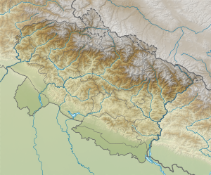
Relief map of Uttarakhand. Elevation data from STRM3.
This file is not in the public domain. Therefore you are requested to use the following next to the image if you reuse this file: © Yann Forget / Wikimedia Commons, CC BY-SA 4.0
Panwali Dhar (6663 m, left) and Nanda Khat (6611 m, right), Uttarakhand, India.


