Nanda-Devi-Nationalpark
Nanda-Devi-Nationalpark नन्दा देवी राष्ट्रीय उद्यान | ||
 Westwand der Nanda Devi | ||
| Lage | Uttarakhand | |
| Fläche | 71.783 ha | |
| WDPA-ID | 1813 | |
| Geographische Lage | 30° 44′ N, 79° 36′ O | |
| Einrichtungsdatum | 1988 | |
Der Nanda-Devi-Nationalpark (Hindiनन्दा देवी राष्ट्रीय उद्यान IASTNandā devī rāṣṭrīya udyāna) ist ein Schutzgebiet im indischen Bundesstaat Uttarakhand. Es wurde 1988 ausgewiesen und wird von der UNESCO mit dem Valley-of-Flowers-Nationalpark als zusammenhängendes Areal geschützt.[1] Der Name des Parks lehnt sich an den Berg Nanda Devi an. Er ist ein bedrohtes Weltnaturerbe.[2]
Nanda Devi Sanctuary

Den inneren, am höchsten gelegenen Teil des Nationalparks bildet das Nanda Devi Sanctuary (Schutzgebiet), das im Kern ein durch die Hochgebirgskämme gebildetes Gletscherbecken ist.[3][4]
Bilder

Weblinks
Einzelnachweise
- ↑ Nanda Devi and Valley of Flowers National Parks. UNESCO, abgerufen am 29. September 2016 (englisch).
- ↑ Protecting People Through Nature. (PDF) WWF, S. 55, abgerufen am 29. September 2016 (englisch).
- ↑ Uttarakhand Forest, Government Of Uttarakhand, India. Archiviert vom (nicht mehr online verfügbar) am 24. November 2020; abgerufen am 11. Februar 2021. Info: Der Archivlink wurde automatisch eingesetzt und noch nicht geprüft. Bitte prüfe Original- und Archivlink gemäß Anleitung und entferne dann diesen Hinweis.
- ↑ NANDA DEVI SANCTUARY - A NATURALIST'S REPORT : Himalayan Journal vol.35/20. Abgerufen am 11. Februar 2021.
Auf dieser Seite verwendete Medien
Autor/Urheber: Subhajit Saha, Lizenz: CC BY-SA 4.0
Cows roaming in alpine pastures (Bugyal) within Nanda Devi Biosphere Reserve.
Autor/Urheber: Asheeshmamgain, Lizenz: CC BY-SA 4.0
Nanda Devi peak makes a splendid horizon, Uttarakhand, India
Autor/Urheber: Subhajit Saha, Lizenz: CC BY-SA 4.0
Phulandi Bugyal (alpine meadow) landscape within Nanda Devi Biosphere Reserve.
Autor/Urheber: Spireguy, Lizenz: CC BY-SA 2.5
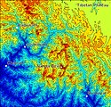
Shaded contour map of the Nanda Devi region in Uttarakhand, India. Made with MATLAB using free SRTM data; labels done in Paint Shop Pro. Region shown is from Latitude 31N to 30N, Longitude 79.3E to 80.5E.
Autor/Urheber: Ankitv2512, Lizenz: CC BY-SA 4.0
There is a small lake named Vaitarani (Bedini Kund), situated amidst the meadow. The rich flora of the area includes 'Brahm Kamal' . it lies under NANDA DEVI NATIONAL PARK.
Autor/Urheber: Spattadar, Lizenz: CC BY-SA 4.0
Brahmakamal flowers near Trishul, Chamoli
Autor/Urheber: Own work based on Milenoscuro, Lizenz: CC BY-SA 4.0
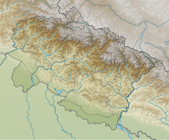
Relief map of Uttarakhand. Elevation data from STRM3.
Autor/Urheber: आशीष भटनागर, Lizenz: CC BY-SA 3.0
Snow clad Himalayan peaks from Nainital snow peak, Nanda devi, Trishool, Pancholi peaks
Autor/Urheber: Spattadar, Lizenz: CC BY-SA 4.0
Near Trishul peak, on the way to Roopkund
Autor/Urheber: Subhajit Saha, Lizenz: CC BY-SA 4.0
Landscape view within Nanda Devi Biosphere Reserve. West Himalaya fir (Abies pindrow) patches amongst grassland pastures.
Autor/Urheber: Aishik Saha, Lizenz: CC BY-SA 4.0
A strikingly beautiful flower probably a Daylily in the Nanda Devi national park.
Autor/Urheber: Mountain Shepherds, Lizenz: CC BY-SA 4.0
Bird checklist and photo documentation of the bio diversity of Nanda Devi National Park is part of the campaign to promote interpretive treks to Nanda Devi National Park.
Autor/Urheber: Gpradnya, Lizenz: CC BY-SA 4.0
The graceful swallowtail-The Golden Birdwing with its arms unfurled-depicting nature's true glory,in the backdrop of the blue sky.(At Nandadevi Biosphere Reserve)
Autor/Urheber: Thincat, Lizenz: CC BY-SA 4.0
Sketch map of Nanda Devi Sanctuary and surrounds
Ridges (schematic): brown
Rivers: blue
Peaks: yellow, names: magenta
Villages:black
Glaciers: white, names italic black
Inner Sanctuary:cyan
Outer Sanctuary: pale cyan
Autor/Urheber: Asheeshmamgain, Lizenz: CC BY-SA 4.0
Nanda Devi peak in Silhouette, Uttarakhand, India
Autor/Urheber: Michael Scalet from India, Lizenz: CC BY-SA 2.0
Nanda Devi from the west.
Autor/Urheber: Spattadar, Lizenz: CC BY-SA 4.0
Brahmakamal near Trishul, Chamoli


