Municipio Ozumba
| Ozumba | ||
|---|---|---|
 | ||
| Symbole | ||
| ||
| Basisdaten | ||
| Staat | Mexiko | |
| Bundesstaat | México | |
| Sitz | Ozumba de Alzate | |
| Fläche | 46,2 km² | |
| Einwohner | 27.207 (2010) | |
| Dichte | 588,6 Einwohner pro km² | |
| Gründung | 1825 | |
| Webauftritt | ozumba.gob.mx | |
| INEGI-Nr. | 15068 | |
| Politik | ||
| Presidente municipal | Hugo González Cortes | |
 | ||
Koordinaten: 19° 2′ 21″ N, 98° 47′ 37″ W
Ozumba ist ein Municipio im mexikanischen Bundesstaat México. Es gehört zur Zona Metropolitana del Valle de México, der Metropolregion um Mexiko-Stadt.
Das Municipio hatte beim Zensus 2010 27.207 Einwohner, seine Fläche beläuft sich auf 46,3 km². Verwaltungssitz und größter der 16 Orte des Municipios ist Ozumba de Alzate mit 16.700 Einwohnern. Weitere Orte mit mehr als 2.000 Einwohnern sind San Mateo Tecalco, San Vicente Chimalhuacán und Santiago Mamalhuazuca.
Geographie
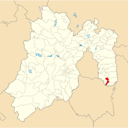
Das Municipio liegt im Südosten des Bundesstaates México auf etwa 2200 bis 2700 Metern Höhe. 90 % der Fläche des Municipios wird landwirtschaftlich genutzt.
Ozumba grenzt an die Municipios Tepetlixpa, Juchitepec, Amecameca und Atlautla sowie an den Bundesstaat Morelos.
Weblinks
- Enciclopedia de los Municipios y Delegaciones de México: Municipio Ozumba (spanisch)
- INEGI: Datos Geográficos: Municipio Ozumba (spanisch; PDF)
Auf dieser Seite verwendete Medien
Logo based on the shield of the municipality of Ozumba belonging to the State of Mexico, based on the one shown in the official website of the municipality and the Municipal Bando Police and Good Government www.edomex.gob.mx/legistelfon/doc/pdf/bdo/bdo070.pdf Art. 5 and 6; And www.inafed.gob.mx/work/templates/enciclo/mexico/mpios/15068a.htm
Coat of arms of Mexico State
Autor/Urheber: JORMK16, Lizenz: CC BY-SA 3.0
Localización de Ozumba en el Estado de México-
Autor/Urheber: MGM25, Lizenz: CC BY-SA 3.0
Centro de Ozumba, ex-convento y parroquia inmaculada concepción


