Mount Rogers (Virginia)
| Mount Rogers | ||
|---|---|---|
 Blick auf den Mount Rogers vom Pine Mountain | ||
| Höhe | 1746 m | |
| Lage | Virginia, Vereinigte Staaten | |
| Gebirge | Blue Ridge Mountains | |
| Dominanz | 65,19 km → Calloway Peak-East Summit | |
| Schartenhöhe | 746 m ↓ Payne Gap | |
| Koordinaten | 36° 39′ 35″ N, 81° 32′ 41″ W | |
| Erstbesteigung | Unbekannt | |
| Besonderheiten | Höchster Berg in Virginia | |
Mount Rogers ist der höchste Berg im US-Bundesstaat Virginia. Er gehört zur Gebirgskette der Blue Ridge Mountains. Der Berg hat eine Höhe von 1746 Meter über dem mittleren Meeresspiegel, der Gipfel befindet sich im Grayson County etwa 10 Kilometer von Trout Dale entfernt. Er ist Teil der Mount Rogers National Recreation Area. Er lässt sich sehr leicht über ausgewiesene Wanderwege erreichen.
Er wurde nach William Barton Rogers benannt.
Siehe auch
Weblinks
- Mount Rogers (Virginia) auf Peakbagger.com (englisch)
Auf dieser Seite verwendete Medien
Autor/Urheber: Famartin, Lizenz: CC BY-SA 4.0
View west-northwest toward Mount Rogers from the summit of Pine Mountain within the Mount Rogers National Recreation Area in Grayson County, Virginia
en:Mount Rogers National Recreation Area, with en:Mount Rogers in the background. Trees in foreground are Abies fraseri.
Autor/Urheber: SANtosito, Lizenz: CC BY-SA 4.0
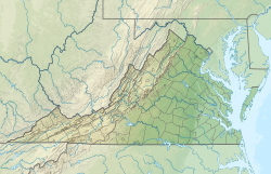
Location map of Virginia, USA
Geographic limits of the map:
- N: 40.2° N
- S: 35.8° N
- W: 83.9° W
- E: 75.0° W
"Mount Rainier towers over all surrounding mountains, lit by the sunset and wreathed in clouds."


