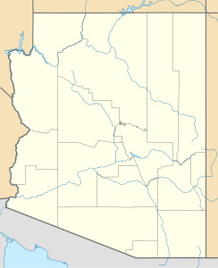
Mount Hopkins (Arizona)
| Mount Hopkins | ||
|---|---|---|
| Höhe | 2616 m | |
| Lage | Arizona, USA | |
| Gebirge | Santa Rita Mountains | |
| Koordinaten | 31° 41′ 18″ N, 110° 53′ 7″ W | |
Mount Hopkins ist ein Berg im Santa Cruz County (Arizona) mit einer Höhe von 2616 m. Das Fred-Lawrence-Whipple-Observatorium befindet sich auf Mount Hopkins.
Auf dieser Seite verwendete Medien
Autor/Urheber: NordNordWest, Lizenz: CC BY-SA 3.0
Positionskarte von Arizona, USA
Autor/Urheber: Wars, Lizenz: CC BY-SA 3.0
The image represents the summit of Mount Hopkins from the range Santa Rita Mountains, Arizona, USA. It was photographed from the entrance to the Fred Lawrence Whipple Observatory that has two locations, one at the bottom of the mountains and the second (this one) located on the slopes of Mount Hopkins.


