Mount Conrad
| Mount Conrad | ||
|---|---|---|
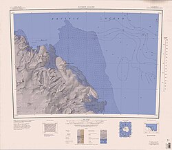
 Karte mit den Goodman Hills (links oben) und dem Mount Conrad | ||
| Höhe | 600 m | |
| Lage | Viktorialand, Ostantarktika | |
| Gebirge | Wilson Hills, Transantarktisches Gebirge | |
| Koordinaten | 69° 25′ 25″ S, 158° 46′ 3″ O | |
| Normalweg | Hochtour (vergletschert) | |
Mount Conrad ist ein 600 m hoher und etwas unscheinbarer Berg im Norden des ostantarktischen Viktorialands. In den Wilson Hills ragt er 11,8 km südlich des Kap Kinsey im Zentrum der Goodman Hills auf.
Der United States Geological Survey kartierte ihn anhand eigener Vermessungen und Luftaufnahmen der United States Navy aus den Jahren von 1960 bis 1963. Das Advisory Committee on Antarctic Names benannte ihn 1970 nach dem US-amerikanischen Piloten Max Conrad (1903–1979), dem im selben Jahr als Erstem ein Alleinflug zum geografischen Südpol gelang.
Weblinks
- Mount Conrad. In: Geographic Names Information System. United States Geological Survey, United States Department of the Interior, archiviert vom (englisch).
- Mount Conrad auf geographic.org (englisch)
Auf dieser Seite verwendete Medien
Autor/Urheber: Alexrk2, Lizenz: CC BY-SA 3.0
Physische Positionskarte Antarktis, Mittabstandstreue Azimutalprojektion
1:250,000-scale topographic reconnaissance map of the Suvorov Glacier area from 158°-162°E to 69°-70°S in Antarctica. Mapped, edited and published by the U.S. Geological Survey in cooperation with the National Science Foundation.


