Mount Balbi
| Mount Balbi | ||
|---|---|---|
 | ||
| Der Vulkan Balbi im Zentrum des Bildes (Bild: NASA) | ||
| Höhe | 2715 m | |
| Lage | Bougainville, Papua-Neuguinea | |
| Koordinaten | 5° 55′ 0″ S, 154° 59′ 0″ O | |
| Typ | Schichtvulkan | |
| Letzte Eruption | unbekannt | |
| Besonderheiten | Höchster Berg der Insel Bougainville | |
Der Schichtvulkan Balbi bildet mit 2715 Metern Höhe den höchsten Punkt der Insel Bougainville, Papua-Neuguinea. Nördlich des Gipfels gibt es eine Kette von fünf Kratern, wobei einer einen See enthält. Im Krater B an der Westflanke des Balbi lässt sich Fumarolentätigkeit beobachten. Der Vulkan ist in historischer Zeit nicht ausgebrochen, es liegen nur unsichere Aufzeichnungen über eine mögliche Eruption um das Jahr 1825 (± 25 Jahre) vor.
Literatur
- Stichwort: Balbi. Online in: Deutsches Kolonial-Lexikon, Band I, Leipzig 1920, S. 122.
Weblinks
- Mount Balbi im Global Volcanism Program der Smithsonian Institution (englisch)
Auf dieser Seite verwendete Medien
Autor/Urheber: Carport, Lizenz: CC BY-SA 3.0
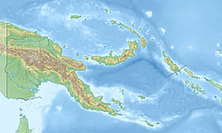
Physische Positionskarte von Papua-Neuguinea
Much of the left side of this NASA image with north to the upper left is covered by volcanic products from Tore (volcano) in the Emperor Range on NW Bougainville Island. The Tore massif lies to the left of the light-colored area at the center of the image, Mount Balbi volcano. The dark-colored caldera lake of Billy Mitchell (volcano) is at the right, above an ash plume originating from Bagana volcano. Papua New Guinea


