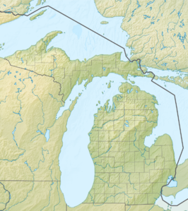
Mount Arvon
| Mount Avron | ||
|---|---|---|
 Gipfel | ||
| Höhe | 603 m | |
| Lage | L’Anse Township, Baraga County, Michigan | |
| Gebirge | Huron Mountains | |
| Dominanz | 198,32 km → Blueberry Hill (Minnesota) | |
| Schartenhöhe | 289 m ↓ Nördlich des Upper St. Croix Lake | |
| Koordinaten | 46° 45′ 20″ N, 88° 9′ 21″ W | |
 Aussicht auf Lake Superior sowie die Halbinseln Abbaye (Vordergrund) und Keweenaw | ||
Der Mount Avron ist mit 603 Metern der höchste Punkt des US-Bundesstaates Michigan. Er befindet sich im am Oberen See gelegenen Baraga County, in den Huron Mountains.
Auf dieser Seite verwendete Medien
Autor/Urheber: Yinan Chen, Lizenz: Public Domain
Free Public Domain stock pictures of Michigan's Highest point, Mount Arvon The clear and forest at the top of Arvon
Autor/Urheber: Yinan Chen, Lizenz: Public Domain
Free Public Domain stock pictures of Michigan's Highest point, Mount Arvon The view of the hills and lake Superior in the Distance from Mount Arvon
Autor/Urheber: Nzeemin, Lizenz: CC BY-SA 3.0
Relief map of Michigan, USA
"Mount Rainier towers over all surrounding mountains, lit by the sunset and wreathed in clouds."


