Moreux (Marskrater)
| Marskrater Moreux | ||
|---|---|---|
(c) ESA/DLR/FU Berlin, CC BY-SA IGO 3.0 | ||
| Perspektivische Schrägansicht | ||
| Position | 41° 47′ N, 44° 32′ O | |
| Durchmesser | 132 km | |
| Eponym | Théophile Moreux | |
Der Krater Moreux ist ein Einschlagkrater Protonilus-Region an der Hochland-Tiefland-Grenze auf dem Mars. Er misst etwa 132 km im Durchmesser und wurde nach Théophile Moreux benannt.
Siehe auch
Weblinks
Auf dieser Seite verwendete Medien
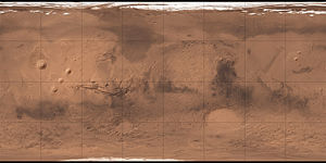
Carte de Mars reconstituée à partir des mesures de Mars Global Surveyor (MOLA) et des observations de Viking.
(c) ESA/DLR/FU Berlin, CC BY-SA IGO 3.0
This image shows a feature on Mars’ surface named Moreux crater. It comprises data gathered on 30 October 2019 during orbit 20014. The ground resolution is approximately 16 m/pixel and the images are centred at about 44°E/42°N.
This image was created using data from the nadir and colour channels of the High Resolution Stereo Camera (HRSC). The nadir channel is aligned perpendicular to the surface of Mars, as if looking straight down at the surface.
The mountain is the crater's central peak, uplifted from the deep crust, and the dark areas surrounding the peak are dune fields. The rim is not visible.


