Moorfoot Hills
| Moorfoot Hills | ||
|---|---|---|
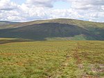
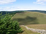
(c) Chris Heaton, CC BY-SA 2.0 Blick auf die Südwestflanke der Moorfoot Hills | ||
| Höchster Gipfel | Windlestraw Law (659 m ASL) | |
| Lage | Schottland | |
| Koordinaten | 55° 42′ N, 3° 2′ W | |
| Alter des Gesteins | ca. 420 Mio. Jahre | |
Die Moorfoot Hills sind ein Hügelgebiet der Southern Uplands in Schottland. Sie erstrecken sich über eine Länge von etwa 20 km zwischen Peebles im Südwesten und Tynehead im Nordosten.[1] Administrativ befinden sich die Moorfoot Hills im Wesentlichen in den Scottish Borders, die Kuppen entlang der Nordwestflanke markieren jedoch die Grenze zu Midlothian. Historisch verlief dort die Grenze zwischen Edinburghshire und Peeblesshire. Die Moorfoot Hills liegen zwischen den Pentland Hills im Westen und den Lammermuir Hills im Nordosten.
Beschreibung
Das Hügelgebiet entstand im späten Silur, vor etwa 420 Mio. Jahren. Im Westen begrenzt das Tal des Eddleston Water, im Osten das des Gala Water das Hügelgebiet. Beide Flüsse münden in den Tweed, der entlang der Südflanke verläuft. Die Hügelgruppe besteht aus separierten oder gruppierten, meist grasbewachsenen Hügeln ohne durchgängigen Grat.[2] Höchster Punkt ist der 659 m hohe Windlestraw Law.[1]
Gipfel der Moorfoot Hills
| Name | Höhe | Council Area | Bild |
|---|---|---|---|
| Windlestraw Law 55° 40′ 38,6″ N, 3° 0′ 7,1″ W | 659 m[3] | Scottish Borders | (c) Richard Webb, CC BY-SA 2.0 |
| Bareback Knowe 55° 40′ 4,2″ N, 3° 0′ 55,6″ W | 656 m[4] | Scottish Borders | (c) Richard Webb, CC BY-SA 2.0 |
| Blackhope Scar 55° 43′ 24,1″ N, 3° 5′ 31,1″ W | 651 m[5] | Scottish Borders/Midlothian | (c) Richard Webb, CC BY-SA 2.0 |
| Bowbeat Hill 55° 42′ 37,5″ N, 3° 7′ 37,4″ W | 626 m[6] | Scottish Borders/Midlothian | (c) Richard Webb, CC BY-SA 2.0 |
| Whitehope Law 55° 41′ 22,9″ N, 3° 3′ 58,9″ W | 623 m[7] | Scottish Borders | (c) Richard Webb, CC BY-SA 2.0 |
| Dundreich 55° 43′ 47,2″ N, 3° 9′ 23,6″ W | 622 m[8] | Scottish Borders | (c) Richard Webb, CC BY-SA 2.0 |
| Emly Bank 55° 42′ 53,5″ N, 3° 7′ 13,6″ W | 605 m[9] | Scottish Borders/Midlothian | (c) Wind turbines on Emly Bank by Jim Barton, CC BY-SA 2.0 |
| Dunslair Heights 55° 40′ 50,7″ N, 3° 8′ 4,3″ W | 602 m[10] | Scottish Borders | (c) Jim Barton, CC BY-SA 2.0 |
| Totto Hill 55° 41′ 44,6″ N, 3° 5′ 57,8″ W | 601 m[11] | Scottish Borders | (c) Chris Eilbeck, CC BY-SA 2.0 |
| Eastside Heights 55° 42′ 8″ N, 3° 1′ 37″ W | 593 m[12] | Scottish Borders | (c) Frances Webb, CC BY-SA 2.0 |
| Cardon Law 55° 41′ 54,5″ N, 3° 8′ 57,8″ W | 588 m[13] | Scottish Borders | (c) Graham Ellis, CC BY-SA 2.0 |
| Makeness Kipps 55° 41′ 19,3″ N, 3° 8′ 37,2″ W | 583 m[14] | Scottish Borders | (c) Jim Barton, CC BY-SA 2.0 |
| Scawd Law 55° 39′ 13,2″ N, 3° 0′ 22,1″ W | 549 m[15] | Scottish Borders | (c) Iain Lees, CC BY-SA 2.0 |
| Priesthope Hill 55° 38′ 55,8″ N, 3° 2′ 0,2″ W | 543 m[16] | Scottish Borders | (c) Richard Webb, CC BY-SA 2.0 |
| Seathope Law 55° 39′ 8,2″ N, 2° 58′ 41,9″ W | 542 m[17] | Scottish Borders | (c) Chris Eilbeck, CC BY-SA 2.0 |
| Rawburn Head 55° 43′ 8″ N, 2° 59′ 34″ W | 542 m[18] | Scottish Borders | (c) Richard Webb, CC BY-SA 2.0 |
| The Kipps 55° 44′ 19″ N, 3° 6′ 30,6″ W | 542 m[19] | Midlothian | (c) Richard Webb, CC BY-SA 2.0 |
| Clog Knowe 55° 39′ 58,1″ N, 3° 5′ 42,5″ W | 541 m[20] | Scottish Borders | (c) Richard Webb, CC BY-SA 2.0 |
| Black Law 55° 40′ 2,6″ N, 3° 6′ 3,7″ W | 538 m[21] | Scottish Borders | (c) Richard Webb, CC BY-SA 2.0 |
| Huntly Cot Hill 55° 44′ 44,7″ N, 3° 5′ 40,4″ W | 531 m[22] | Midlothian | (c) Jim Barton, CC BY-SA 2.0 |
| Black Knowe 55° 39′ 27,8″ N, 3° 5′ 12″ W | 522 m[23] | Scottish Borders | (c) Richard Webb, CC BY-SA 2.0 |
| Mauldslie Hill 55° 45′ 16″ N, 3° 4′ 56″ W | 513 m[24] | Scottish Borders/Midlothian | (c) Richard Webb, CC BY-SA 2.0 |
| Yardstone Knowe 55° 40′ 12,4″ N, 2° 55′ 53,8″ W | 513 m[25] | Scottish Borders | (c) Richard Webb, CC BY-SA 2.0 |
| Garvald Law 55° 44′ 16″ N, 3° 3′ 0″ W | 512 m[26] | Scottish Borders | (c) Richard Webb, CC BY-SA 2.0 |
| Great Law 55° 39′ 42,5″ N, 2° 56′ 28,7″ W | 509 m[27] | Scottish Borders | |
| Dunlee Hill 55° 40′ 32,9″ N, 2° 56′ 22″ W | 505 m[28] | Scottish Borders | (c) Richard Webb, CC BY-SA 2.0 |
| Stony Knowe 55° 38′ 43,3″ N, 2° 57′ 49,7″ W | 505 m[29] | Scottish Borders | (c) Richard Webb, CC BY-SA 2.0 |
| Lee Pen 55° 38′ 10,7″ N, 3° 4′ 20″ W | 502 m[30] | Scottish Borders | (c) Richard Webb, CC BY-SA 2.0 |
| Maiden Law 55° 39′ 40,2″ N, 2° 58′ 6,4″ W | 502 m[31] | Scottish Borders | (c) Chris Eilbeck, CC BY-SA 2.0 |
| Ferniehirst Hill 55° 40′ 4″ N, 2° 54′ 54″ W | 501 m[32] | Scottish Borders | (c) Chris Eilbeck, CC BY-SA 2.0 |
| Dod Law 55° 44′ 53,2″ N, 2° 59′ 50,6″ W | 473 m[33] | Scottish Borders | (c) Kirsty Smith, CC BY-SA 2.0 |
| Torfichen Hill 55° 45′ 46,8″ N, 3° 3′ 36″ W | 460 m[34] | Scottish Borders/Midlothian | (c) Walter Baxter, CC BY-SA 2.0 |
| Broad Law 55° 46′ 21,2″ N, 3° 2′ 52,4″ W | 450 m[35] | Scottish Borders/Midlothian | (c) Richard Webb, CC BY-SA 2.0 |
| The Struther 55° 43′ 5″ N, 2° 57′ 28″ W | 438 m[36] | Scottish Borders | |
| Hog Hill 55° 44′ 49,4″ N, 3° 8′ 56,9″ W | 434 m[37] | Midlothian | (c) Jim Barton, CC BY-SA 2.0 |
| Dod Hill 55° 40′ 10,6″ N, 3° 3′ 30,2″ W | 433 m[38] | Scottish Borders | (c) Richard Webb, CC BY-SA 2.0 |
| Carcant Hill 55° 45′ 47″ N, 3° 0′ 14,6″ W | 425 m[39] | Scottish Borders | (c) Richard Webb, CC BY-SA 2.0 |
| Watherston Hill 55° 42′ 32″ N, 2° 55′ 10″ W | 414 m[40] | Scottish Borders | (c) Adam Ward, CC BY-SA 2.0 |
| Kirn Law 55° 39′ 24,6″ N, 3° 7′ 27,8″ W | 412 m[41] | Scottish Borders | (c) Chris Eilbeck, CC BY-SA 2.0 |
| Ruther Law 55° 47′ 21,8″ N, 3° 0′ 11″ W | 383 m[42] | Scottish Borders/Midlothian | (c) Richard Webb, CC BY-SA 2.0 |
| Bowshank Hill 55° 39′ 10″ N, 2° 53′ 55,3″ W | 379 m[43] | Scottish Borders | |
| Knowes Hill 55° 38′ 6,6″ N, 2° 53′ 43,2″ W | 374 m[44] | Scottish Borders | (c) Richard Webb, CC BY-SA 2.0 |
| Hog Hill 55° 42′ 34,1″ N, 3° 11′ 11,4″ W | 350 m[45] | Scottish Borders | |
| Ven Law 55° 39′ 25,4″ N, 3° 10′ 47,5″ W | 325 m[46] | Scottish Borders | (c) M J Richardson, CC BY-SA 2.0 |
| Castle Hill 55° 38′ 56,7″ N, 3° 7′ 36,2″ W | 324 m[47] | Scottish Borders | (c) Chris Eilbeck, CC BY-SA 2.0 |
Einzelnachweise
- ↑ a b Eintrag im Gazetteer for Scotland
- ↑ Moorfoot in: F. H. Groome (Hrsg.): Ordnance Gazetteer of Scotland: A Survey of Scottish Topography, Statistical, Biographical and Historical, Grange Publishing Works, Edinburgh, 1882–1885.
- ↑ Eintrag im Gazetteer for Scotland
- ↑ Eintrag auf themountainguide.co.uk
- ↑ Eintrag im Gazetteer for Scotland
- ↑ Eintrag auf themountainguide.co.uk
- ↑ Eintrag im Gazetteer for Scotland
- ↑ Eintrag im Gazetteer for Scotland
- ↑ Eintrag im Gazetteer for Scotland
- ↑ Eintrag im Gazetteer for Scotland
- ↑ Eintrag im Gazetteer for Scotland
- ↑ Eintrag auf themountainguide.co.uk
- ↑ Eintrag im Gazetteer for Scotland
- ↑ Eintrag im Gazetteer for Scotland
- ↑ Eintrag auf themountainguide.co.uk
- ↑ Eintrag auf themountainguide.co.uk
- ↑ Eintrag auf themountainguide.co.uk
- ↑ Eintrag auf themountainguide.co.uk
- ↑ Eintrag im Gazetteer for Scotland
- ↑ Eintrag im Gazetteer for Scotland
- ↑ Eintrag im Gazetteer for Scotland
- ↑ Eintrag auf themountainguide.co.uk
- ↑ Eintrag im Gazetteer for Scotland
- ↑ Eintrag im Gazetteer for Scotland
- ↑ Eintrag im Gazetteer for Scotland
- ↑ Eintrag auf themountainguide.co.uk
- ↑ Eintrag im Gazetteer for Scotland
- ↑ Eintrag im Gazetteer for Scotland
- ↑ Eintrag auf themountainguide.co.uk
- ↑ Eintrag im Gazetteer for Scotland
- ↑ Eintrag auf themountainguide.co.uk
- ↑ Eintrag im Gazetteer for Scotland
- ↑ Eintrag auf themountainguide.co.uk
- ↑ Eintrag im Gazetteer for Scotland
- ↑ Eintrag im Gazetteer for Scotland
- ↑ Eintrag auf themountainguide.co.uk
- ↑ Eintrag im Gazetteer for Scotland
- ↑ Eintrag im Gazetteer for Scotland
- ↑ Eintrag auf themountainguide.co.uk
- ↑ Eintrag auf themountainguide.co.uk
- ↑ Eintrag auf themountainguide.co.uk
- ↑ Eintrag im Gazetteer for Scotland
- ↑ Eintrag auf themountainguide.co.uk
- ↑ Eintrag auf themountainguide.co.uk
- ↑ Eintrag im Gazetteer for Scotland
- ↑ Eintrag im Gazetteer for Scotland
- ↑ Eintrag im Gazetteer for Scotland
Weblinks
Auf dieser Seite verwendete Medien
(c) Richard Webb, CC BY-SA 2.0
Storm damage. The ground view of the wee plantation under Mauldslie Hill.
(c) Chris Eilbeck, CC BY-SA 2.0
Williamslee Farm. Totto Hill in the background, the Williamslee burn and valley on the right.
(c) Richard Webb, CC BY-SA 2.0
Ruther Law. Sheep pasture. Westward view.
(c) Chris Eilbeck, CC BY-SA 2.0
Track, Ferniehirst Hill Overnight snow has marked the faint landrover tracks up the NW shoulder of Ferniehirst Hill. The dark mass on the right is heather on the far side of a wall.
(c) Chris Eilbeck, CC BY-SA 2.0
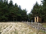
Summit, Kirn Law A small wedge of ground free of trees. A mountain bike track runs on the other side of the wall on the right, and the structure on the right is a shelter for mountain bikers.
(c) Richard Webb, CC BY-SA 2.0
Garvald Law Small hill at the end of one of the long ridges running off Blackhope Scar.
(c) Richard Webb, CC BY-SA 2.0
Black Knowe Cloud about to cover Black Knowe.
(c) Richard Webb, CC BY-SA 2.0
Summit cairn, Carcant Hill. Looking north to the Pentland Hills.
(c) Richard Webb, CC BY-SA 2.0
Glen of the South Esk. The head of the South Esk Glen, deep in the Moorfoot Hills. The surrounding land is peaty plateau, some given over to the Bowbeat Hill power station. A small hut is a water works relic. Unsure why it's here, as the burn runs into Gladhouse reservoir.
(c) Chris Eilbeck, CC BY-SA 2.0
Summit, Castle Hill. The hill boasts the remains of a old settlement, but on the ground there's not much to see - only a few depressions and the remains of a small ditch and bank
(c) Richard Webb, CC BY-SA 2.0
Black Law. Glentress Forest gives way to moorland on the ridges. View along to Dunslair Heights, with mast.
(c) Richard Webb, CC BY-SA 2.0
Lee Pen Looking out of Caberston Forest to the eastern side of Lee Pen above the bridge and golf course by the Leithen Water.
(c) Wind turbines on Emly Bank by Jim Barton, CC BY-SA 2.0
Wind turbines on Emly Bank
(c) Richard Webb, CC BY-SA 2.0
Knowes Hill Rough grazing beyond a few cleared fields. Originally they would have been stony, but have been painstakingly cleared.
(c) Jim Barton, CC BY-SA 2.0
Dunslair Heights from the west The ridge between Dunslair Heights (with the mast) and Shieldgreen Kipps (L of centre) seen from Hamilton Hill.
(c) Walter Baxter, CC BY-SA 2.0
Frosted grass by Broadlaw Burn This area of rough grass on the south side of Broadlaw Burn was in shade and still frosted. Torfichen Hill is straight ahead.
(c) Frances Webb, CC BY-SA 2.0
South side of Eastside Heights Snow and ice highlight an all terrain vehicle track over the Moorfoot Hills.
(c) Richard Webb, CC BY-SA 2.0
Summit, Clog Knowe Burnt patch of heather with a view past the strange aerial gates towards Windlestraw Law.
(c) Chris Eilbeck, CC BY-SA 2.0
Summit Cairn, Seathope Law. The highest point seems a few yards to the left of the picture, but is unmarked. The square construction to the right behind the fence is a grouse butt.
(c) Richard Webb, CC BY-SA 2.0
Priesthope Hill A steep pull up through deep heather from the col with Corby Craigs, Priesthope Sware. The hill has suffered the attentions of motorcycle vandals and is badly cut up on this side with fresh erosion gullies forming along the tyre marks.
(c) Richard Webb, CC BY-SA 2.0
Blackhope Scar. From Bowman'c Cleuch on Jeffries Corse, a view of Midlothian's highest hill.
(c) Richard Webb, CC BY-SA 2.0
Dundreich from Huntly Cot. From the top of the Huntly Cot Hills, view west over the hidden South Esk to Dundreich.
(c) Richard Webb, CC BY-SA 2.0
Dunlee Hill Dunlee Hill seen across the Caddon Water.
(c) Graham Ellis, CC BY-SA 2.0
View from Bowbeat Hill Looking SW down into the valley with Cardon Law the hill on the other side. This picture was taken about 10 m from a wind turbine with the blades swishing round behind me!
(c) Kirsty Smith, CC BY-SA 2.0
Bell Wood and Red Scar, Dod Law. Dow Law summit is to the right of this photo, but the ridge runs off rightwards towards Heriot.
(c) Richard Webb, CC BY-SA 2.0
Stony Knowe The Moorfoot Hills in the heather season, view from Elibank Forest across the Tweed.
(c) Chris Heaton, CC BY-SA 2.0
View towards the Moorfoot Hills Taken from the grassy moors above Jedderfield Plantation towards the distant Moorfoot Hills, north of Peebles.
(c) M J Richardson, CC BY-SA 2.0
Ven Law and Peebles from across the Tweed
(c) Richard Webb, CC BY-SA 2.0
Yardstone Knowe. A moorland summit.
(c) Chris Eilbeck, CC BY-SA 2.0
Gate and fence, Maiden Law. The fence skirts the summit of Maiden Law, and this corner is as close as it gets. Looking towards Seathope Law.
(c) Jim Barton, CC BY-SA 2.0
Forestry below Shieldgreen Kipps Striking patterns of the forest rides seen from South Knowe.
(c) Richard Webb, CC BY-SA 2.0
Bareback Knowe A broad ridge which provides an easy route onto Windlestraw Law. The upper part is peaty, and snow filled runnels provided easy underfoot conditions.
(c) Richard Webb, CC BY-SA 2.0
The Kipps. View north from the slopes of Blackhope Scar. A zigzag road climbing out of the deep glen of the South Esk on the south slopes of The Kipps.
(c) Richard Webb, CC BY-SA 2.0
Whitehope Law The eastern side of Whitehope Law seen from Eastside Heights.
(c) Eric Gaba, NordNordWest, Uwe Dedering, CC BY-SA 3.0
Positionskarte von Schottland, Vereinigtes Königreich
(c) Richard Webb, CC BY-SA 2.0
Dod Hill The truncated end of a grassy ridge off Windlestraw Law (background). The steep slopes are well drained and there are no peat deposits giving a green appearance. Cloud is rapidly forming.
(c) Iain Lees, CC BY-SA 2.0
Looking North from theCairn Hill, Scawd Law Col
(c) Jim Barton, CC BY-SA 2.0
Between Huntly Cot and Mauldslie In the background are Huntly Cot and Mauldslie Hills named after the farms at their bases, part of the Moorfoot Hills.
(c) Richard Webb, CC BY-SA 2.0
Slopes of Windlestraw Law Gentle, waterlogged moorland slopes. View across the B709 to Leithen Hopes and another member of Donald's list, Whitehope Law (623m).
(c) Adam Ward, CC BY-SA 2.0
Trig Point. A trig point on Watherston Hill at the corner of a fairly mature plantation.
(c) Richard Webb, CC BY-SA 2.0
Quarry, Broad Law. Moorfoot scarp, quarried. No longer worked but the quarry is visible from a long way away.
(c) Jim Barton, CC BY-SA 2.0
Gladhouse Reservoir from closed car park A view south towards the valley of the South Esk. The car park is no longer available.
(c) Richard Webb, CC BY-SA 2.0
Rawburn Head A road as yet marked on the OS maps crosses from Over Shiels to Ladyside.


