Moon Island (Massachusetts)
| Moon Island | ||
|---|---|---|
| Übersichtskarten der Inseln Long und Moon Island | ||
| Gewässer | Boston Harbor, Atlantischer Ozean | |
| Geographische Lage | 42° 18′ 21″ N, 70° 59′ 6″ W | |
| Fläche | 18,5 ha | |
| Höchste Erhebung | 29,9 m | |
Moon Island (auch Half Moon Island) ist eine Insel im Boston Harbor. Sie liegt in der Quincy Bay 5,5 mi (8,9 km) vom Bostoner Stadtzentrum entfernt auf dem Gebiet des Bundesstaats Massachusetts der Vereinigten Staaten. Moon Island verfügt über eine dauerhafte Fläche von ca. 45,7 Acres (18,5 ha) sowie extensive Wattgebiete. Die Insel gehört zu Quincy und ist Teil der Boston Harbor Islands National Recreation Area.
Die Insel ist geologisch gesehen ein Drumlin und erhebt sich bis zu 98 ft (29,9 m) und ist nicht öffentlich zugänglich, da sich dort ein Feuerwehr-Übungszentrum sowie ein Polizei-Schießplatz befinden.[1]
Einzelnachweise
- ↑ Island Facts: Moon Island. National Park Service, abgerufen am 25. Mai 2014 (englisch).
Weblinks
- Moon Island im Geographic Names Information System des United States Geological Survey
- Half Moon Island im Geographic Names Information System des United States Geological Survey
- Half Moon Island (historisch) im Geographic Names Information System des United States Geological Survey
- Moon Island – Geschichte der Insel als Ausbildungszentrum
Auf dieser Seite verwendete Medien
Autor/Urheber: , Lizenz: CC BY-SA 3.0
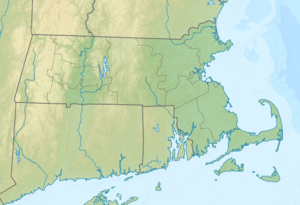
Relief map of Massachusetts, USA
Long and Moon islands, two of the Boston Harbor Islands in Boston, Massachusetts, USA. This image is believed to have been produced as part of a re-use planning study for the City of Boston. The map shows the rough location of general features on Long Island. The label "Fort Strong" on the map only refers to the concrete emplacements for Btys Drum, Hitchcock, and Ward on the North Head, not to the whole fort, which in fact occupied the entire northerly 25% of the island. The "Existing Pier" no longer (in 2010) exists, and the site of the "Former Pier" (which is now a brand new existing pier, serving (at least) the children's camp) is in fact located some 500 ft. further north up the shore of the island, just where the former Mining Wharf of the fort was located.


