Montgomery County (Maryland)
.jpg) | |
| Verwaltung | |
|---|---|
| US-Bundesstaat: | Maryland |
| Verwaltungssitz: | Rockville |
| Adresse des Verwaltungssitzes: | Executive Office Building 101 Monroe Street Rockville, MD 20850 |
| Gründung: | 1776 |
| Gebildet aus: | Frederick County, Prince George’s County, Charles County |
| Vorwahl: | 001 240 |
| Demographie | |
| Einwohner: | 1.062.061 (Stand: 2020) |
| Bevölkerungsdichte: | 827,8 Einwohner/km2 |
| Geographie | |
| Fläche gesamt: | 1313 km² |
| Wasserfläche: | 30 km² |
| Karte | |
 | |
| Website: www.montgomerycountymd.gov | |
Das Montgomery County[2] ist ein County im US-Bundesstaat Maryland.
Der Verwaltungssitz (County Seat) ist Rockville. Bei der Volkszählung im Jahr 2020 hatte das County 1.062.061 Einwohner und eine Bevölkerungsdichte von 828 Einwohnern pro Quadratkilometer.[3]
Das Montgomery County ist Bestandteil der Metropolregion um die US-Hauptstadt Washington, D.C.
Geographie
Lage
Das 1313 Quadratkilometer – davon 30 Quadratkilometer (2,29 Prozent) Wasserflächen – große County bildet den nördlichen Vorortbereich der US-Bundeshauptstadt Washington und wird im Südwesten durch den Potomac River begrenzt, der die Grenze zu Virginia bildet.
 Wappen
 Flagge
Nachbarcounties
| Frederick County | Howard County | |
| Loudoun County (Virginia) | .svg) | |
| Fairfax County (Virginia) | Washington, D.C. | Prince George’s County |
Geschichte

Das Montgomery County wurde 1776 aus Teilen des Frederick, Prince George’s und des Charles County gebildet. Benannt wurde es nach Richard Montgomery (1738–1775), einem General der Kontinentalarmee im Amerikanischen Unabhängigkeitskrieg, der in der Schlacht von Québec als erster und höchstrangiger General fiel.
Als Verwaltungssitz wurde ein Ort in der Mitte des Countys ausgewählt, aus dem sich die heutige Stadt Rockville entwickelte.
1791 wurden Teile des Montgomery County einschließlich der damaligen Stadt Georgetown ausgegliedert, um gemeinsam mit Teilen benachbarter Countys in Maryland und Virginia den neu zu gründenden District of Columbia zu bilden.
Sechs Stätten im Montgomery County haben aufgrund ihrer geschichtlichen Bedeutung den Status einer National Historic Landmark.[4] 73 Bauwerke und Stätten des Countys sind im National Register of Historic Places eingetragen (Stand 14. November 2017).[5]
Demografische Daten
| Bevölkerungswachstum | |||
|---|---|---|---|
| Census | Einwohner | ± rel. | |
| 1790 | 18.003 | — | |
| 1800 | 15.058 | −16,4 % | |
| 1810 | 17.980 | 19,4 % | |
| 1820 | 16.400 | −8,8 % | |
| 1830 | 19.816 | 20,8 % | |
| 1840 | 15.456 | −22 % | |
| 1850 | 15.860 | 2,6 % | |
| 1860 | 18.322 | 15,5 % | |
| 1870 | 20.563 | 12,2 % | |
| 1880 | 24.759 | 20,4 % | |
| 1890 | 27.185 | 9,8 % | |
| 1900 | 30.451 | 12 % | |
| 1910 | 32.089 | 5,4 % | |
| 1920 | 34.921 | 8,8 % | |
| 1930 | 49.206 | 40,9 % | |
| 1940 | 83.912 | 70,5 % | |
| 1950 | 164.401 | 95,9 % | |
| 1960 | 340.928 | 107,4 % | |
| 1970 | 522.809 | 53,3 % | |
| 1980 | 579.053 | 10,8 % | |
| 1990 | 757.027 | 30,7 % | |
| 2000 | 873.341 | 15,4 % | |
| 2010 | 971.777 | 11,3 % | |
| 2020 | 1.062.061 | 9,3 % | |
| vor 1900[6] 1900–1990[7] 2000 + 2010[8] | |||
Nach der Volkszählung im Jahr 2010 lebten im Montgomery County 971.777 Menschen in 344.099 Haushalten. Die Bevölkerungsdichte betrug 757,4 Einwohner pro Quadratkilometer.
Ethnisch betrachtet setzte sich die Bevölkerung zusammen aus 57,5 Prozent Weißen, 17,2 Prozent Afroamerikanern, 0,4 Prozent amerikanischen Ureinwohnern, 14,0 Prozent Asiaten sowie aus anderen ethnischen Gruppen; 4,0 Prozent stammten von zwei oder mehr Ethnien ab. Unabhängig von der ethnischen Zugehörigkeit waren 17,0 Prozent der Bevölkerung spanischer oder lateinamerikanischer Abstammung.
In den 344.099 Haushalten lebten statistisch je 2,72 Personen.
24,5 Prozent der Bevölkerung waren unter 18 Jahre alt, 63,2 Prozent waren zwischen 18 und 64 und 12,3 Prozent waren 65 Jahre oder älter. 51,5 Prozent der Bevölkerung war weiblich.
Das jährliche Durchschnittseinkommen eines Haushalts lag bei 93.774 USD. Das Prokopfeinkommen betrug 46.122 USD. 6,7 Prozent der Einwohner lebten unterhalb der Armutsgrenze.[9]
Wirtschaft und Infrastruktur

Verkehr
Montgomery wird durch den Capital Beltway und den Interstate Highway 270 erschlossen. Das County verfügt mit dem Montgomery County Airpark über einen Flughafen, der hauptsächlich für den Geschäftsflugverkehr genutzt wird.
Städte und Gemeinden
|
|
|
- Chevy Chase Section Three
- Chevy Chase Section Five
- Martin’s Additions
- North Chevy Chase
- Drummond
- Friendship Heights
- Oakmont
- Battery Park
|
|
|
|
|
|
|
1 – teilweise im Prince George’s County
Einzelnachweise
- ↑ Auszug aus dem National Register of Historic Places - Nr. 86003352 Abgerufen am 4. September 2011
- ↑ Montgomery County (Maryland). In: Geographic Names Information System. United States Geological Survey, United States Department of the Interior, abgerufen am 5. September 2024 (englisch).
- ↑ Maryland (Bundesstaat, USA) - Einwohnerzahlen, Grafiken, Karte und Lage. Abgerufen am 1. März 2022.
- ↑ Listing of National Historic Landmarks by State: Maryland. National Park Service, abgerufen am 14. November 2017.
- ↑ Suchmaske Datenbank im National Register Information System. National Park Service, abgerufen am 14. November 2017.
- ↑ University of Virginia Library - Historical Census Browser Abgerufen am 4. September 2011
- ↑ United States Census.gov Abgerufen am 4. September 2011
- ↑ Auszug aus census.gov (2000+2010) ( des vom 15. Juli 2011 auf WebCite) Info: Der Archivlink wurde automatisch eingesetzt und noch nicht geprüft. Bitte prüfe Original- und Archivlink gemäß Anleitung und entferne dann diesen Hinweis. Abgerufen am 4. April 2012
- ↑ U.S. Census Buero, State & County QuickFacts - Montgomery County ( des vom 15. Juli 2011 auf WebCite) Info: Der Archivlink wurde automatisch eingesetzt und noch nicht geprüft. Bitte prüfe Original- und Archivlink gemäß Anleitung und entferne dann diesen Hinweis. Abgerufen am 4. September 2011
Weblinks
- U.S. Census Buero, State & County QuickFacts - Montgomery County
- Maryland State Archives - Montgomery County
- Yahoo Bildersuche - Montgomery County
- www.city-data.com - Montgomery County
Liste der Countys in Maryland
Allegany | Anne Arundel | Baltimore City | Baltimore | Calvert | Caroline | Carroll | Cecil | Charles | Dorchester | Frederick | Garrett | Harford | Howard | Kent | Montgomery | Prince George’s | Queen Anne’s | Saint Mary’s | Somerset | Talbot | Washington | Wicomico | Worcester
Koordinaten: 39° 8′ N, 77° 12′ W
Auf dieser Seite verwendete Medien
Autor/Urheber: Aude, Lizenz: CC BY-SA 2.5
View of three buildings in the Montgomery County Courthouse Historic District in Rockville, Maryland: "Grey Courthouse" in the foreground, "Red Brick Courthouse" in the middle ground, and the Judicial Center in the background.
As of 2025 the Grey Courthouse (built 1931) and Red Brick Courthouse (built 1891) are no longer used by the courts. The Judicial Center opened in 1982 and is used by the Circuit Court of Maryland. (The current District Court of Maryland building, which opened in 2011, is not seen in this photograph.)
Locator map of Montgomery County — in Maryland, adjacent to the Potomac River and Washington, D.C.
- Credits
- David Benbennick made this map.
- For more information, see Commons:United States county locator maps.

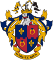
The coat of arms of Montgomery County, Maryland. It was designed and approved by the College of Arms, and was adopted as the official flag of Montgomery County, Maryland on October 5, 1976, at the request of the Montgomery County executive, under Bill 38-76 (Section 1-402 of the Montgomery County Code).
The coat of arms uses some of the elements of the family arms of General Richard Montgomery for whom the County was named in 1776.
Description of Coat of Arms The broken spear at the top of the crest is probably an award to an early member of the Montgomery family.
The spear and the armor encased forearm or cubit arm are used by those Montgomery families that use the motto “Gardez Bien” or Guard Well.
The pointed yellow and black flags at the top of the crest were taken from the Maryland State coat of arms in order to reflect Montgomery County’s relation with the State of Maryland.
The gold mural crown is used by many municipalities and the indented line at its top represents the borders of a local government.
The helmet and mantling are of a style used in municipal coats of arms.
The gold fleur-de-lis in two quarters of the shield are reminders of the French ancestry of the Montgomery family.
The gold rings with blue gemstones in two quarters of the shield proclaim royal favor and protection, and are found in the family coat of arms of General Montgomery’s family.
The indented line which separates the upper quarters of the shield from the lower quarters of the shield represents the borders of a local government.
Autor/Urheber: Wikipedian1234, Lizenz: CC BY-SA 3.0
The Montgomery County Judicial Center in Rockville, Maryland.

The flag of Montgomery County, Maryland. It was designed and approved by the College of Arms, and was adopted as the official flag of Montgomery County, Maryland on October 5, 1976, at the request of the Montgomery County executive, under Bill 38-76 (Section 1-402 of the Montgomery County Code). The flag's design utilizes elements from Richard Montgomery's family heraldic coat of arms. Additional information about the flag, including official specifications, can be found here. The flag's symbolism can be found here.
Engraved portrait of Richard Montgomery, the Continental Army general killed at the 1775 Battle of Quebec.