Mohave Valley (CDP)
| Mohave Valley | |
|---|---|
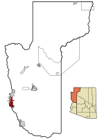
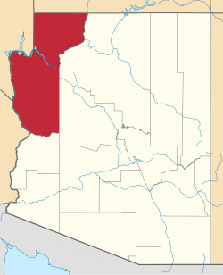
Lage im County und in Arizona | |
| Basisdaten | |
| Staat: | Vereinigte Staaten |
| Bundesstaat: | Arizona |
| County: | Mohave County |
| Koordinaten: | 34° 57′ N, 114° 35′ W |
| Zeitzone: | Mountain Standard Time (UTC−7) |
| Einwohner: | 2.693 (Stand: 2020) |
| Haushalte: | 1.095 (Stand: 2020) |
| Fläche: | 117,3 km² (ca. 45 mi²) davon 117,2 km² (ca. 45 mi²) Land |
| Bevölkerungsdichte: | 23 Einwohner je km² |
| Höhe: | 159 m |
| Postleitzahlen: | 86440, 86446 |
| Vorwahl: | +1 928 |
| FIPS: | 04-47400 |
| GNIS-ID: | 1866989 |
Mohave Valley ist ein Census-designated place (CDP) im Mohave County im US-Bundesstaat Arizona. Das U.S. Census Bureau hat bei der Volkszählung 2020 eine Einwohnerzahl von 2.693[1] auf einer Fläche von 117,3 km² ermittelt. Die Bevölkerungsdichte liegt somit bei 23 Einwohnern pro km².
Das CDP liegt direkt am Colorado River. Im Süden des Gebiets liegen die Seen Topock Marsh Lake, Beal Lake und Topock Bay. Mohave Valley liegt ganz im Fort Mohave Indianer-Reservation. Am Nordende des CSP liegt die Geisterstadt Fort Mohave.
Durch Mohave Valley verläuft die Arizona State Route 95.
Weblinks
Einzelnachweise
- ↑ Explore Census Data Mohave Valley CDP, Arizona. Abgerufen am 22. Oktober 2022.
Auf dieser Seite verwendete Medien
Autor/Urheber: Arkyan, Lizenz: CC BY-SA 3.0
This map shows the incorporated cities, unincorporated areas, and Indian reservations in Mohave County, Arizona.
- Highlighting Mohave Valley in red, along the Colorado River.
- Credits


