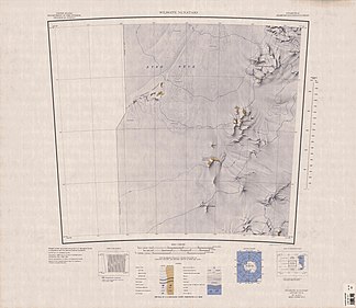
Mizar-Nunatakker
| Mizar-Nunatakker | ||
|---|---|---|
Topographische Karte mit den Mizar-Nunatakkern (unten) | ||
| Lage | Australisches Antarktis-Territorium, Ostantarktika | |
| Teil des | Transantarktischen Gebirges | |
| Koordinaten | 81° 52′ S, 154° 35′ O | |
Die Mizar-Nunatakker sind eine kleine Gruppe von Nunatakkern im Transantarktischen Gebirge. Sie liegen nahe dem Polarplateau rund 19 km südlich der Wilhoite-Nunatakker.
Das Advisory Committee on Antarctic Names benannte sie 1965 nach dem Frachtschiff USNS Mizar der United States Navy, das bei der Operation Deep Freeze des Jahres 1961 im Einsatz war.
Weblinks
- Mizar Nunataks auf geographic.org (englisch)
- Mizar Nunataks. (ZIP; 1,76 MB) In: Geographic Names Information System. United States Geological Survey (englisch). (englisch)
Auf dieser Seite verwendete Medien
Autor/Urheber: Alexrk2, Lizenz: CC BY-SA 3.0
Physische Positionskarte Antarktis, Mittabstandstreue Azimutalprojektion
1:250,000-scale topographic reconnaissance map of the Wilhoite Nunataks area from 150°-157°30'E to 81°-82°S in Antarctica. Mapped, edited and published by the U.S. Geological Survey in cooperation with the National Science Foundation.


