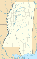
Mississippi Authority for Educational Television Tower
Mississippi Authority for Educational Television Tower | ||
|---|---|---|
 Bild gesucht | ||
| Basisdaten | ||
| Ort: | Raymond | |
| Bundesstaat: | Mississippi | |
| Staat: | Vereinigte Staaten | |
| Höhenlage: | 101 m | |
| Koordinaten: 32° 11′ 30,5″ N, 90° 24′ 22,6″ W | ||
| Verwendung: | Rundfunksender | |
| Besitzer: | Mississippi Authority for Educational Television | |
| Daten des Mastes | ||
| Bauzeit: | 2000 | |
| Betriebszeit: | seit 2000 | |
| Gesamthöhe: | 474,9 m | |
| Daten zur Sendeanlage | ||
| Wellenbereich: | UKW-Sender | |
| Positionskarte | ||
Der Mississippi Authority for Educational Television Tower ist ein Radiomast der Mississippi Authority for Educational Television, welcher sich in Raymond, Mississippi befindet. Der im Jahre 2000 errichtete Sendemast wird zur Fernsehübertragung genutzt. Er erreicht eine Höhe von 474,90 m und zählt damit zu den höchsten Türmen Mississippis.
Weblinks
Auf dieser Seite verwendete Medien
Autor/Urheber: Alexrk2, Lizenz: CC BY 3.0
Diese Landkarte wurde mit GeoTools erstellt.
Autor/Urheber: Uwe Dedering, Lizenz: CC BY-SA 3.0
Relief location map of the USA (without Hawaii and Alaska).
EquiDistantConicProjection : Central parallel :
* N: 37.0° N
Central meridian :
* E: 96.0° W
Standard parallels:
* 1: 32.0° N
* 2: 42.0° N
Made with Natural Earth. Free vector and raster map data @ naturalearthdata.com.
Formulas for x and y:
x = 50.0 + 124.03149777329222 * ((1.9694462586094064-({{{2}}}* pi / 180))
      * sin(0.6010514667026994 * ({{{3}}} + 96) * pi / 180))
y = 50.0 + 1.6155950752393982 * 124.03149777329222 * 0.02613325650382181
      - 1.6155950752393982  * 124.03149777329222 *
     (1.3236744353715044  - (1.9694462586094064-({{{2}}}* pi / 180))
      * cos(0.6010514667026994 * ({{{3}}} + 96) * pi / 180))


