Milnathort
| Milnathort | ||
|---|---|---|
| Koordinaten | 56° 14′ N, 3° 25′ W | |
| Traditionelle Grafschaft | Kinross-shire | |
| Einwohner | 1890 Zensus 2011 | |
| Verwaltung | ||
| Post town | KINROSS | |
| Postleitzahlenabschnitt | KY13 | |
| Vorwahl | 01577 | |
| Landesteil | Scotland | |
| Council area | Perth and Kinross | |
| Britisches Parlament | Ochil and South Perthshire | |
| Schottisches Parlament | Perthshire South and Kinross-shire | |
Milnathort ist eine Ortschaft in der schottischen Council Area Perth and Kinross und der traditionellen Grafschaft Kinross-shire. Sie ist etwa 15 km westnordwestlich von Glenrothes und 37 km südlich von Perth am Fuße der Ochil Hills gelegen. Milnathort liegt direkt südlich der M90, die von Dunfermline nach Perth führt, und in ihrer Verlängerung als A90 den Firth of Forth in Richtung Edinburgh überquert. Eine Anbindung an das Eisenbahnnetz besteht nicht. Im Jahre 2011 verzeichnete Milnathort 1890 Einwohner.[1]
Geschichte
Milnathort entwickelte sich als Marktort des nahegelegenen Burleigh Castle.[2] Zwischen 1780 und 1828 war Milnathort Standort der Whiskybrennerei Hattonburn.[3][4] Im frühen 19. Jahrhundert half die Lage an der Kreuzung zweier Straßen zur Entwicklung der Ortschaft.[2] Im Jahre 2006 ließen starke Regenfälle den Back Burn, der durch Milnathort fließt, über die Ufer treten, was die Evakuierung eines Teils der Bevölkerung zur Folge hatte.[5]
- Überreste von Burleigh Castle
- (c) Richard Webb, CC BY-SA 2.0Back Burn
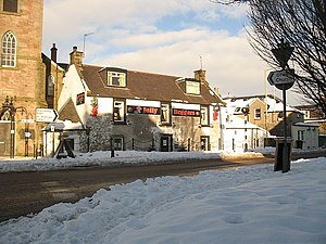
- (c) james denham, CC BY-SA 2.0Hauptstraße aus Richtung Kinross
Persönlichkeiten
- Laura Muir (* 1993), Langstreckenläuferin
Einzelnachweise
- ↑ Zensus 2011
- ↑ a b Eintrag im Gazetteer for Scotland
- ↑ Eintrag zur Hattonburn-Brennerei auf lostdistillery.com
- ↑ Eintrag zur Hattonburn-Brennerei auf scotlandsplaces.gov.uk ( des vom 16. Februar 2016 im Internet Archive) Info: Der Archivlink wurde automatisch eingesetzt und noch nicht geprüft. Bitte prüfe Original- und Archivlink gemäß Anleitung und entferne dann diesen Hinweis.
- ↑ BBC NEWS, Scotland, Tayside and Central: Village evacuated amid flooding, 14. Dezember 2006
Weblinks
- Eintrag zu Milnathort in Canmore, der Datenbank von Historic Environment Scotland (englisch)
Auf dieser Seite verwendete Medien
(c) Eric Gaba, NordNordWest, CC BY-SA 3.0
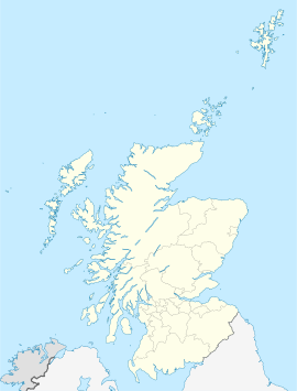
Positionskarte von Schottland, Vereinigtes Königreich
(c) Richard Webb, CC BY-SA 2.0
Jolly Beggars, Milnathort At the centre of Milnathort - on New Road. The junction in the foreground is between Stirling Road, Wester Loan, New Street and South Street and is a mini roundabout.
(c) james denham, CC BY-SA 2.0
The Tolbooth, Milnathort This great clock tower dominates the town centre.
(c) Richard Webb, CC BY-SA 2.0
Back Burn, Milnathort Looks innocuous, but since the construction of the M90 this burn has caused devastating flooding of Milnathort on several occasions.
Autor/Urheber: Otter, Lizenz: CC BY-SA 3.0
Burleigh Castle, Milnathort, Perth and Kinross, Scotland - east side


