Millen Range
| Millen Range | ||
|---|---|---|
| Höchster Gipfel | Mount Aorangi (3135 m) | |
| Lage | Viktorialand, Ostantarktika | |
| Teil der | Victory Mountains, Transantarktisches Gebirge | |
| Koordinaten | 72° 20′ S, 166° 15′ O | |
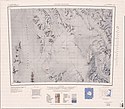
 Karte der Freyberg Mountains und des Evans-Firnfeldes, am rechten Kartenrand Monteath Hills, Millen Range und Barker Range | ||
Die Millen Range ist ein markanter Gebirgszug in den Victory Mountains des ostantarktischen Viktorialands. Die Range verläuft in nordwest-südöstlicher Richtung westlich der Cartographers Range. Zu ihren Erhebungen gehören der Inferno Peak, der Omega Peak, der Le Couteur Peak, der Head Peak der Cirque Peak, der Gless Peak, der Turret Peak, der Crosscut Peak und Mount Aorangi.
Mitglieder der New Zealand Federated Mountain Clubs Antarctic Expedition (1962–1963) benannten sie nach ihrem Expeditionsleiter John M. Millen.
Weblinks
- Millen Range. In: Geographic Names Information System. United States Geological Survey, United States Department of the Interior, archiviert vom (englisch).
- Millen Range auf geographic.org (englisch).
Auf dieser Seite verwendete Medien
Autor/Urheber: Alexrk2, Lizenz: CC BY-SA 3.0
Physische Positionskarte Antarktis, Mittabstandstreue Azimutalprojektion
1:250,000-scale topographic reconnaissance map of the Freyberg Mountains area from 162°-163°30'E to 72°-73°S in Antarctica, including the Evans Névé. Mapped, edited and published by the U.S. Geological Survey in cooperation with the National Science Foundation.


