Michigan’s Adventure
| Michigan’s Adventure | |||
|---|---|---|---|
 | |||
| Ort | Muskegon, Michigan, | ||
| Eröffnung | 1956 | ||
| Website | www.miadventure.com | ||
| |||
Koordinaten: 43° 20′ 51″ N, 86° 16′ 44″ W
Michigan’s Adventure ist ein US-amerikanischer Freizeitpark in Muskegon, Michigan, der 1956 als Deer Park eröffnet wurde.
1968 wurde der Park von Roger Jourden aufgekauft und anschließend von 1972 bis 1987 unter dem Namen Deer Park Funland. Cedar Fair kaufte den Park 2001 auf und betreibt ihn seitdem.
Liste der Achterbahnen
| Name | Typ | Hersteller | Eröffnungsjahr | Bemerkungen | Weblinks |
|---|---|---|---|---|---|
| Corkscrew | Stahlachterbahn mit Inversionen | Arrow Dynamics | 1979 | [1] [2] | |
| Mad Mouse | Wilde Maus | Arrow Dynamics | 1999 | [3] [4] | |
| Shivering Timbers | Holzachterbahn | Custom Coasters International | 1998 | [5] [6] | |
| Thunderhawk | Inverted Coaster | Vekoma | 2008 | Ursprünglich 1998 als Serial Thriller in Geauga Lake & Wildwater Kingdom eröffnet. Nach der Schließung des Parks im Jahr 2007 kam die Bahn nach Michigan’s Adventure. | [7] [8] |
| Wolverine Wildcat | Holzachterbahn | Dinn Corporation | 1988 | [9] [10] | |
| Woodstock Express | Familienachterbahn | Chance Rides | 1999 | Fuhr ursprünglich unter dem Namen Big Dipper an einer anderen Stelle im Park. | [11] [12] [13] |
| Zach's Zoomer | Holzachterbahn, Familienachterbahn | Custom Coasters International | 1994 | Der Name bezieht sich auf den Enkel des früheren Parkeigentümers Roger Jourden. | [14] [15] |
Weblinks
- offizielle Website (englisch)
Auf dieser Seite verwendete Medien
Autor/Urheber: TUBS
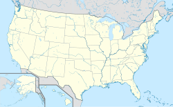
Location map of the USA (Hawaii and Alaska shown in sidemaps).
Main map: EquiDistantConicProjection : Central parallel :
* N: 37.0° N
Central meridian :
* E: 96.0° W
Standard parallels:
* 1: 32.0° N
* 2: 42.0° N
Made with Natural Earth. Free vector and raster map data @ naturalearthdata.com.
Formulas for x and y:
x = 50.0 + 124.03149777329222 * ((1.9694462586094064-({{{2}}}* pi / 180))
      * sin(0.6010514667026994 * ({{{3}}} + 96) * pi / 180))
y = 50.0 + 1.6155950752393982 * 124.03149777329222 * 0.02613325650382181
      - 1.6155950752393982  * 124.03149777329222 *
     (1.3236744353715044  - (1.9694462586094064-({{{2}}}* pi / 180))
      * cos(0.6010514667026994 * ({{{3}}} + 96) * pi / 180))
Hawaii side map: Equirectangular projection, N/S stretching 107 %. Geographic limits of the map:
- N: 22.4° N
- S: 18.7° N
- W: 160.7° W
- E: 154.6° W
Alaska side map: Equirectangular projection, N/S stretching 210.0 %. Geographic limits of the map:
- N: 72.0° N
- S: 51.0° N
- W: 172.0° E
- E: 129.0° W
Autor/Urheber: Jeremy Thompson, Lizenz: CC BY 2.0
Michigan's Adventure 031


