Memnonia Fossae
| Graben auf dem Mars | ||
|---|---|---|
| Memnonia Fossae | ||
 | ||
| Grabensystem inmitten eines Kraters | ||
| Position | 24° S, 154° W | |
| Ausdehnung | 1585 km | |
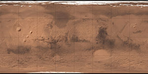
Die Grabensysteme Memnonia Fossae entstanden durch Risse und Brüche, sind das Ergebnis von tektonischen Spannungen in der Marskruste und erstrecken sich über 1600 Kilometer weit in ost-westlicher Richtung. Sie sind sehr wahrscheinlich durch das Aufwölben der Tharsis-Vulkanregion entstanden. Benannt wurden die „Gräben von Memnonia“ nach einer Tempelanlage im altägyptischen Theben.
Weblinks
Auf dieser Seite verwendete Medien
Autor/Urheber: European Space Agency, Lizenz: CC BY-SA 2.0
An extensive network of fault lines cut through this region of Mars, including one that slices clean through an ancient 52 km-wide crater.
The fault network is likely linked to the formation of the Tharsis Bulge, a region to the east that is home to several large volcanoes, including Olympus Mons.
Vast volumes of lava that erupted from these volcanoes in the past were deposited onto the surface, building up thick layers. The load imposed on the crust by the lava resulted in immense stress, which was later released by the formation of a wide-reaching fault and fracture system.
One 1.5 km-wide ‘graben’ cuts through the crater in this image. It also encounters numerous blocks of material that sit on the otherwise smooth crater floor, reminiscent of chaotic terrain found in many locations on Mars.
The crater has apparently been infilled by other materials, perhaps a mix of lava and wind-blown or fluvial sediments. To the top left of the crater, in particular, the sediments have been shaped into parallel features known as yardangs.
This image was first published on the <a href="http://www.dlr.de/dlr/en/desktopdefault.aspx/tabid-10081/151_read-17593/#/gallery/22761" rel="nofollow">DLR website</a> on 28 April 2016.
Credit: ESA/DLR/FU Berlin, <a href="http://www.esa.int/Services/Creative_Commons_Attribution-ShareAlike_3.0_IGO_CC_BY-SA_3.0_IGO_Licence" rel="nofollow">CC BY-SA 3.0 IGO</a>Carte de Mars reconstituée à partir des mesures de Mars Global Surveyor (MOLA) et des observations de Viking.


