Meck Island
| Meck Island | ||
|---|---|---|
 | ||
| Gewässer | Pazifischer Ozean | |
| Inselgruppe | Kwajalein Atoll | |
| Geographische Lage | 9° 0′ 7″ N, 167° 43′ 36″ O | |
| Länge | 1,2 km | |
| Breite | 360 m | |
| Fläche | 22 ha | |
| Höchste Erhebung | Mount Olympus 21 m | |
| Einwohner | unbewohnt | |
| Hauptort | − | |
 | ||
Meck Island (Meckinsel, auch: Meik Island, Meiku, Meiku-tō, RTS, USAKA) ist ein Teil des Kwajalein-Atolls, welches Teil der Ralik-Kette von den Marshallinseln (RMI) ist. Die Insel liegt im Osten des Atolls südlich der Eniwetak Passage. Die Insel gehört zu den von den Vereinigten Staaten gepachteten Gebieten.
Geographie
Das Motu liegt im östlichen Riffsaum des Atolls und gehört zu den Omelek-Inseln. Sie liegt südlich der Eniwetak Passage, die sich zwischen der Insel und der Insel Kwadack erstreckt. Die namengebende Insel Eniwetak liegt nach Westen, zum Innern der Lagune, versetzt.[1] Auf der Insel befindet sich auf der Lagunenseite ein Hafen, eine Flug-Landebahn, eine Telemetrische Einrichtung und die Meck ABM launch site. Auf Meck Island als Bestandteil der Raketen-Teststation Ronald Reagan Ballistic Missile Defense Test Site werden Anti-Ballistic Missiles getestet.
Der Hügel Mount Olympus ist künstlich aufgeschüttet.
Nach der Volkszählung 1999 wurden keine Einwohner auf Meck Island nachgewiesen.[2]
Klima
Das Klima ist tropisch heiß, wird jedoch von ständig wehenden Winden gemäßigt. Ebenso wie die anderen Orte der Kwajalein-Gruppe wird Meck gelegentlich von Zyklonen heimgesucht.
Weblinks
Einzelnachweise
- ↑ Meck bei GeoNames, geonames.org. Abgerufen am 14. Januar 2021.
- ↑ 1999 Census of Population (keine bewohnten Inseln zwischen Enubirr und Ningi; PDF-Datei; 437 kB)
Auf dieser Seite verwendete Medien
Autor/Urheber: NordNordWest, Lizenz: CC BY 3.0
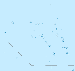
Positionskarte der Marshallinseln
MV Delta Mariner docks at Meck Island with support equipment for use in the Missile Defense Agency's two-stage intermediate/long-range launch vehicle (LV-2) program. These target missiles will be used during agency tests later this year. (2009 official description)
The north-south runway on the right was originally built to accommodate operations by STOL aircraft, notably the De Havilland Canada Caribou and Twin Otter. Strong prevailing winds from the west made for tricky landings and it was later decommissioned. Most transit today is by boat, and the runway area now hosts two helicopter landing pads - only one is seen here, the other appears on photographs as late as 1991 but appears to be decommissioned. The construction area at the south end of the runway (nearer to the camera) is used as a launch site for smaller missiles like THAAD and Patriot.
At the upper part of the the image, framed by the red and white towers, is the main launch area. This was originally built in the 1960s as part of the Sentinel and Safeguard ABM programs. As Meck is only a few feet over sea level, and the missiles were launched from underground silos, the entire area had to be built up into a hill so the silos would not be under water. Seen just below the launch site, although separated by some distance when seen from other angles, is the original Missile Site Radar (MSR) that was built as part of these same tests. The smaller red and white tower on its roof was added later and appears to hold communications gear. The large silver-roofed building to its south hosted the computers, which would normally be under the radar, but were moved here to be above the waterline. The smaller building to the left of the MSR, similarly shaped, is the Site Defense Radar (SDR), essentially a modernized MSR built in the late 1970s. This was built in 1977 on backfilled land that extended the entire area to the west, the former shoreline ran just to the left of the MSR building. Most of the buildings in the photo are from the SDR era or newer, built to support ongoing operations and new launch services.
This image is taken looking roughly north-northeast. The small island in the upper left is Kuwatep, and the longer crescent-shaped one further north is Omelek. Eniwetak is just off frame to the left of Kuwatep. Eniwetak and Omelek host a number of camera sites used to photograph launches from Meck.


