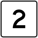
Massachusetts Route 2
 | |
|---|---|
| Karte | |
 | |
| Basisdaten | |
| Gesamtlänge: | 142,29 mi (229 km) |
| Eröffnung: | 1927 |
| Countys: | Berkshire County Franklin County Worcester County Middlesex County Norfolk County Suffolk County |
Die Massachusetts Route 2 ist eine in Ost-West-Richtung verlaufende State Route im Bundesstaat Massachusetts der Vereinigten Staaten.
Geographie
Die Massachusetts Route 2 führt von North Adams im Westen nach Boston beinahe über das gesamte Gebiet des Bundesstaates in der Ost-West-Richtung.
Die Route 2 ist auf weiten Abschnitten identisch mit dem Mohawk Trail, einem ehemaligen Pfad der Mohawk-Indianer.
Siehe auch
Weblinks
- MA 2 auf www.massachusettsroute2.com (Memento vom 17. Mai 2014 im Internet Archive)
Auf dieser Seite verwendete Medien
600 mm by 600 mm (24 in by 24 in) Massachusetts Route shield, made to the specifications of the 1996 edition of Construction and Traffic Standard Details (sign M1-5). Uses the Roadgeek 2005 fonts. (United States law does not permit the copyrighting of typeface designs, and the fonts are meant to be copies of a U.S. Government-produced work anyway.) The outside border has a width of 1 (1 mm) and a color of black so it shows up; in reality, signs have no outside border. The specs actually do not show the curve on the outside border, instead making it a perfect square, but all signs I have seen round the corners.
Official highway sign placed along many state highways indicating a corporate boundary. This sign indicates entering the city of Boston.
Autor/Urheber: Sswonk, Lizenz: CC BY-SA 3.0
Map of major highways in Massachusetts with Massachusetts Route 2 highlighted in red


