Massachusetts Route 1A
 | |
|---|---|
| Karte | |
 | |
| Basisdaten | |
| Gesamtlänge: | 94,26 mi (151,7 km)[1] |
| Eröffnung: | 1927 |
| Anfangspunkt: | |
| Endpunkt: | |
| Countys: | Bristol County Norfolk County Suffolk County Essex County |

Die Massachusetts Route 1A ist eine in Nord-Süd-Richtung verlaufende State Route im Bundesstaat Massachusetts der Vereinigten Staaten. Sie ist als alternative Strecke zum U.S. Highway 1 ausgelegt und in ihrem Verlauf teilweise mit diesem identisch, weshalb die Route 1A zweifach unterbrochen und nicht kontinuierlich ausgewiesen ist. Aufgrund der Neuordnung durch den Big Dig auf dem Stadtgebiet von Boston ist die Strecke dort ebenfalls unterbrochen.[2] Die älteren Tunnel von und nach East Boston verfügen über Kreuzungen zur I-93 und Straßenverbindungen zu einem Punkt nördlich der Stelle, wo die nicht als solche ausgewiesene Route 1A von der Route 1 im Bostoner Stadtzentrum abzweigt. Eine Verbindung zur Route 1A ist über die I-90 und den neueren Ted-Williams-Tunnel möglich.
Streckenverlauf
Teil 1: Attleboro
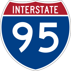
Ein kurzes, 1,8 mi (2,9 km) langes Teilstück der Route 1A in Attleboro erstreckt sich vom U.S. Highway 1A an der Grenze nach Rhode Island über eine Kreuzung mit der I-95, um sich dann in Richtung Norden zu wenden und mit dem U.S. Highway 1 zu vereinen. Die beschriebene Strecke ist als Newport Avenue ausgewiesen.
Teil 2: Von North Attleborough nach Dedham
Dieses Segment der Route 1A erstreckt sich nordwärts von North Attleborough nach Dedham. Die Strecke verläuft dabei durch die Städte Plainville, Wrentham, Norfolk, Walpole, Norwood und Westwood.
Teil 3: Von Boston nach Salisbury
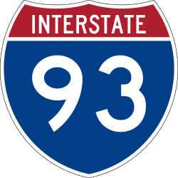
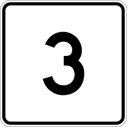
Dieses Teilstück verläuft von Boston nach Salisbury. Die Strecke beginnt am U.S. Highway 1 an der ehemaligen Kreuzung Government Center/Logan International Airport mit der I-93 und Massachusetts Route 3. Sie verläuft von dort nördlich durch den Callahan-Tunnel (mautfrei) und südlich durch den Sumner-Tunnel (mautpflichtig), um nach der Abfahrt zum Logan Airport zum East Boston Expressway zu werden. Gleich nach dem Flughafen endet die I-90 an der Route 1A.
Die Strecke führt als autobahnähnliche Straße weiter durch Revere vorbei an Suffolk Downs und dem Wonderland Greyhound Park nach Lynn. Dort ist die Strecke zunächst für 1,5 mi (2,4 km) identisch mit dem Lynnway und stark befahren. Anschließend ist die Strecke für 1 mi (1,6 km) identisch mit der Massachusetts Route 129, bevor sie als Paradise Road nach Swampscott führt. Am Vinnin Square geht es als Loring Avenue weiter nach Salem, um dann auf der Lafayette Street identisch zur Massachusetts Route 114 zu verlaufen. An der Kreuzung zur Derby Street biegt die Route 1A nach rechts ab, um kurz darauf als Hawthorne Boulevard wieder nach links abzubiegen. Von dort führt die Strecke weiter über die Winter Street und die Bridge Street nach Beverly.
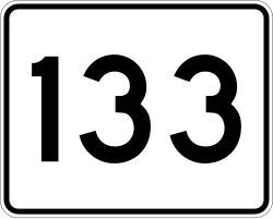
In der Stadt folgt die Strecke den Hauptstraßen im Stadtzentrum und wendet sich dann nordwärts durch Wenham, Hamilton und Ipswich, wo sie zum größten Teil identisch zur Massachusetts Route 133 ist, bis sie Rowley erreicht. Dort führt sie weiter durch Newbury, um sich in Newburyport mit dem U.S. Highway 1 zu vereinen und über den Merrimack River in das Stadtzentrum von Salisbury zu führen. Die Strecke endet schließlich am Salisbury Beach an der Grenze zu New Hampshire, von wo aus sie als New Hampshire Route 1A weiterführt.
Wichtige Straßenverbindungen
| County | Ort | Entfernung | Verbindung zur | Bemerkungen |
|---|---|---|---|---|
| Bristol | Attleboro | 0 mi (0 km) | Südliches Ende der Massachusetts Route 1A, Weiterführung nach Rhode Island als U.S. Highway 1A | |
| 0,4 mi (0,6 km) | Ausfahrten 2A und 2B | |||
| 1,7 mi (2,7 km) | Zum | |||
| 1,8 mi (2,9 km) | Nördliches Ende des ersten Teilstücks der Route 1A | |||
| Unterbrechung des Highways | ||||
| Bristol | North Attleborough | 7,1 mi (11,4 km) | Südliches Ende des zweiten Teilstücks der Route 1A | |
| Norfolk | Plainville | 8 mi (12,9 km) | Westliches Ende der Route 106 | |
| Wrentham | 10,6 mi (17,1 km) | Ausfahrt 15 | ||
| 11,4 mi (18,3 km) | Östliches Ende der Route 121 | |||
| 12,8 mi (20,6 km) | ||||
| Norfolk | 15,1 mi (24,3 km) | |||
| Walpole | 19,7 mi (31,7 km) | Zum | ||
| Dedham | 27,1 mi (43,6 km) | Providence Highway (früher U.S. Highway 1) | Nördliches Ende des zweiten Teilstücks der Route 1A. Anschlussverbindungen zur | |
| Unterbrechung des Highways | ||||
| Suffolk | Boston | 47,7 mi (76,8 km) | Südliches Ende des dritten Teilstücks der Route 1A. Anschlussverbindungen zur I-93 (Central Artery, Ausfahrt 24). Kein Zugang zur Route 1A von der I-93 Richtung Norden; kein Zugang zur I-93 Richtung Süden von der Route 1A. Für diese Verbindungen muss der Massachusetts Turnpike genutzt werden. | |
| 49,4 mi (79,5 km) | Östliches Ende der I-90. Kein Zugang von der I-90 auf die Route 1A Richtung Süden. Richtung Logan International Airport. | |||
| East Boston | 49,7 mi (80 km) | Südliches Ende der Route 145 | ||
| Revere | 50,0 mi (80,5 km) | Teilverbindung; Ausfahrt Richtung Norden, Zufahrt Richtung Süden. | ||
| 52,1 mi (83,8 km) | Östliches Ende der Route 16 sowie der Route 60 | |||
| Essex | Lynn | 58,3 mi (93,8 km) | ||
| Salem | 61,8 mi (99,5 km) | Südliches Ende des identischen Verlaufs der Route 1A / Route 114 | ||
| 62,8 mi (101,1 km) | Nördliches Ende des identischen Verlaufs der Route 1A / Route 114 | |||
| 63,4 mi (102 km) | Nördliches Ende der Route 107 | |||
| Beverly | 64,6 mi (104 km) | Südliches Ende der Route 22 und Route 127 | ||
| 65,5 mi (105,4 km) | ||||
| 66,9 mi (107,7 km) | Südliches Ende der Route 97 | |||
| 67,1 mi (108 km) | Ausfahrten 20A und 20B | |||
| Ipswich | 75,1 mi (120,9 km) | Südliches Ende des identischen Verlaufs der Route 1A / Route 133 | ||
| Rowley | 79,1 mi (127,3 km) | Nördliches Ende des identischen Verlaufs der Route 1A / Route 133 Verbindung zum | ||
| Newburyport | 87,7 mi (141,1 km) | Östliches Ende der Route 113 | ||
| 88,1 mi (141,8 km) | Südliches Ende des identischen Verlaufs des U.S. Highway 1 und der Route 1A | |||
| Salisbury | 90,1 mi (145 km) | Nördliches Ende des identischen Verlaufs des U.S. Highway 1 und der Route 1A Östliches Ende der Route 110. | ||
| 94,26 mi (151,7 km) | Nördliches Ende der Route 1A, Weiterführung nach New Hampshire als New Hampshire Route 1A | |||
Siehe auch
Einzelnachweise
- ↑ Road Inventory. (Nicht mehr online verfügbar.) Massachusetts Department of Transportation, archiviert vom Original am 20. Juni 2012; abgerufen am 30. September 2012 (englisch). Info: Der Archivlink wurde automatisch eingesetzt und noch nicht geprüft. Bitte prüfe Original- und Archivlink gemäß Anleitung und entferne dann diesen Hinweis.
- ↑ Office of Geographic Information (MassGIS). Abgerufen am 30. September 2012 (englisch).
Weblinks
- Boston’s First Expressway. Massachusetts Department of Transportation, abgerufen am 15. November 2016 (englisch).
- East Boston Expressway. Historic Overview. Boston Roads, abgerufen am 30. September 2012 (englisch).
Auf dieser Seite verwendete Medien
600 mm by 600 mm (24 in by 24 in) Massachusetts Route shield, made to the specifications of the 1996 edition of Construction and Traffic Standard Details (sign M1-5). Uses the Roadgeek 2005 fonts. (United States law does not permit the copyrighting of typeface designs, and the fonts are meant to be copies of a U.S. Government-produced work anyway.) The outside border has a width of 1 (1 mm) and a color of black so it shows up; in reality, signs have no outside border. The specs actually do not show the curve on the outside border, instead making it a perfect square, but all signs I have seen round the corners.
750 mm by 600 mm (30 in by 24 in) Massachusetts Route shield, made to the specifications of the 1996 edition of Construction and Traffic Standard Details (sign M1-5). Uses the Roadgeek 2005 fonts. (United States law does not permit the copyrighting of typeface designs, and the fonts are meant to be copies of a U.S. Government-produced work anyway.) The outside border has a width of 1 (1 mm) and a color of black so it shows up; in reality, signs have no outside border. The specs actually do not show the curve on the outside border, instead making it a perfect rectangle, but all signs I have seen round the corners.
750 mm by 600 mm (30 in by 24 in) Massachusetts Route shield, made to the specifications of the 1996 edition of Construction and Traffic Standard Details (sign M1-5). Uses the Roadgeek 2005 fonts. (United States law does not permit the copyrighting of typeface designs, and the fonts are meant to be copies of a U.S. Government-produced work anyway.) The outside border has a width of 1 (1 mm) and a color of black so it shows up; in reality, signs have no outside border. The specs actually do not show the curve on the outside border, instead making it a perfect rectangle, but all signs I have seen round the corners.
Official highway sign placed along many state highways indicating a corporate boundary. This sign indicates entering the city of Boston.
600 mm by 300 mm (24 in by 12 in) west plate, made to the specifications of the 2004 edition of Standard Highway Signs (sign M3-4). Uses the Roadgeek 2005 fonts. (United States law does not permit the copyrighting of typeface designs, and the fonts are meant to be copies of a U.S. Government-produced work anyway.) The outside border has a width of 1 (1 mm) and a color of black so it shows up; in reality, signs have no outside border.
750 mm by 600 mm (30 in by 24 in) Massachusetts Route shield, made to the specifications of the 1996 edition of Construction and Traffic Standard Details (sign M1-5). Uses the Roadgeek 2005 fonts. (United States law does not permit the copyrighting of typeface designs, and the fonts are meant to be copies of a U.S. Government-produced work anyway.) The outside border has a width of 1 (1 mm) and a color of black so it shows up; in reality, signs have no outside border. The specs actually do not show the curve on the outside border, instead making it a perfect rectangle, but all signs I have seen round the corners.
750 mm by 600 mm (30 in by 24 in) Massachusetts Route shield, made to the specifications of the 1996 edition of Construction and Traffic Standard Details (sign M1-5). Uses the Roadgeek 2005 fonts. (United States law does not permit the copyrighting of typeface designs, and the fonts are meant to be copies of a U.S. Government-produced work anyway.) The outside border has a width of 1 (1 mm) and a color of black so it shows up; in reality, signs have no outside border. The specs actually do not show the curve on the outside border, instead making it a perfect rectangle, but all signs I have seen round the corners.
600 mm by 600 mm (24 in by 24 in) Massachusetts Route shield, made to the specifications of the 1996 edition of Construction and Traffic Standard Details (sign M1-5). Uses the Roadgeek 2005 fonts. (United States law does not permit the copyrighting of typeface designs, and the fonts are meant to be copies of a U.S. Government-produced work anyway.) The outside border has a width of 1 (1 mm) and a color of black so it shows up; in reality, signs have no outside border. The specs actually do not show the curve on the outside border, instead making it a perfect square, but all signs I have seen round the corners.
600 mm by 600 mm (24 in by 24 in) Massachusetts Route shield, made to the specifications of the 1996 edition of Construction and Traffic Standard Details (sign M1-5). Uses the Roadgeek 2005 fonts. (United States law does not permit the copyrighting of typeface designs, and the fonts are meant to be copies of a U.S. Government-produced work anyway.) The outside border has a width of 1 (1 mm) and a color of black so it shows up; in reality, signs have no outside border. The specs actually do not show the curve on the outside border, instead making it a perfect square, but all signs I have seen round the corners.
750 mm by 600 mm (30 in by 24 in) Massachusetts Route shield, made to the specifications of the 1996 edition of Construction and Traffic Standard Details (sign M1-5). Uses the Roadgeek 2005 fonts. (United States law does not permit the copyrighting of typeface designs, and the fonts are meant to be copies of a U.S. Government-produced work anyway.) The outside border has a width of 1 (1 mm) and a color of black so it shows up; in reality, signs have no outside border. The specs actually do not show the curve on the outside border, instead making it a perfect rectangle, but all signs I have seen round the corners.
750 mm by 600 mm (30 in by 24 in) Massachusetts Route shield, made to the specifications of the 1996 edition of Construction and Traffic Standard Details (sign M1-5). Uses the Roadgeek 2005 fonts. (United States law does not permit the copyrighting of typeface designs, and the fonts are meant to be copies of a U.S. Government-produced work anyway.) The outside border has a width of 1 (1 mm) and a color of black so it shows up; in reality, signs have no outside border. The specs actually do not show the curve on the outside border, instead making it a perfect rectangle, but all signs I have seen round the corners.
Autor/Urheber: John Phelan, Lizenz: CC BY 3.0
Veterans Memorial Bridge entering Beverly Massachusetts
600 mm by 300 mm (24 in by 12 in) north plate, made to the specifications of the 2004 edition of Standard Highway Signs (sign M3-1). Uses the Roadgeek 2005 fonts. (United States law does not permit the copyrighting of typeface designs, and the fonts are meant to be copies of a U.S. Government-produced work anyway.) The outside border has a width of 1 (1 mm) and a color of black so it shows up; in reality, signs have no outside border.
600 mm by 600 mm (24 in by 24 in) Massachusetts Route shield, made to the specifications of the 1996 edition of Construction and Traffic Standard Details (sign M1-5). Uses the Roadgeek 2005 fonts. (United States law does not permit the copyrighting of typeface designs, and the fonts are meant to be copies of a U.S. Government-produced work anyway.) The outside border has a width of 1 (1 mm) and a color of black so it shows up; in reality, signs have no outside border. The specs actually do not show the curve on the outside border, instead making it a perfect square, but all signs I have seen round the corners.
750 mm by 600 mm (30 in by 24 in) Massachusetts Route shield, made to the specifications of the 1996 edition of Construction and Traffic Standard Details (sign M1-5). Uses the Roadgeek 2005 fonts. (United States law does not permit the copyrighting of typeface designs, and the fonts are meant to be copies of a U.S. Government-produced work anyway.) The outside border has a width of 1 (1 mm) and a color of black so it shows up; in reality, signs have no outside border. The specs actually do not show the curve on the outside border, instead making it a perfect rectangle, but all signs I have seen round the corners.
750 mm by 600 mm (30 in by 24 in) Massachusetts Route shield, made to the specifications of the 1996 edition of Construction and Traffic Standard Details (sign M1-5). Uses the Roadgeek 2005 fonts. (United States law does not permit the copyrighting of typeface designs, and the fonts are meant to be copies of a U.S. Government-produced work anyway.) The outside border has a width of 1 (1 mm) and a color of black so it shows up; in reality, signs have no outside border. The specs actually do not show the curve on the outside border, instead making it a perfect rectangle, but all signs I have seen round the corners.
600 mm by 600 mm (24 in by 24 in) New Hampshire Route shield, made to the specifications of the 2001 sign specs (sign M1-5 and variants). Uses the Roadgeek 2005 fonts. (United States law does not permit the copyrighting of typeface designs, and the fonts are meant to be copies of a U.S. Government-produced work anyway.)
600 mm × 600 mm (24 in × 24 in) U.S. Highway shield, made to the specifications of the 2004 edition of Standard Highway Signs. (Note that there is a missing "J" label on the left side of the diagram.) Uses the Roadgeek 2005 fonts. (United States law does not permit the copyrighting of typeface designs, and the fonts are meant to be copies of a U.S. Government-produced work anyway.)
600 mm by 300 mm (24 in by 12 in) east plate, made to the specifications of the 2004 edition of Standard Highway Signs (sign M3-2). Uses the Roadgeek 2005 fonts. (United States law does not permit the copyrighting of typeface designs, and the fonts are meant to be copies of a U.S. Government-produced work anyway.) The outside border has a width of 1 (1 mm) and a color of black so it shows up; in reality, signs have no outside border.
600 mm by 600 mm (24 in by 24 in) Massachusetts Route shield, made to the specifications of the 1996 edition of Construction and Traffic Standard Details (sign M1-5). Uses the Roadgeek 2005 fonts. (United States law does not permit the copyrighting of typeface designs, and the fonts are meant to be copies of a U.S. Government-produced work anyway.) The outside border has a width of 1 (1 mm) and a color of black so it shows up; in reality, signs have no outside border. The specs actually do not show the curve on the outside border, instead making it a perfect square, but all signs I have seen round the corners.
600 mm by 600 mm (24 in by 24 in) Massachusetts Route shield, made to the specifications of the 1996 edition of Construction and Traffic Standard Details (sign M1-5). Uses the Roadgeek 2005 fonts. (United States law does not permit the copyrighting of typeface designs, and the fonts are meant to be copies of a U.S. Government-produced work anyway.) The outside border has a width of 1 (1 mm) and a color of black so it shows up; in reality, signs have no outside border. The specs actually do not show the curve on the outside border, instead making it a perfect square, but all signs I have seen round the corners.
750 mm by 600 mm (30 in by 24 in) Massachusetts Route shield, made to the specifications of the 1996 edition of Construction and Traffic Standard Details (sign M1-5). Uses the Roadgeek 2005 fonts. (United States law does not permit the copyrighting of typeface designs, and the fonts are meant to be copies of a U.S. Government-produced work anyway.) The outside border has a width of 1 (1 mm) and a color of black so it shows up; in reality, signs have no outside border. The specs actually do not show the curve on the outside border, instead making it a perfect rectangle, but all signs I have seen round the corners.
Map of Massachusetts Route 1A
750 mm by 600 mm (30 in by 24 in) Massachusetts Route shield, made to the specifications of the 1996 edition of Construction and Traffic Standard Details (sign M1-5). Uses the Roadgeek 2005 fonts. (United States law does not permit the copyrighting of typeface designs, and the fonts are meant to be copies of a U.S. Government-produced work anyway.) The outside border has a width of 1 (1 mm) and a color of black so it shows up; in reality, signs have no outside border. The specs actually do not show the curve on the outside border, instead making it a perfect rectangle, but all signs I have seen round the corners.
750 mm by 600 mm (30 in by 24 in) Massachusetts Route shield, made to the specifications of the 1996 edition of Construction and Traffic Standard Details (sign M1-5). Uses the Roadgeek 2005 fonts. (United States law does not permit the copyrighting of typeface designs, and the fonts are meant to be copies of a U.S. Government-produced work anyway.) The outside border has a width of 1 (1 mm) and a color of black so it shows up; in reality, signs have no outside border. The specs actually do not show the curve on the outside border, instead making it a perfect rectangle, but all signs I have seen round the corners.
750 mm by 600 mm (30 in by 24 in) Massachusetts Route shield, made to the specifications of the 1996 edition of Construction and Traffic Standard Details (sign M1-5). Uses the Roadgeek 2005 fonts. (United States law does not permit the copyrighting of typeface designs, and the fonts are meant to be copies of a U.S. Government-produced work anyway.) The outside border has a width of 1 (1 mm) and a color of black so it shows up; in reality, signs have no outside border. The specs actually do not show the curve on the outside border, instead making it a perfect rectangle, but all signs I have seen round the corners.
750 mm by 600 mm (30 in by 24 in) Massachusetts Route shield, made to the specifications of the 1996 edition of Construction and Traffic Standard Details (sign M1-5). Uses the Roadgeek 2005 fonts. (United States law does not permit the copyrighting of typeface designs, and the fonts are meant to be copies of a U.S. Government-produced work anyway.) The outside border has a width of 1 (1 mm) and a color of black so it shows up; in reality, signs have no outside border. The specs actually do not show the curve on the outside border, instead making it a perfect rectangle, but all signs I have seen round the corners.
600 mm by 600 mm (24 in by 24 in) U.S. Route shield, made to the specifications of the 2004 edition of Standard Highway Signs. (Note that there is a missing "J" label on the left side of the diagram.) Uses the Roadgeek fonts. (United States law does not permit the copyrighting of typeface designs, and the fonts are meant to be copies of a U.S. Government-produced work anyway.)
600 mm by 600 mm (24 in by 24 in) Massachusetts Route shield, made to the specifications of the 1996 edition of Construction and Traffic Standard Details (sign M1-5). Uses the Roadgeek 2005 fonts. (United States law does not permit the copyrighting of typeface designs, and the fonts are meant to be copies of a U.S. Government-produced work anyway.) The outside border has a width of 1 (1 mm) and a color of black so it shows up; in reality, signs have no outside border. The specs actually do not show the curve on the outside border, instead making it a perfect square, but all signs I have seen round the corners.
600 mm by 300 mm (24 in by 12 in) south plate, made to the specifications of the 2004 edition of Standard Highway Signs (sign M3-3). Uses the Roadgeek 2005 fonts. (United States law does not permit the copyrighting of typeface designs, and the fonts are meant to be copies of a U.S. Government-produced work anyway.) The outside border has a width of 1 (1 mm) and a color of black so it shows up; in reality, signs have no outside border.

