Maquoketa
| Maquoketa | |
|---|---|
| Spitzname: Timber City | |
 Die Middle School von Maquoketa | |
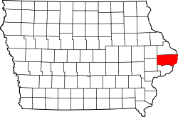
| Lage in Iowa | |
| Basisdaten | |
| Gründung: | 1838 |
| Staat: | Vereinigte Staaten |
| Bundesstaat: | Iowa |
| Countys: | Jackson County Clinton County |
| Koordinaten: | 42° 4′ N, 90° 40′ W |
| Zeitzone: | Central (UTC−6/−5) |
| Einwohner: | 6.128 (Stand: 2020) |
| Haushalte: | 2.577 (Stand: 2020) |
| Fläche: | 9,0 km² (ca. 3 mi²) davon 8,9 km² (ca. 3 mi²) Land |
| Bevölkerungsdichte: | 689 Einwohner je km² |
| Höhe: | 214 m |
| Postleitzahl: | 52060 |
| Vorwahl: | +1 563 |
| FIPS: | 19-49215 |
| GNIS-ID: | 0458789 |
| Website: | www.maquoketaia.com |
| Bürgermeister: | Tom Messerli[1] |
Maquoketa, umgangssprachlich auch Timber City, ist die Bezirkshauptstadt (County Seat) des Jackson County in Iowa, Vereinigte Staaten. Das U.S. Census Bureau hat bei der Volkszählung 2020 eine Einwohnerzahl von 6.128[2] ermittelt.
Lage
Maquoketa liegt bei 42°4'1" Nord, 90°39'58" West (42,066901, −90,666238). Ein Teil der City liegt in Clinton County.
Geschichte
Maquoketa wurde 1838 gegründet. Zuerst lautete der Name der Stadt Springfield, aber am 13. März 1844 entschloss man sich, den Namen in Maquoketa zu ändern, da es schon eine Menge Städte und Dörfer mit dem Namen Springfield gab.
Politik
Bürgermeister
- Tom Messerli
- Jack Roseberg
Söhne und Töchter der Stadt
- Norris Brown (1863–1960), Senator für Nebraska
- Herbert E. Hitchcock (1867–1958), Senator für South Dakota
- George Ryan (* 1934), Gouverneur von Illinois
- Bryan Willman (* 1959), Autorennfahrer
Weblinks
- Offizieller Internetauftritt der Ortschaft Maquoketa (englisch)
- Maquoketa Area Chamber of Commerce (englisch)
- Maquoketa´s Radio Station KMAQ (englisch)
- Maquoketa Sentinel-Press
- Old City Hall Gallery
Einzelnachweise
- ↑ www.maquoketaia.com. (abgerufen am 14. Februar 2024).
- ↑ Explore Census Data Maquoketa city, Iowa. Abgerufen am 30. November 2022.
Auf dieser Seite verwendete Medien
Autor/Urheber: Arkyan, Lizenz: CC BY-SA 3.0
This map shows the incorporated and unincorporated areas in Jackson County, Iowa, highlighting Maquoketa in red. It was created with a custom script with US Census Bureau data and modified with Inkscape.
Maquoketa Middle School
This is a locator map showing Jackson County in Iowa. For more information, see Commons:United States county locator maps.
This is a locator map showing Clinton County in Iowa. For more information, see Commons:United States county locator maps.


