Manra
| Manra | ||
|---|---|---|
 | ||
| Gewässer | Pazifischer Ozean | |
| Inselgruppe | Phoenixinseln | |
| Geographische Lage | 4° 27′ 15″ S, 171° 14′ 45″ W | |
| Länge | 3,2 km | |
| Breite | 2,8 km | |
| Fläche | 4,4 km² | |
| Einwohner | unbewohnt | |
 | ||
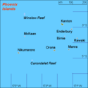
Manra (englisch Manra Island, früher Sydney Island) ist das südöstlichste Atoll der kiribatischen Phoenixinseln. Es liegt im Pazifischen Ozean, etwa 490 km südlich des Äquators. Die Lagune hat keinen Zugang zum Meer und bildet einen stark salzhaltigen See, dessen Wasserspiegel etwas tiefer als der des umgebenden Meeres liegt. Auf diesem See befinden sich zahlreiche kleine Sandinseln (Motus).
Manra wurde 1823 vom Kapitän des Londoner Walfangschiffs Sydney Packet, T. Emmett, entdeckt und Sydney benannt.
Die (einschließlich Lagune) etwa 4,5 km² große Insel war nur zwischen 1938 und 1963 bewohnt. Sie war damals Zielort eines von britischen Kolonialisten eingeleiteten Umsiedlungsprogramms, des sogenannten „Phoenix Islands Settlement Scheme“, um der Überbevölkerung auf den nordwestlich gelegenen Gilbertinseln Herr zu werden. Es wurden zwei Dörfer angelegt, die Mauta und Ona hießen. Nach dem Scheitern des Projekts verließen aber nach und nach die Siedler die drei betroffenen Inseln Manra (Sydney), Nikumaroro und Orona (Hull) wieder.
Die Inseln sind heute unbewohnt, dienen allerdings zahlreichen Seevögeln als Brutplatz; seit 1975 ist Manra ein offizielles Naturreservat.
- Galerie
- Die innere Lagune von Manra
- NASA-Aufnahme des Manra-Atolls
- Dichter Scaevola-Bewuchs auf Manra
Literatur
- Maude, Henry Evans: Of islands and men : studies in Pacific history; Melbourne [u. a.] : Oxford Univ. Pr., 1968
- Jones, A. G. E.: Ships employed in the South Seas trade Vol. 1: 1775–1861; Canberra 1986 & Vol. 2: 1775–1859; Burwood, Vic. [1992]
Weblinks
- Karten und weitere Informationen (englisch)
- Manra auf oceandots.com ( vom 23. Dezember 2010 im Internet Archive) (englisch)
Auf dieser Seite verwendete Medien
Scaevola (in Hawaii "beach naupaka") bushes, may look like an invasive species but they are not. Manra (formerly Sydney) Island Island, Phoenix Islands, Kiribati. Original field notes: Scaevola is an Indo-Pacific-wide beach species, highly tolerant to salt and wind. On some equatorial atolls and coral islands, they form impenetrable barriers around the island rim. This is also true on Nikumaroro (Gardner) Atoll, where Americans still seek the remains of Amelia Earhart.
Autor/Urheber: EVS-Islands, Lizenz: CC BY 2.0
Map of Manra Atoll, Phoenix Islands, Kiribati
View across salty lagoon on Manra (formerly Sydney) Island, Phoenix Islands, Kiribati. Original field notes:Interior lagoon is partly filled in as part of the original atoll's evolution.
NASA-Astronautenbild des Manra-Atolls (Phönix-Inseln, Kiribati) im Pazifischen Ozean
Autor/Urheber: Uwe Dedering, Lizenz: CC BY-SA 3.0
Location map of Kiribati
Equirectangular projection. Geographic limits of the map:
- N: 6° N
- S: 13° S
- W: 169° E
- E: 149° W
Made with Natural Earth. Free vector and raster map data @ naturalearthdata.com.
Sea-Borders from the political map made by NNWMap (rough) of the Phoenix islands, Kiribati, own work composed from various mapreferences


