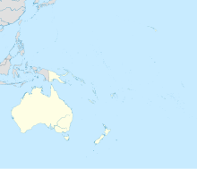
Mahina (Französisch-Polynesien)
Koordinaten: 17° 30′ S, 149° 29′ W
Mahina ist eine Gemeinde mit rund 14.400 Einwohnern (2007) auf der Insel Tahiti in Französisch-Polynesien. Sie ist die nördlichste der zwölf Gemeinden auf der Insel. Auf ihrer Gemarkung steht der 2241 m hohe Mont Orohena.
Weblinks
Auf dieser Seite verwendete Medien
Autor/Urheber: Uwe Dedering, Lizenz: CC BY-SA 3.0
Location map of Oceania.
- Projection: Lambert azimuthal equal-area projection.
- Area of interest:
- N: 35.0° N
- S: -55.0° N
- W: 110.0° E
- E: 230.0° E (This is -130° E)
- Projection center:
- NS: -10.0° N
- WE: 170.0° E
- GMT projection: -JA170/-5/20c
- GMT region: -R79.58168799459713/-44.42200097096855/-120.83787447194456/33.90289238708686r
- GMT region for grdcut: -R80.0/-63.0/260.0/39.0r
- Made with Natural Earth. Free vector and raster map data @ naturalearthdata.com.


