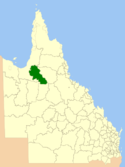
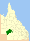
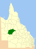
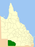
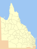
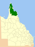
Local Government Areas in Queensland

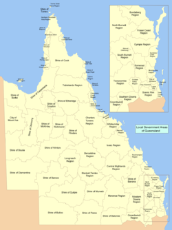
Der australische Bundesstaat Queensland ist seit 17. März 2008 nur noch in 53 lokale Verwaltungsgebiete (Local Government Areas) unterteilt.
Siehe auch
Weblinks
Auf dieser Seite verwendete Medien
Flag of Australia, when congruence with this colour chart is required (i.e. when a "less bright" version is needed).
See Flag of Australia.svg for main file information.Autor/Urheber: self, Lizenz: CC BY-SA 3.0
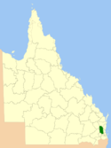
Location of the Local Government Area in Queensland
Autor/Urheber: self, Lizenz: CC BY-SA 3.0
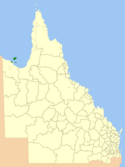
Location of the Local Government Area in Queensland
Autor/Urheber: self, Lizenz: CC BY-SA 3.0
Location of the Local Government Area in Queensland
Autor/Urheber: self, Lizenz: CC BY-SA 3.0
Location of the Local Government Area in Queensland
Autor/Urheber: self, Lizenz: CC BY-SA 3.0
Location of the Local Government Area in Queensland
Autor/Urheber: self, Lizenz: CC BY-SA 3.0
Location of the Local Government Area in Queensland
Autor/Urheber: self, Lizenz: CC BY-SA 3.0
Location of the Local Government Area in Queensland
Autor/Urheber: MagpieShooter, Lizenz: CC BY-SA 3.0
Redland City Council from 15 March, 2008
Autor/Urheber: Die Autorenschaft wurde nicht in einer maschinell lesbaren Form angegeben. Es wird Roke~commonswiki als Autor angenommen (basierend auf den Rechteinhaber-Angaben)., Lizenz: CC BY-SA 3.0
Local Government Areas of Queensland as of March 15 2008. Reference: Stronger Councils (Map of old councils: Local Government Publications)
Autor/Urheber: self, Lizenz: CC BY-SA 3.0
Location of the Local Government Area in Queensland
Autor/Urheber: self, Lizenz: CC BY-SA 3.0
Location of the Local Government Area in Queensland
Autor/Urheber: self, Lizenz: CC BY-SA 3.0
Location of the Local Government Area in Queensland
Autor/Urheber: self, Lizenz: CC BY-SA 3.0
Location of the Local Government Area in Queensland
Autor/Urheber: self, Lizenz: CC BY-SA 3.0
Location of the Local Government Area in Queensland
Autor/Urheber: self, Lizenz: CC BY-SA 3.0
Location of the Local Government Area in Queensland
Autor/Urheber: self, Lizenz: CC BY-SA 3.0
Location of the Local Government Area in Queensland
Autor/Urheber: MagpieShooter, Lizenz: CC BY-SA 3.0
Gold Coast City Council from 15 March, 2008
Autor/Urheber: MagpieShooter, Lizenz: CC BY-SA 3.0
Logan City Council from 15 March, 2008
Autor/Urheber: MagpieShooter, Lizenz: CC BY-SA 3.0
Ipswich City Council from 15 March, 2008
Autor/Urheber: self, Lizenz: CC BY-SA 3.0
Location of the Local Government Area in Queensland
Autor/Urheber: self, Lizenz: CC BY-SA 3.0
Location of the Local Government Area in Queensland
Autor/Urheber: User:Roke, Lizenz: CC BY-SA 3.0
Location of the Local Government Area in Queensland
Autor/Urheber: self, Lizenz: CC BY-SA 3.0
Location of the Local Government Area in Queensland
Autor/Urheber: self, Lizenz: CC BY-SA 3.0
Location of the Local Government Area in Queensland
Autor/Urheber: self, Lizenz: CC BY-SA 3.0
Location of the Local Government Area in Queensland
Autor/Urheber: self, Lizenz: CC BY-SA 3.0
Location of the Local Government Area in Queensland
Autor/Urheber: self, Lizenz: CC BY-SA 3.0
Location of the Local Government Area in Queensland
Autor/Urheber: self, Lizenz: CC BY-SA 3.0
Location of the Local Government Area in Queensland
Autor/Urheber: self, Lizenz: CC BY-SA 3.0
Location of the Local Government Area in Queensland
Autor/Urheber: self, Lizenz: CC BY-SA 3.0
Location of the Local Government Area in Queensland
Autor/Urheber: self, Lizenz: CC BY-SA 3.0
Location of the Local Government Area in Queensland
Autor/Urheber: self, Lizenz: CC BY-SA 3.0
Location of the Local Government Area in Queensland
Autor/Urheber: self, Lizenz: CC BY-SA 3.0
Location of the Local Government Area in Queensland
Autor/Urheber: self, Lizenz: CC BY-SA 3.0
Location of the Local Government Area in Queensland
Autor/Urheber: self, Lizenz: CC BY-SA 3.0
Location of the Local Government Area in Queensland
Autor/Urheber: self, Lizenz: CC BY-SA 3.0
Location of the Local Government Area in Queensland
Autor/Urheber: self, Lizenz: CC BY-SA 3.0
Location of the Local Government Area in Queensland
Autor/Urheber: self, Lizenz: CC BY-SA 3.0
Location of the Local Government Area in Queensland
Autor/Urheber: self, Lizenz: CC BY-SA 3.0
Location of the Local Government Area in Queensland
Autor/Urheber: self, Lizenz: CC BY-SA 3.0
Location of the Local Government Area in Queensland
Autor/Urheber: self, Lizenz: CC BY-SA 3.0
Location of the Local Government Area in Queensland
Autor/Urheber: self, Lizenz: CC BY-SA 3.0
Location of the Local Government Area in Queensland
Autor/Urheber: self, Lizenz: CC BY-SA 3.0
Location of the Local Government Area in Queensland
Autor/Urheber: self, Lizenz: CC BY-SA 3.0
Location of the Local Government Area in Queensland
Autor/Urheber: self, Lizenz: CC BY-SA 3.0
Location of the Local Government Area in Queensland
Autor/Urheber: self, Lizenz: CC BY-SA 3.0
Location of the Local Government Area in Queensland
Autor/Urheber: self, Lizenz: CC BY-SA 3.0
Location of the Local Government Area in Queensland
Autor/Urheber: self, Lizenz: CC BY-SA 3.0
Location of the Local Government Area in Queensland
Autor/Urheber: self, Lizenz: CC BY-SA 3.0
Location of the Local Government Area in Queensland
Autor/Urheber: self, Lizenz: CC BY-SA 3.0
Location of the Local Government Area in Queensland
Autor/Urheber: self, Lizenz: CC BY-SA 3.0
Location of the Local Government Area in Queensland
Autor/Urheber: self, Lizenz: CC BY-SA 3.0
Location of the Local Government Area in Queensland
Autor/Urheber: self, Lizenz: CC BY-SA 3.0
Location of the Local Government Area in Queensland
Autor/Urheber: self, Lizenz: CC BY-SA 3.0
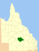
Lage der Barcaldine Region in Queensland
Autor/Urheber: self, Lizenz: CC BY-SA 3.0
Location of the Local Government Area in Queensland
Autor/Urheber: self, Lizenz: CC BY-SA 3.0
Location of the Local Government Area in Queensland
Autor/Urheber: self, Lizenz: CC BY-SA 3.0
Location of the Local Government Area in Queensland
Autor/Urheber: self, Lizenz: CC BY-SA 3.0
Location of the Local Government Area in Queensland
Autor/Urheber: self, Lizenz: CC BY-SA 3.0
Location of the Local Government Area in Queensland
Autor/Urheber: self, Lizenz: CC BY-SA 3.0
Location of the Local Government Area in Queensland
Autor/Urheber: self, Lizenz: CC BY-SA 3.0
Location of the Local Government Area in Queensland
Autor/Urheber: self, Lizenz: CC BY-SA 3.0
Location of the Local Government Area in Queensland
Autor/Urheber: MagpieShooter, Lizenz: CC BY-SA 2.5 au
Brisbane City Council from 15 March, 2008
Autor/Urheber: self, Lizenz: CC BY-SA 3.0
Location of the Local Government Area in Queensland
Autor/Urheber: self, Lizenz: CC BY-SA 3.0
Location of the Local Government Area in Queensland
Autor/Urheber: self, Lizenz: CC BY-SA 3.0
Location of the Local Government Area in Queensland
Autor/Urheber: self, Lizenz: CC BY-SA 3.0
Location of the Local Government Area in Queensland
Autor/Urheber: self, Lizenz: CC BY-SA 3.0
Location of the Local Government Area in Queensland


