Liste von Vulkanen in Saudi-Arabien
Dies ist eine Liste von Vulkanen in Saudi-Arabien, die während des Quartärs mindestens einmal aktiv waren.
| Bild | Name | Vulkan- typ | letzte Eruption | Höhe | Geo- koordinaten |
|---|---|---|---|---|---|
| Al Harrah | Vulkan- feld | unbekannt | 1100 m | 31° 05′ 00″ N, 038° 25′ 00″ O | |
 | Harrat al-Birk | 381 m | 18° 22′ 00″ N, 041° 38′ 00″ O | ||
 | Harrat ar-Rahah | 1950 m | 27° 48′ 00″ N, 036° 10′ 00″ O | ||
 | Harrat Ithnayn | 1625 m | 26° 35′ 00″ N, 040° 12′ 00″ O | ||
 | Harrat Khaybar | 650 (±50) | 2093 m | 25° 38′ 44″ N, 039° 56′ 45″ O | |
| Harrat Kishb | unbekannt | 1475 m | 22° 48′ 00″ N, 041° 23′ 00″ O | ||
 | Harrat Lunayyir | um 1000 | 1370 m | 25° 10′ 00″ N, 037° 45′ 00″ O | |
 | Harrat Rahat | 1256 | 1744 m | 24° 19′ N, 039° 46′ O | |
 | Harrat 'Uwayrid | um 640 | 1920 m | 27° 05′ 00″ N, 037° 15′ 00″ O | |
| Jabal Yar | 1810 (±10) | 305 m | 17° 03′ 00″ N, 042° 50′ 00″ O |
Siehe auch
Weblinks
Auf dieser Seite verwendete Medien
(c) OOjs UI Team and other contributors, MIT
An icon from the OOjs UI MediaWiki lib.
Lava flows radiate down desert valleys away from the center of Harrat Lunayyir, a basaltic volcanic field in NW Saudi Arabia, east of the Red Sea port of Umm Lajj. Harrat Lunayyir contains about 50 volcanic cones that were constructed along a N-S axis. Harrat Lunayyir is one of the smallest of the Holocene lava fields of Saudi Arabia, but individual flow lobes extend up to about 30 km from the center of the Harrat. One of the cones may have erupted around the 10th century AD or earlier.
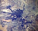
The 4000 sq km Harrat Ithnayn volcanic field appears in the center of this Space Shuttle image with north to the upper right. Harrat Ithnayn contains scattered shield volcanoes and scoria cones that have produced extensive lava flows, some of which are less than 4500 years old. Harrat Ithnayn merges with the larger Harrat Khaybar volcanic field to its south, the dark partially cloud-covered area at the lower left.
Dark-coloured volcanic cones sprout from an ancient lava field known as Harrat Al Birk along Saudi Arabia's Red Sea coastline. Many such lava fields dot the Arabian Peninsula and range in age from 2 million to 30 million years old.
This image was acquired by Landsat 7’s Enhanced Thematic Mapper plus (ETM+) sensor.
Satellite image of Harrat Khaybar volcanic field
- Harrat Khaybar, Saudi Arabia is featured in this image photographed by an Expedition 16 crewmember on the International Space Station. The western half of the Arabian peninsula contains not only large expanses of sand and gravel, but extensive lava fields known as haraat (harrat for a named field). One such field is the 14,000-square kilometer Harrat Khaybar, located approximately 137 kilometers to the northeast of the city of Al Madinah (Medina). According to scientists, the volcanic field was formed by eruptions along a 100-kilometer long north-south linear vent system over the past 5 million years; the most recent recorded eruption took place between 600 - 700 A.D.
- Harrat Khaybar contains a wide range of volcanic rock types and spectacular landforms, several of which are represented in this view. Jabal al Quidr is built from several generations of dark, fluid basalt lava flows; the flows surround the 322--meter high stratovolcano (Jabal is translated as "mountain" in Arabic). Jabal Abyad, in the center of the image, was formed from a more viscous, silica-rich lava classified as a rhyolite. While Jabal al Quidr exhibits the textbook cone shape of a stratovolcano, Jabal Abyad is a lava dome -- a rounded mass of thicker, more solidified lava flows. To the west (top center) is the impressive Jabal Bayda'.
- This symmetric structure is a tuff cone, formed by eruption of lava in the presence of water. This leads to the production of wet, sticky pyroclastic deposits that can build a steep cone structure, particularly if the deposits consolidate quickly. White deposits visible in the crater of Jabal Bayda' (and two other locations to the south) are formed from sand and silt that accumulate in shallow, protected depressions. The presence of tuff cones -- together with other volcanic features indicative of water -- in the Harrat Khaybar suggest that the local climate was much wetter during some periods of volcanic activity. Today, however, the regional climate is hyperarid -- little to no yearly precipitation -- leading to an almost total lack of vegetation.
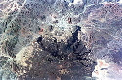
The large dark wedge-shaped area pointing to the lower right near the center of this Space Shuttle image is Harrat 'Uwayrid, a major volcanic field in NW Saudi Arabia. Harrat 'Uwayrid lies on the Bedouin pilgrim route to Syria and contains young basaltic scoria and tuff cones. Bedouin legends say that Hala-'l-Bedr erupted fire and stones in 640 AD, killing herdsmen and their cattle and sheep. Another volcanic field, Harrat ar Rahah (upper left), lies to the NW, left of the small light-colored desert area at the upper left-center.
The northern part of Saudi Arabia's largest lava field, 20,000 sq km Harrat Rahat, is seen in this Space Shuttle image (with north to the upper left). Harrat Rahat extends for 300 km south of the holy city of Madinah (Medina), the light-colored area at the top-center. Although basaltic scoria cones dominate Harrat Rahat, small shield volcanoes and pelean-type lava domes are also present. The best-known eruption took place in 1256 AD, when the large dark-colored flow seen extending to the upper right traveled 23 km to within 4 km of Madinah.
The darker-colored area extending diagonally to the right down the center of this Space Shuttle image is Harrat ar Rahah, the northernmost of a series of Quaternary volcanic fields paralleling the Red Sea coast of Saudi Arabia. The geometrical outlines of the historical town of Tabuk (top-center), located on the road leading from Hijr to Damascus, can be seen to the north. There are fewer young volcanoes in Harrat ar Rahah than in other harrats (lava fields) to the south.


