Liste von Vulkanen in Mexiko
Diese Liste von Vulkanen in Mexiko stellt aktive und erloschene Vulkane in Mexiko nach den Informationen des Global Volcanism Program der Smithsonian Institution zusammen (siehe L. Siebert, T. Simkin 2002). Die Höhenangaben können je nach Quelle leicht voneinander abweichen.
Niederschläge fallen in Zentralmexiko im Winter bis in Höhen von etwa 3000 m als Schnee, der jedoch meist binnen weniger Tage wieder weitgehend verschwindet; eine Schneekappe ist nur bei den Bergen über 5000 m ganzjährig zu beobachten. Bei den Berggipfeln unterhalb dieser Grenze schmilzt der Schnee bereits im Frühling, spätestens aber im Sommer, vollständig ab.
Siehe auch
Literatur
- L. Siebert, T. Simkin: Volcanoes of the World: an Illustrated Catalog of Holocene Volcanoes and their Eruptions. Smithsonian Institution, Global Volcanism Program Digital Information Series, GVP-3, 2002. Mexikos Vulkane
Einzelnachweise
- ↑ a b c d T. Hasenaka, I. S. E. Carmichael: The cinder cones of Michoacán-Guanajuato, central Mexico: their age, volume and distribution, and magma discharge rate. In: J. Volc. Geotherm. Res., 1985, 25, S. 105–124; geo.mtu.edu (PDF; 1,1 MB)
- ↑ S. Siebe, V. Rodriguez-Lara, P. Schaaf, M. Abrams: Radiocarbon ages of Holocene Pelado, Guespalapa, and Chichinautzin scoria cones, south of Mexico City: implications for archaeology and future hazards. In: Bull. Volc., 2004, 66, S. 203–225; geo.mtu.edu (PDF; 1,8 MB)
Auf dieser Seite verwendete Medien
(c) OOjs UI Team and other contributors, MIT
An icon from the OOjs UI MediaWiki lib.
Autor/Urheber: Christian Frausto Bernal from Tepic, Nayarit, MEXICO, Lizenz: CC BY-SA 2.0
Ceboruco in Nayarit, Mexico.
(c) Jakub Hejtmánek in der Wikipedia auf Tschechisch, CC BY-SA 3.0
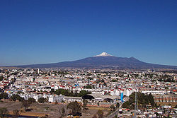
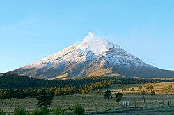
Nordseite des Popocatépetl gesehen vom Paso de Cortez Mexiko
Isla Tortuga is 4-km-wide volcanic island located in the Gulf of California, 40 km off the coast of Baja California.
Cerro El Colli, a small rhyolitic lava dome that is one of the youngest post-caldera domes of the Sierra La Primavera volcanic complex, rises to the south above the eastern caldera floor. The dome has been dated at about 30,000 years and is the easternmost of several emplaced along an arc along the southern caldera margin. Eruption of the Southern Arc lavas began about 60,000 years ago and were accompanied by eruptions of airfall pumice and pyroclastic flows. Southern Arc lavas are generally younger to the east.
Küste der Insel Socorro, Mexiko
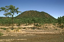
The forest-covered lava flows in the middle of the photo traveled short distances to the south from vents on the flank of Xitle, the scoria cone in the background. Most lava flows were directed by the topographic gradient to the north. Scoria-fall deposits from the 150-m-high Xitle pyroclastic cone mantle the foreground and overlie parts of the lava flows.
The twin Las Derrumbadas lava domes - the most prominent features of the Serdán-Oriental volcanic field.
An aerial view from the SE shows the Bárcena tuff cone, constructed during an eruption in the Revillagigedo Islands off the western coast of México during 1952-53. The 700-m-wide crater is partially filled by small lava domes, and a fissure on the flank of the cone fed the black lava delta at the lower right.
Autor/Urheber: AlejandroLinaresGarcia, Lizenz: CC BY-SA 4.0
Iztaccihuatl — as seen from the Sacromonte mountain in Amecameca, Mexico State.
- Part of the Trans-Mexican Volcanic Belt — a principal volcanic mountain system in central México.
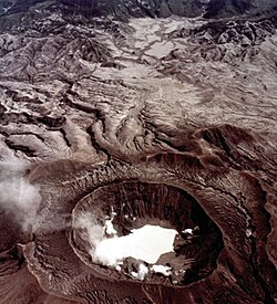
A high-altitude aerial oblique view taken on November 4, 1982 shows the effect of the El Chichón eruption about seven months later. This view from the west shows fumaroles around the new lake partially filling the crater and areas devastated by pyroclastic flows and surges. The circular rim of the nearly 2-km-wide pre-eruption somma can be seen surrounding the 1982 crater rim.
The 3450-m-high Cuauhtzin lava dome (right horizon), capping a low lava shield north of the crest of the Sierra Chichinautzin, was formed between about 7360 and 8225 radiocarbon years ago. Dacitic lava flows and block-and-ash flow deposits surround the dome. Cuauhtzin means "seat of the eagle" in the Nahuatl language. Snow-capped Iztaccihuatl volcano lies on the left horizon.
San Quintín volcanic field on the NW coast of Baja California state — Mexico.
Autor/Urheber: LCGS Russ, Lizenz: CC BY 3.0
El Virgen volcano, of the Tres Virgenes complex of volcanoes on the Baja California Peninsula.
- Located in Mulegé Municipality in the northern region of the state of Baja California Sur, México.
The broad ridge in the distance to the NW is Los Humeros, the easternmost of a series of large silicic volcanic centers with active geothermal systems located north of the axis of the Mexican Volcanic Belt.
The western side of La Gloria volcanic complex in Mexico.
Snow in July on the Mexican volcano, el Nevado de Toluca.
- Part of the Trans-Mexican Volcanic Belt — a principal volcanic mountain system in central México.
Südostküste der Insel Guadelupe, Mexiko
Las Cumbres volcanic complex, a Quaternary volcano NNE of Pico de Orizaba in Mexico.
The Naolinco volcanic field consists of a broad area of scattered Quaternary pyroclastic cones and associated dominantly basaltic lava flows north of the city of Jalapa in Mexico.
Cofre de Perote, a massive Quaternary andesitic-dacitic shield volcano in Mexico.
Autor/Urheber: Carolina Lopez, Lizenz: CC BY 2.0
El cerro de Jocotitlán; en la parte baja se observa el poblado homónimo.
Autor/Urheber: Jrobertiko, Lizenz: CC BY-SA 3.0
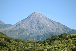
Colima Volcano. Image taken from Colima, Mexico
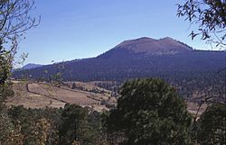
Volcán Pelado is a small symmetrical shield volcano in the eastern part of the Chichinautzin volcanic field that is capped by a pyroclastic cone. Formation of the volcano between about 9260 and 10,500 years ago was accompanied by pyroclastic flows that entrained pottery fragments from nearby settlements. Volcán Pelado lies 10 km south of Xitle, another cinder cone of the Chichinautzin volcanic field that erupted less than 2000 years ago.
Autor/Urheber: Autor/-in unbekannt, Lizenz: CC0
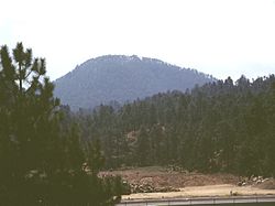
(Descripción original) Cerro del mohinora a 3470 metros sobre el nivel del mar, cerro del mohinora, municipio de guadalupe y calvo, chihuahua, (informacion subida a la red por luis alfonso uribe, ponchin)
Autor/Urheber: David Tuggy (http://www.sil.org/~tuggyd/Pix/PixEnglish.htm), Lizenz: CC BY-SA 2.5
Picture of the Sierra Negro, Mexico, with the Pico de Orizaba
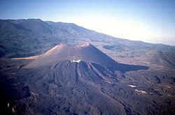
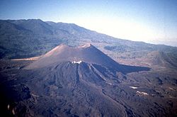
Parícutín — a major cinder cone of the Michoacán-Guanajuato volcanic field, in the Michoacán state section.
Sangangüey is an eroded andesitic and dacitic stratovolcano in Mexico.
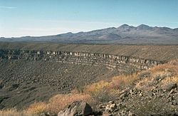
The Pinacate volcanic field is a roughly 55 x 60 km area containing numerous maars, tuff rings, and cinder cones in NW México near the head of the Gulf of California.
- The crater rim in the center of the photo is that of Crater Elegante, a 1.6-km-wide maar.
- Part of El Pinacate y Gran Desierto de Altar Biosphere Reserve — Sonora.
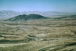
Cerro Prieto ("Dark Hill") is a small, 223-m-high compound rhyodacitic lava dome in México.
Buildings of a biological research station and fishermen's shacks line the shores of Playa Chica on the SE side of Isla Isabel. The two spires at the upper left are the Islotes Las Monas, eroded remnants of an offshore tuff cone. The lake-filled Laguna Fragatas maar can be seen at the left in front of the spires of the Islotes Las Monas.
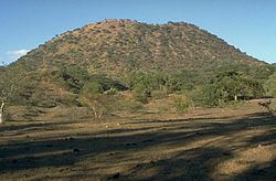
The rounded dacitic lava dome, Cerro Papayo, in the State of México.
- The 1-km-wide Cerro Papayo dome rises 230 m above surrounding lava flows.
- It is 2.5 km south of the pass in the northern Trans-Mexican volcanic belt (Sierra Nevada), between Mexico City and Puebla. Cerro Papayo fed voluminous dacitic lava flows that traveled about 10 km ENE toward the Puebla basin and 10 km WSW into the Valley of Mexico.
The principal vent of Jorullo volcano, seen here from the SSE, formed a cinder cone that grew to 250 m in height during the first month and a half of the eruption. Lava flows were erupted at some unknown later time from four flank vents located along a NE-SW fissure cutting through the main cone.
A group of calc-alkaline andesitic and minette cinder cones, volcanic fields, and lava flows are located near the town of Mascota, east of Puerto Vallarta — Jalisco.
- Steep-sided Tecomate lava cone (left center) is andesitic, and Molcajete cinder cone (right center) is of minette composition; they are seen here from the NW.


