Liste von Vulkanen in Kenia
Dies ist eine Liste von Vulkanen in Kenia, die während des Quartärs mindestens einmal aktiv waren.
Siehe auch
Einzelnachweise
Hauptquelle: Smithsonian Institution - Global Volcanism Program: Worldwide Holocene Volcano and Eruption Information
sowie:
- ↑ a b c d Mega Basalt Field im Global Volcanism Program der Smithsonian Institution (englisch)
Auf dieser Seite verwendete Medien
(c) OOjs UI Team and other contributors, MIT
An icon from the OOjs UI MediaWiki lib.
Autor/Urheber: Kathryn Combes 2008, exec officer, Soysambu Conservancy Ltd, Lizenz: CC BY-SA 3.0
view from Eburru to Elementeita Badlands
Autor/Urheber: Hansueli Krapf, Lizenz: CC BY-SA 3.0
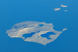
Central Island in Lake Turkana
The dark lava flows at the right side of this Landsat image are from vents at the western end of the Chyulu Hills volcanic field, Kenya. This 100-km-long, NW-SE-trending volcanic field is located 150 km east of the Kenya Rift. Two of the several hundred small cones and flows, Shaitani and Chaimu, erupted during the mid-19th century. Many of the cinder cones are aligned along dominantly NW-trending older faults and younger NNE-trending fissures.
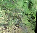
The Segererua and Rusarus Plateaus, Kenya, right of the center of this NASA Landsat image (with north to the top) contain a large number of late-Pleistocene to Holocene basaltic cones, lava flows, and maars. The Milgris River cuts across the top of the image, and Merille River lies just below the center of the image. Other vents lie east of the Kauro River (bottom center). Plateau basalts are also visible at the right-center.
Autor/Urheber: Hgmichna, Lizenz: CC BY 3.0
Menengai-Krater - Blick vom Rand der Caldera. Der weitere Verlauf des Randes ist dicht unter dem Horizont sichtbar.
Vegetated Eburru volcano (center) is elongated perpendicular to the Gregory Rift NW of Lake Naivasha (lower right), Kenya. The E-W-trending main edifice is eroded, but young craters cut the eastern part of the summit ridge, and partly vegetated, probably Holocene rhyolitic domes occur on the east flank. Extensive fumarolic activity occurs at cinder cones and craters constructed along faults cutting the massif. Lava flows of the Elmenteita Badlands are visible at the top-center portion of this Landsat image.
Autor/Urheber: User:Doron, Lizenz: CC BY-SA 3.0
South Island, eine Insel vulkanischem Ursprungs, im süden des Turkana-Sees, Kenia.
Homa Mountain in Kenya
The central caldera of Suswa, the southernmost caldera of the Kenya rift, contains an unusual 5-km-wide circular graben that isolates a tilted island block of caldera-floor lava flows. Construction of an early shield volcano was followed by eruption of voluminous pumice flows and lava flows that accompanied formation of the caldera. The latest eruptions of Suswa have originated from parasitic vents that have issued still-unvegetated lava flows that may be only a century or so old. North is to the top in this NASA Landsat image.
Pyroclastic cones of the Mega Basalt field dot the center of this NASA Landsat image (with north to the top). The volcanic field, straddling the Ethiopia-Kenya border, which cuts diagonally across the image from the upper left to lower right, is referred to in Kenya as the Dukana volcanic field. The volcanic field includes the 1.8-km-wide Gof Dukana basaltic maar, and about 50 pyroclastic cones with associated lava flows rise to about 150 m above the lava platform in northern Kenya.


