Liste von Vulkanen in Indonesien
Dies ist eine Liste von Vulkanen in Indonesien, die während des Quartärs mindestens einmal aktiv waren.
Übersicht
Tabelle
Siehe auch
Weblinks
Einzelnachweise
- ↑ Indonesia Volcanoes. Global Volcanism Program Smithsonian Institution, abgerufen am 5. August 2024 (englisch).
Auf dieser Seite verwendete Medien
(c) OOjs UI Team and other contributors, MIT
An icon from the OOjs UI MediaWiki lib.
Autor/Urheber: Der ursprünglich hochladende Benutzer war Feureau in der Wikipedia auf Englisch, Lizenz: CC BY-SA 2.5
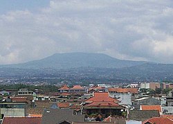
Photographed by Feureau who lives in a high apartment where he can see the Tangkuban Perahu mountain smacked right before his windows.
Gunung Wilis volcano in Java.
Krakatoa archipelago, viewed from space. The photograph was taken between 1999 and 2003, probably in 2001, because there was an eruption in from july to september.
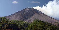
Gunung Merbabu, seen here from the south near the summit of Merapi volcano.
An unvegetated lava dome is visible at the summit of Paluweh volcano, also known as Rokatenda. The complex stratovolcano forms an 8-km-wide island located north of the volcanic arc that cuts across Flores Island. The summit region contains overlapping craters and lava domes; several flank vents occur along a NW-trending fissure. The largest historical eruption of Paluweh occurred in 1928.
Autor/Urheber: tatakimo, Lizenz: CC BY 2.0
Jailolo is a bay located in West Halmahera Regency, North Maluku Province, Indonesia.
Mollucas is so famous with its spices since thousand years ago, that's why this year festival take spices as its theme.Autor/Urheber: WahyuS, Lizenz: CC BY 2.0
View of Mount Kerinci from Kayuaro
Forested stratovolcano Sorikmarapi in Indonesia.
Gunung Kaba, rising above farmlands at Pematang Danau, has three large historically active craters trending ENE from the summit to the upper NE flank. The SW-most crater of Gunung Kaba is the largest. Most historical activity has consisted of explosive eruptions that affected only the summit region of the volcano. They originated from the central summit craters, although the upper-NE flank crater Kawah Vogelsang also produced explosions during the 19th and 20th centuries.
Toba, the Earth's largest Quaternary caldera, is seen here in a NASA Landsat satellite image (with north to the top). The 35 x 100 km caldera, partially filled by Lake Toba, was formed during four major ignimbrite-forming eruptions in the Pleistocene, the latest of which occurred about 74,000 years ago. The large island of Samosir is a resurgent uplifted block. The solfatarically active Pusukbukit volcano was later constructed near the south-central caldera rim, and Tandukbenua volcano on the NW rim may be only a few hundred years old.
The volcanic terrain of the Dieng plateau, the "Abode of the Gods," contains the oldest temples in Java. The Dieng volcanic complex, seen here from the SE, consists of two or more stratovolcanoes and numerous small craters and cones of Pleistocene-to-Holocene age over an area of 6 x 14 km. Minor phreatic eruptions have occurred in historical time, sometimes associated with toxic gas emissions.
Crescent-shaped Lake Ranau partially fills the 8 x 13 km Ranau caldera in Indonesia. A morphologically young post-caldera stratovolcano, Gunung Semuning, its summit capped by clouds below the bottom center lake shore in this NASA Landsat image (with north to the top), was constructed within the SE side of the caldera to a height of more than 1600 m above the caldera lake surface. The age of the most recent eruptions at Ranau are not known, but fish kills and sulfur smells in the late 19th and early 20th centuries may be related to sublacustral eruptions.
Mount Merapi and Bukittinggi. (Courtessy: Hanafi, taken in June 2005, all rights released for public domain)
faizul hadiAutor/Urheber: Riza Nugraha ? from Utrecht, The Netherlands, Lizenz: CC BY 2.0
Mts. Bromo-Semeru-Batok-Widodaren, Tengger Caldera, East Java
Autor/Urheber: Bolaruwet, Lizenz: CC BY-SA 4.0
foto wisata bromo malang, jawa timur
Tambora volcano on Indonesia's Sumbawa Island was the site of the world's largest historical eruption in April 1815. This NASA Landsat mosaic shows the 6-km-wide caldera truncating the 2850-m-high summit of the massive volcano. Pyroclastic flows during the 1815 eruption reached the sea on all sides of the 60-km-wide volcanic peninsula, and the ejection of large amounts of tephra caused world-wide temperature declines in 1815 and 1816.
The small 637-m Iya volcano anchors the southern end of a peninsula on central Flores Island, seen here from the village of Kori Bari on the NW. Intermittent explosive eruptions have been recorded since 1671.
Kelimutu, a small volcano on Flores Island, in Indonesia, is noted for its three crater lakes of different colors. This aerial view from the SW shows Tiwu Ata Mbupu (Lake of Old People) at the lower left, and the double craters of Tiwu Nua Muri Kooh Tai (Lake of Young Men and Maiden) and Tiwu Ata Polo (Bewitched, or Enchanted Lake) at the upper right. Water color varies periodically, but is often blue, green, and red, respectively. Phreatic eruptions have occurred from the middle lake in historical time.
Rinjani volcano on Lombok Island is one of Indonesia's highest volcanoes, rising to 3726 m. As seen here from the village of Sembalum Lawang to the NE, Rinjani has a symmetrical profile, but its western side is truncated by the 6 x 8.5 km, oval-shaped Segara Anak caldera. Historical eruptions have been recorded since 1847 from Gunung Barujari, a pyroclastic cone within the caldera.
Eastern flank of Gunung Sundoro, one of the most symmetrical volcanoes in Java.
A lava dome, formed during the first historical eruption of Iliwerung volcano in 1870, occupies the summit crater of the volcano, seen here in 1979 from the rim of Ado Wajung crater. Iliwerung forms one of the south-facing peninsulas on Lembata (formerly Lomblen) Island, and has a series of lava domes and craters along N-S and NW-SE lines. Many of these vents, including submarine vents offshore, have erupted in historical time.
The massive Iyang-Argapura volcanic complex rises east of the lowlands across from Raung volcano.
Nila Island, viewed here from off its northern coast, is the emergent summit of a stratovolcano that rises 3700 m from the Banda Sea floor. A submarine vent is located off the north flank immediately west of the small island of Nika. Gas bubbles were observed along the rim of the submarine cone in 1932, when an eruption occurred from a fissure extending from the summit to the SE coast.
Gunung Ibu volcano on the NW coast of Halmahera Island rises beyond a small village on its WNW flank. The summit of the stratovolcano is truncated by nested craters; the inner crater, 1 km wide and 400 m deep, contains several small crater lakes. The outer crater is breached on the north side, forming the deep valley seen here on the left side of the summit ridge. Few eruptions are known in historical time from Ibu, although it was erupting at the time of this February 1999 photo.
Gunung Egon volcano, seen here from the NW, sits astride the narrow waist of eastern Flores Island. The lower flanks of Egon volcano extend nearly to both the Flores Sea on the north and the Savu Sea to the south. The unvegetated summit of the volcano is capped by a 350-m-wide crater. A lava dome forms a lesser summit to the south.
Gunung Ebulobo (also known as Amburombu or Keo Peak) towers above the village of Boa Wae, located below the NW flank of the volcano. Ebulobo is a symmetrical 2124-m-high stratovolcano in central Flores Island with a flat-topped summit lava dome. Historical eruptions, recorded since 1830, include lava emission down the north flank and explosive eruptions from the summit crater.
The Bratan volcanic complex is seen here from the east on the rim of Batur caldera.
Tandikat volcano in Sumatra, Indonesia.
Gunung Slamet, Java's second highest volcano, towers above the village of Kutabawa. The modern volcano forms a less-vegetated cone that rises above the forested slopes of an older volcano in the foreground. Slamet is one of Java's most active volcanoes and has produced frequent explosive eruptions recorded since the 18th century.
Sumbing stratovolcano rises above rice fields in Java island to 3371 m immediately to the SE of Sundoro volcano.
Ruang volcano, seen here from the nearby island of Tagulandang, forms a small 4 x 5 km island that is part of a chain of islands extending north from Sulawesi. Explosive eruptions, recorded in historical time since 1808, have been accompanied by pyroclastic flows and lava dome formation, and have frequently caused damage to populated areas.
Kawi-Butak is volcanic massif lies immediately east of Kelut volcano. The high point of the complex is flat-topped 2868-m-high Gunung Butak on the right horizon. The 2551-m-high Gunung Kawi si in the left side.
A shallow lake partially fills the summit crater of Awu volcano in this 1995 view. Gunung Awu volcano, one of the deadliest in Indonesia, is cut by deep valleys that form passageways for lahars dissect the flanks of the 1320-m-high volcano. Powerful explosive eruptions in 1711, 1812, 1856, 1892, and 1966 produced devastating pyroclastic flows and lahars that caused more than 8000 fatalities.
Autor/Urheber: Reworked by Geoethno; original photograph by Cosmotic;, Lizenz: CC BY-SA 3.0
Mount Raung . Photo was taken from Malaysia Airlines flight MH853 (from Kuala Lumpur to Denpasar, Bali).
The small Soputan stratovolcano, seen here from the west, was constructed on the southern rim of the Quaternary Tondano caldera in northern Sulawesi Island. The youthful, largely unvegetated Soputan volcano is one of Sulawesi's most active volcanoes. During historical time the locus of eruptions has included both the summit crater and Aeseput, a prominent NE flank vent that formed in 1906 and was the source of intermittent major lava flows until 1924.
Thin clouds drape one of four summit peaks of Peuet Sague volcano in NW Sumatra. This infrequently visited volcano lies several days' journey on foot from the nearest village. The first recorded historical eruption took place during 1918-21, when explosive activity and pyroclastic flows accompanied summit lava dome growth.
Autor/Urheber: RaymondSutanto, Lizenz: CC BY-SA 4.0
Hiri Island, North Maluku
The compound Belirang-Beriti volcano, also spelled Belerang-Beriti, rises above Mubai village. The volcano rises above the Semalako Plain in SW Sumatra, forming a NW-SE-trending massif that contains a 1.2-km-wide crater breached to the NE. The age of its latest eruptions is not known, although fumaroles occur in the crater walls.
Mount Tampomas in Java.
Talang volcano, seen here from the Volcanological Survey of Indonesia observation post at Batu Barjangan on the NNE side, is a twin volcano with the older Pasar Arbaa volcano. The summit of Talang lacks a crater, and historical eruptions, consisting of mild explosive activity, have originated from a valley on the NE flank.
Mount Seulawaih Agam in Aceh, Indonesia
Autor/Urheber: Candra Firmansyah, Lizenz: CC BY-SA 4.0
A feral buffalo (Bubalus bubalis) soaking at the Bekol Savannah in Baluran National Park at dusk.
An atmospheric cloud rises above the summit of Dempo stratovolcano in SE Sumatra. Gunung Dempo here towers nearly 3 km above tea plantations below its eastern flank. Dempo is one of Sumatra's most active volcanoes, producing small-to-moderate explosive eruptions. Seven partially overlapping craters cut the summit; the youngest of these is partially filled by a crater lake.
Mount Arjuna viewed from Malang
Gunung Penanggungan, one of Java's most revered mountains.
Autor/Urheber: Serenade, Lizenz: CC BY-SA 3.0
Small mercury lakes after eruption in 2001 of the Inielika volcano located in the central part of the island of Flores, Indonesia, north of the city of Bajawa
Ilimuda volcano, rising above Sukutukang village on its WSW flank, is a low, 1100-m-high stratovolcano with a large crater breached to the SE. The volcano overlooks Konga bay on the east. No historical eruptions are known from Ilimuda, although an active fumarole is located inside the NE crater rim.
The steep-walled summit crater (right) of Gede cuts the broad summit of the volcano. Gunung Gede is one of the most prominent volcanoes in western Java, forming a twin volcano with Pangrango volcano to the NW. Many lava flows are visible on the flanks of the younger Gunung Gede, including some that may have been erupted in historical time. Historical activity, recorded since the 16th century, typically consists of small explosive eruptions of short duration.
A new lava dome, named Anak Ranakah (center) was formed in 1987 on the outer flanks of the poorly known Poco Leok caldera on western Flores Island. The new dome was located in an area without previous historical eruptions at the base of the large older lava dome of Gunung Ranakah. Anak Ranakah ("Child of Ranakah"), seen here from the SW, is part of an arcuate group of lava domes extending westward from Gunung Ranakah.
Historically active Bur ni Telong volcano, seen here from the SE, was constructed on the southern flank of Bur ni Geureudong volcano, part of which is visible in the background. The two summits of the complex are 4.5 km apart and differ only 34 m in elevation. The summit crater of 2624-m-high Bur ni Telong has migrated to the ESE, leaving arcuate crater rims. Lava flows are exposed on the southern flank. Explosive eruptions were recorded during the 19th and 20th centuries.
A monitoring team from the Volcanological Survey of Indonesia visits Talagabodas. Gunung Talagabodas stratovolcano lies immediately north of the more well-known Galunggung volcano. The crater of Talagabodas (which means "White Lake") contains this large sulfur-saturated lake. Fumaroles, mud pots, and a warm spring are found around the 400-500 m wide lake, which has an elevated temperature. Changes in lake color occurred in 1913 and 1921, and expanded solfataric activity was reported in 1927.
Karangetang (Api Siau) volcano rises above the Pengamatan Maralawa volcano observation post of the Volcanological Survey of Indonesia near the village of Salili on the southern flank. Karangetang is one of Indonesia's most active volcanoes. Twentieth-century eruptions have included frequent explosive activity that is sometimes accompanied by pyroclastic flows and lahars. Lava dome growth has occurred in the summit craters; collapse of lava flow fronts has also produced pyroclastic flows.
Nearly constant explosive eruptions keep the ash-blanketed crater floor of Dukono volcano unvegetated. This view from Gunung Heneowara peak on the southern crater rim shows Gunung Telori peak at the upper left and the small Gunung Dilekene pyroclastic cone at the right-center. The slopes of Gunung Mamuya stratovolcano rise at the extreme right above the coast. Dukono has been in continuous eruption since 1933.
Autor/Urheber: User Mark Richards on en.wikipedia, Lizenz: CC BY-SA 3.0
BandaVolcano
The small dark-green area below the center of this NASA Landsat image of NW Sumatra (with north to the top) is Imun volcano. This cone of uncertain age lies south of the renowned large caldera containing Lake Toba (top).
Autor/Urheber: Die Autorenschaft wurde nicht in einer maschinell lesbaren Form angegeben. Es wird Hullie als Autor angenommen (basierend auf den Rechteinhaber-Angaben)., Lizenz: CC BY-SA 2.5
Indonesia Papandayan volcano
Picture taken by Hullie august 1997Wurlali volcano (also referred to as Damar), seen here from Cape Wilhelmus on the north, is part of Indoneisia's Banda Island chain. The 868-m-high stratovolcano was formed in the northern part of a 5-km-wide caldera, and has twin summit craters. During historical time only a single explosive eruption occurred, in 1892 from the summit crater.
Muria stratovolcano forms the broad Muria Peninsula along the northern coast of central Java in this NASA Landsat mosaic (with north to the top). This 1625-m-high volcano lies well north of the main volcanic chain in Java. It is largely Pleistocene in age and displays deeply eroded flanks. The summit is cut by several large N-S-trending craters, some containing lava domes. The most recent eruptive activity at Muria produced three maars on the SE and NE flanks and a lava flow from a SE-flank vent that entered one of the maars.
The steaming summit caldera of Gunung Sirung volcano is seen here from the eastern caldera rim. Sirung volcano lies at the NE end of a 14-km-long line of volcanic centers forming a peninsula at the southern end of Pantar Island. A lava dome (center) at the western side of the caldera forms the summit of Gunung Sirung volcano; other cones along the chain to the SE increase in height. The 2-km-wide summit caldera has been the source of small phreatic eruptions during the 20th century.
Autor/Urheber: Faza hizba, Lizenz: CC BY-SA 4.0
pulau sempu terletak 800 meter dari pantai selatan provinsi jawa timur Indonesia, sekitar 70 km dari kota malang
The forested, compound stratovolcano Lawu, seen here from the SW, lies between the cities of Surakarta (Solo), Ngawi and Madiun. A trail to the top of the volcano is used for pilgramages to the Hindu-Buddhist temple near the summit.
Autor/Urheber: Sakurai Midori, Lizenz: CC BY 2.5
Lake Tondano, North Sulawesi, Indonesia
Iliboleng volcano at the SE end of Adonara Island, east of Flores Island, is a symmetrical stratovolcano with many partially overlapping summit craters. Iliboleng is seen here from Bukit Tomu, north of the volcano. Explosive eruptions from the summit crater have been recorded since 1885. Only one historical eruption, in 1888, produced a lava flow.
Tongkoko volcano, seen here from Lembe Island to the east, is a broad, 1149-m-high stratovolcano capped by a large summit crater. The lava dome Batu Angus, which formed in an eruption in 1801, can be seen on the east flank of the volcano in the center of the photo. Gunung Dua Saudara National Park, a noted wildlife preserve, extends from the volcanic highlands to offshore coral reefs.
Photo of Mount Salak
Insel Manuk in der Bandasee
Lamongan, a small 1631-m-high stratovolcano located between the massive Tengger and Iyang-Argapura volcanoes, rises above Lamongan Lake on its western flank
Mahawu volcano, located immediately to the east of Lokon-Empung volcano, contains a 450-m-wide, 140-m-deep summit crater. Active fumaroles are seen in this 1991 photo of the north end of the crater, which sometimes contains a crater lake. Small-to-moderate explosive eruptions have been recorded at 1331-m-high Mahawu volcano since the 18th century.
Sangeang Api is a small volcanic island off the NE coast of Sumbawa Island. Two large volcanic cones, Doro Api in the center and Doro Mantoi on the right, were constructed within and on the south rim of a largely obscured caldera. Intermittent eruptions have been recorded since 1512, but the volcano has been frequently active in the 20th century.
Mount Ciremai, West Java, Indonesia, as seen from Cigugur village
View of Gunungapi Wetar from space.
author=NASA source=NASA
URL=http://eol.jsc.nasa.gov/Autor/Urheber: Achmad Rabin Taim, Lizenz: CC BY 2.0
Tidore Island, taken from Ternate Island (Indonesia)
Gamkonora volcano, seen here from the NW coast near Gamsungi village, is one of Halmahera's more active volcanoes. The summit crater of Gamkonora is elongated in a N-S direction, with a small crater lake at the north end. The first two historical eruptions, in 1564 or 1565, and in 1693, were the most severe, producing respectively a destructive lava flow that reached the sea, and a tsunami that inundated villages.
Der Galunggung ist ein Schichtvulkan im Westen Javas. Hier ist seine nach Südosten geöffnete Gipfelcaldera zu sehen.
Weather clouds drape the summit of Gunung Klabat, an isolated symmetrical stratovolcano that rises to 1995 m near the eastern tip of the northern arm of Sulawesi. Klabat, rising above the farming village of Tatelu below its NW flank, has a shallow lake in its 170 x 250 m summit crater. No verified historical eruptions have occurred from Klabat volcano, the highest peak in northern Sulawesi.
The symmetrical Gunung Inierie volcano, seen here from the north, is at 2245 m the highest volcano on Flores Island. The unvegetated cone of Inierie here rises steeply above surrounding hills, which are home to the Malay/Melanesian Ngadi, one of the most traditional native peoples on Flores. A column of "smoke," as occurred in June 1911, is sometimes visible from the crater of Inierie, which is on the eastern side of the summit.
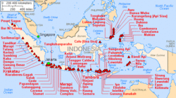
Major volcanoes of Indonesia, with eruptions since 1900 AD
Makian volcano forms a 10-km-wide island near the southern end of a chain of volcanic islands off the western coast of Halmahera. The northern of two prominent valleys that extend from the summit is prominent in this photo. The large 1.5-km-wide summit crater containing a small lake on the NE side gives the 1357-m-high peak a flat-topped profile. Violent eruptions from Makian volcano, also known as Kie Besi, have devastated villages on the island.
Autor/Urheber: Miriam Grandauer, Lizenz: CC BY-SA 4.0
Gelembung-gelembung udara keluar dari area gunung api bawah laut (Banua Wuhu) pulau Mahengetang, Kepulauan Sangihe, Indonesia.
Gamalama (Peak of Ternate) is a stratovolcano that rises on Ternate Island.


