Liste von Vulkanen in Australien

In dieser Liste befinden sich Vulkane auf dem australischen Festland und auf australischen Inseln.[1] Der letzte Vulkanausbruch fand 2011 auf der Heard-Insel durch den Big Ben statt.

Vulkane in Australien einschließlich der Inseln

Queensland

BildNameHöhe (m)Lage
Geo-Koordinaten
VulkantypLetzte EruptionAnmerkungen
AthertonTableland.jpgAtherton Tablelands!482.5000005644.500000517° 30′ 00″ S, 144° 30′ 00″ OVulkanfeldVor weniger als 100.000 JahrenJohn Seach
Lake Barrine
(Atherton Volcano)
730!482.8000005645.400000517° 12′ 00″ S, 145° 24′ 00″ OMaar12.000 JahreJohn Seach
derm.qld.gov.au
Yidyam.jpgLake Eacham
(Atherton Volcano)
!482.8000005645.600000517° 12′ 00″ S, 145° 36′ 00″ OMaar12.000 JahreJohn Seach
Mount Hypipamee Crater
(Atherton Volcano)
1.000!482.8000005645.200000517° 12′ 00″ S, 145° 12′ 00″ O10.000 – 15.000 Jahreatherton-tableland.com
Lake Euramoo
(Atherton Volcano)
1.000!482.8000005645.600000517° 12′ 00″ S, 145° 36′ 00″ O10.000 Jahrederm.qld.gov.au
Bauhinia Volcano!475.2000005649.500000524° 48′ 00″ S, 149° 30′ 00″ OVulkanfeld22–27 Millionen JahreJohn Seach
Brisbane Volcano!472.3000005652.600000527° 42′ 00″ S, 152° 36′ 00″ OVulkanfeld16–62 Millionen JahreJohn Seach
Buckland!474.7700005648.500000525° 13′ 48″ S, 148° 30′ 00″ OVulkanfeld27 Millionen JahreJohn Seach
Bundaberg Volcano!475.1400005652.350000524° 51′ 36″ S, 152° 21′ 00″ O900.000 JahreJohn Seach
Boyne Volcano
(Bunya Mountains)
!473.1600005651.550000526° 50′ 24″ S, 151° 33′ 00″ O380.000 JahreJohn Seach
Chudleigh Volcano680!480.6600005644.360000519° 20′ 24″ S, 144° 21′ 36″ OVulkanfeld250.000 JahreJohn Seach
Mount fox 01-10-06.jpgMount Fox!481.5000005645.470000518° 30′ 00″ S, 145° 28′ 12″ O100.000 Jahreoregonstate.edu
Mount Hay
Hillsborough Volcano590!478.9700005648.940000521° 01′ 48″ S, 148° 56′ 24″ O33,2 Millionen JahreJohn Seach
The Hummock
LakeMoogerah.jpgMain Range Volcano!472.1000005652.400000527° 54′ 00″ S, 152° 24′ 00″ O23–27 Millionen JahreJohn Seach
Mount Le Brun330!474.4022225651.908889525° 35′ 52″ S, 151° 54′ 32″ OVor 600.000 JahrenJohn Seach
Mount McBride
(McBride Volcanic Province)
911!481.7000005644.600000518° 18′ 00″ S, 144° 36′ 00″ O1,7 Millionen JahreJohn Seach
Undara
(McBride Volcanic Province)
40!481.8000005644.700000518° 12′ 00″ S, 144° 42′ 00″ OVulkanfeld3 Millionen Jahreoregonstate.edu
Undara Crater
(McBride Volcanic Province)
1.020!481.7500005644.750000518° 15′ 00″ S, 144° 45′ 00″ OSchildvulkan190.000John Seach
Kinrara Volcano
(McBride Volcanic Province)
740!481.5863895644.915833518° 24′ 49″ S, 144° 54′ 57″ O20.000 Jahreoregonstate.edu
McLean Volcano!484.2000005644.800000515° 48′ 00″ S, 144° 48′ 00″ OVulkanfeldWeniger als 1 Million JahreJohn Seach
Mingela
Mitchell Volcano!474.0000005648.200000526° 00′ 00″ S, 148° 12′ 00″ OVulkanfeld21–24 Millionen JahreJohn Seach
Monto Volcano!475.1500005651.120000524° 51′ 00″ S, 151° 07′ 12″ Ovor 21 bis 70 Millionen JahrenJohn Seach
Nebo Volcano!478.6000005648.200000521° 24′ 00″ S, 148° 12′ 00″ O16–35 Millionen JahreJohn Seach
Nulla Volcano!480.3000005645.300000519° 42′ 00″ S, 145° 18′ 00″ OVulkanfeld 13.000 JahreJohn Seach
Piebald Volcano417!484.9000005645.100000515° 06′ 00″ S, 145° 06′ 00″ OVulkanfeldVor weniger als 3 Millionen JahreJohn Seach
Rockhampton Volcano475!476.7000005650.400000523° 18′ 00″ S, 150° 24′ 00″ O67–71 Millionen JahreJohn Seach
Springsure Volcano600!475.9200005648.170000524° 04′ 48″ S, 148° 10′ 12″ O24–33 Millionen JahreJohn Seach
Sturgeon Volcano!479.7000005644.200000520° 18′ 00″ S, 144° 12′ 00″ OVulkanfeld920.000 JahreJohn Seach
Toomba!480.5000005645.000000519° 30′ 00″ S, 145° 00′ 00″ OLavafeld13.000 Jahreoregonstate.edu
Wallaroo Volcano!482.0000005645.400000518° 00′ 00″ S, 145° 24′ 00″ OVulkanfeldVor weniger als 5 Millionen JahrenJohn Seach
Focal Peak Volcano!471.7386115652.635278528° 15′ 41″ S, 152° 38′ 07″ OSchildvulkan23 Millionen JahreJohn Seach
MtBarney.jpgMount Barney
(Focal Peak)
1.359!471.8300005652.420000528° 10′ 12″ S, 152° 25′ 12″ O23 Millionen JahreJohn Seach
Campbells Folly
(Focal Peak)
23 Millionen JahreJohn Seach
Mount Gilles
(Focal Peak)
23 Millionen JahreJohn Seach
Mount Glennie
(Focal Peak)
23 Millionen JahreJohn Seach
Levers Plateau
(Focal Peak)
23 Millionen JahreJohn Seach
Mount Lindesay Queensland.jpgMount Lindesay
(Focal Peak)
!471.6558335652.722222528° 20′ 39″ S, 152° 43′ 20″ O23 Millionen JahreJohn Seach
Glasshouse mountain.jpgGlass House Mountains240!473.3000005652.900000526° 42′ 00″ S, 152° 54′ 00″ O25–27 Millionen JahreJohn Seach
Mount Miketeebumulgrai
(Glass House Mountains)
19925–27 Millionen JahreJohn Seach
Mount Tunbubudla
(Glass House Mountains)
31225–27 Millionen JahreJohn Seach
Mount Beerburrum
(Glass House Mountains)
27625–27 Millionen JahreJohn Seach
Mount Tibberoowuccum
(Glass House Mountains)
22025–27 Millionen JahreJohn Seach
Tibrogargan.jpgMount Tibrogargan
(Glass House Mountains)
364!473.0666675652.950000526° 56′ 00″ S, 152° 57′ 00″ O25–27 Millionen JahreJohn Seach
Mount Cooee
(Glass House Mountains)
25–27 Millionen JahreJohn Seach
MtCoonowrin.jpgMount Coonowrin
(Glass House Mountains)
377!473.1000005652.916667526° 54′ 00″ S, 152° 55′ 00″ O25–27 Millionen JahreJohn Seach
Mount Beerwah.jpgMount Beerwah
(Glass House Mountains)
556!473.1000005652.883333526° 54′ 00″ S, 152° 53′ 00″ O25–27 Millionen JahreJohn Seach
Mount Ngungun
(Glass House Mountains)
25325–27 Millionen JahreJohn Seach
Mount Coochin
(Glass House Mountains)
23525–27 Millionen JahreJohn Seach
Mount Elimbah
(Glass House Mountains)
12925–27 Millionen Jahre
Round Mountain
(Glass House Mountains)
25–27 Millionen Jahre
Wild Horse Mountain
(Glass House Mountains)
123!473.3000005652.900000526° 42′ 00″ S, 152° 54′ 00″ O25–27 Millionen Jahre
Peak Range807!477.2900005648.060000522° 42′ 36″ S, 148° 03′ 36″ O27 – 35 Millionen JahreJohn Seach
Anvil Peak
(Peak Range)
!477.2000005648.000000522° 48′ 00″ S, 148° 00′ 00″ O27–35 Millionen JahreJohn Seach
Browns Peak
(Peak Range)
807!477.2000005648.000000522° 48′ 00″ S, 148° 00′ 00″ O27–35 Millionen JahreJohn Seach
Table Mountain
(Peak Range) im Table-Mountains-Nationalpark
!477.2000005648.000000522° 48′ 00″ S, 148° 00′ 00″ O27–35 Millionen JahreJohn Seach

New South Wales

BildNameHöhe (m)Lage
Geo-Koordinaten
VulkantypLetzte EruptionAnmerkungen
Abercrombie Volcano!465.7000005649.400000534° 18′ 00″ S, 149° 24′ 00″ O14–26 Millionen JahreJohn Seach
Airly Volcano!467.1000005650.100000532° 54′ 00″ S, 150° 06′ 00″ O34–42 Millionen JahreJohn Seach
Barrington lookout.jpgBarrington Volcano im Barrington-Tops-Nationalpark!468.2000005651.200000531° 48′ 00″ S, 151° 12′ 00″ O44–54 Millionen JahreJohn Seach
Bunda Bunda Volcano!468.9000005652.400000531° 06′ 00″ S, 152° 24′ 00″ O71 Millionen JahreJohn Seach
Byrock Volcano!469.3000005646.300000530° 42′ 00″ S, 146° 18′ 00″ O16 Millionen JahreJohn Seach
Mount Canobolas.jpgMount Canobolas1.395!466.7000005649.000000533° 18′ 00″ S, 149° 00′ 00″ O11–13 Millionen JahreJohn Seach
Cargelligo Volcano!466.6000005646.500000533° 24′ 00″ S, 146° 30′ 00″ O10–15 Millionen JahreJohn Seach
Central Volcano!470.2000005651.600000529° 48′ 00″ S, 151° 36′ 00″ O19-34 Millionen JahreJohn Seach
Comboyne Volcano!468.4000005652.500000531° 36′ 00″ S, 152° 30′ 00″ O11–13 Millionen JahreJohn Seach
Doughboy Volcano!469.7000005652.200000530° 18′ 00″ S, 152° 12′ 00″ O38–45 Millionen JahreJohn Seach
Dubbo Volcano!467.8000005649.200000532° 12′ 00″ S, 149° 12′ 00″ O12–15 Millionen JahreJohn Seach
Ebor Volcano!469.6000005652.400000530° 24′ 00″ S, 152° 24′ 00″ O18–19 Millionen JahreJohn Seach
El Capitan!468.8000005646.200000531° 12′ 00″ S, 146° 12′ 00″ O12–15 Millionen JahreJohn Seach
Gulaga from Montague Island2.jpgMount Gulaga auch Mount Dromedary806!463.7000005650.000000536° 18′ 00″ S, 150° 00′ 00″ O
Mount Kaputar.jpgMount Kaputar
(Nandewar Range)
1,507!469.8000005650.100000530° 12′ 00″ S, 150° 06′ 00″ O17–18 Millionen JahreJohn Seach
Murrurundi NSW.JPGLiverpool Range!468.1000005650.400000531° 54′ 00″ S, 150° 24′ 00″ O32–35 Millionen JahreJohn Seach
Monaro Volcano!464.3000005650.300000535° 42′ 00″ S, 150° 18′ 00″ O37–55 Millionen JahreJohn Seach
oregonstate.edu
Nerriga Volcano!464.8000005649.800000535° 12′ 00″ S, 149° 48′ 00″ O50 Millionen JahreJohn Seach
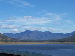
SnowyMountainsNSWTalbingoDam20050423a.JPGSnowy Mountains!464.5000005648.300000535° 30′ 00″ S, 148° 18′ 00″ O17–22 Millionen JahreJohn Seach
South Coast Volcano!464.3000005650.300000535° 42′ 00″ S, 150° 18′ 00″ O26–31 Millionen JahreJohn Seach
Southern Highlands Volcano!465.4000005650.500000534° 36′ 00″ S, 150° 30′ 00″ O31–55 Millionen JahreJohn Seach
The Breadknife.jpgThe Breadknife600!468.7000005649.000000531° 18′ 00″ S, 149° 00′ 00″ O13–17 Millionen Jahrevnc.qld.edu.au
Walcha Volcano!468.6000005651.800000531° 24′ 00″ S, 151° 48′ 00″ O44–56 Millionen JahreJohn Seach
MT warning.jpgMount Warning bzw. Tweed Volcano1.157!471.6027785653.270833528° 23′ 50″ S, 153° 16′ 15″ OSchildvulkan~22 Millionen JahreJohn Seach
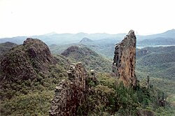
Warrumbungles view from Split Rock 4.jpgWarrumbungles!468.7000005649.000000531° 18′ 00″ S, 149° 00′ 00″ OSchildvulkan13–17 Millionen JahreJohn Seach
vnc.qld.edu.au
oregonstate.edu

Victoria

BildNameHöhe (m)Lage
Geo-Koordinaten
VulkantypLetzte EruptionAnmerkungen
Aberfeldy Volcano!462.2000005646.400000537° 48′ 00″ S, 146° 24′ 00″ O27 Millionen JahreJohn Seach
Bacchus Marsh Volcano!462.4000005644.400000537° 36′ 00″ S, 144° 24′ 00″ O55–64 Millionen JahreJohn Seach
Bogong Volcano1.986!462.9000005647.200000537° 06′ 00″ S, 147° 12′ 00″ O25–37 Millionen JahreJohn Seach
Bonang Volcano!462.8000005648.700000537° 12′ 00″ S, 148° 42′ 00″ O38–42 Millionen JahreJohn Seach
Lake Bullen Merri at Sunset.jpgLake Bullen Merri
(Newer Volcanics Province)
!461.7516675643.104444538° 14′ 54″ S, 143° 06′ 16″ OMaar22.000 Jahresydney.edu.au
Mount Buninyong.jpg
(c) Photograph by Longhair, CC BY 2.5
Mount Buninyong
(Newer Volcanics Province)
745!462.3500005643.900000537° 39′ 00″ S, 143° 54′ 00″ OSchlacken- und Aschenkegelvro.dpi.vic.gov.au
Lake Colongulac
Dargo
Crater of Mount Eccles (Victoria).jpgMount Eccles
(Newer Volcanics Province)
179!461.9300005641.920000538° 04′ 12″ S, 141° 55′ 12″ OSchichtvulkan6.000 – 19.000 JahreJohn Seach
Mount Elephant.jpgMount Elephant
(Newer Volcanics Province)
395!462.0400005643.200000537° 57′ 36″ S, 143° 12′ 00″ OSchlacken- und Aschenkegel5.000–20.000 Jahre
Flinders Volcano!461.5000005645.300000538° 30′ 00″ S, 145° 18′ 00″ O40–48 Millionen JahreJohn Seach
Mount Franklin
(Newer Volcanics Province)
635
Mount Fraser panorama.jpgMount Fraser
(Newer Volcanics Province)
!462.5400005644.970000537° 27′ 36″ S, 144° 58′ 12″ O34–43 Millionen Jahrevro.dpi.vic.gov.au
Gelantipy Volcano!462.8000005648.300000537° 12′ 00″ S, 148° 18′ 00″ O34–43 Millionen JahreJohn Seach
Lake Gnotuk
Mount Hamilton
MarysSlide.jpgMount Hotham1.861

!463.4100005647.080000536° 35′ 24″ S, 147° 04′ 48″ O

Mount-howitt-summit.jpgHowitt Volcano!462.8000005646.700000537° 12′ 00″ S, 146° 42′ 00″ O32–36 Millionen JahreJohn Seach
Lake Keilambete
(Newer Volcanics Province)
Mount Kooroocheang
(Newer Volcanics Province)
230Schlacken- und Aschenkegel
La Trobe Volcano!461.5000005646.300000538° 30′ 00″ S, 146° 18′ 00″ O50–59 Millionen JahreJohn Seach
Mount Leura
(Newer Volcanics Province)
311!461.7558335643.157500538° 14′ 39″ S, 143° 09′ 27″ O5.000–20.000 Jahre
Mount Macedon1.014!462.5900005644.580000537° 24′ 36″ S, 144° 34′ 48″ O360 Millionen Jahre
Mount Napier.jpgMount Napier
(Newer Volcanics Province)
440!462.2000005642.500000537° 48′ 00″ S, 142° 30′ 00″ OSchichtvulkan5.000 – 6.000 JahreJohn Seach
oregonstate.edu
Neerim Volcano!462.0000005646.000000538° 00′ 00″ S, 146° 00′ 00″ O20–25 Millionen JahreJohn Seach
Red rock panorama.jpgRed Rock
(Newer Volcanics Province)
200!461.7416675643.500000538° 15′ 30″ S, 143° 30′ 00″ OMaar 8.000 Jahrevro.dpi.vic.gov.au:
Mount Noorat
(Newer Volcanics Province)
3105.000–20.000 Jahre
Poowong (Vulkan)
Mount Porndon278

!461.8200005643.170000538° 10′ 48″ S, 143° 10′ 12″ O

300.000 Jahre
Lake Purrumbete
(Newer Volcanics Province)
Toombullup Volcano im Alpine-Nationalpark!463.1000005646.300000536° 54′ 00″ S, 146° 18′ 00″ O37–44 Millionen JahreJohn Seach
Tower Hill
(Newer Volcanics Province)
25.000 Jahre
Uplands Volcano!463.2000005647.600000536° 48′ 00″ S, 147° 36′ 00″ O2 Millionen JahreJohn Seach
Mount Warrenheip Victoria.jpgMount Warrenheip
(Newer Volcanics Province)
741!462.3500005643.933333537° 39′ 00″ S, 143° 56′ 00″ Ovro.dpi.vic.gov.au
Mount Warrnambool216

!461.8200005642.440000538° 10′ 48″ S, 142° 26′ 24″ O

2,2 – 0,57 Millionen Jahrevro.dpi.gov.au
Western Plains

South Australia

BildNameHöhe (m)Lage
Geo-Koordinaten
VulkantypLetzte EruptionAnmerkungen
Mt Burr summit.JPGMount Burr Range!462.4500005640.410000537° 33′ 00″ S, 140° 24′ 36″ OVulkanfeld20.000 Jahre
Newer Volcanics Province1,011!462.2300005642.500000537° 46′ 12″ S, 142° 30′ 00″ OVulkankomplex5000 JahreGlobal Volcanism Program
Mount Gambier Blue Lake.jpgMount Gambier
(Newer Volcanics Province)
190!462.1600005640.780000537° 50′ 24″ S, 140° 46′ 48″ OMaare4.500 JahreJohn Seach
oregonstate.edu
Mount Schank from Port MacDonnell road.jpgMount Schank
(Newer Volcanics Province)
158!462.2000005642.500000537° 48′ 00″ S, 142° 30′ 00″ OAschenkegel5.000 JahreJohn Seach
oregonstate.edu

Western Australia

Es gibt keinen aktiven Vulkan in Western Australia, allerdings einige erloschene und den geologischen Nachweis von weiteren. Neunzehn erloschene Vulkane gibt es im Tal des Fitzroy River in der Region von Kimberley, wie auch heiße Quellen, die möglicherweise mit der Aktivität erloschener Vulkane verbunden sind. Es gibt auch Vorkommen von Basalt bei Bunbury und Cape Gosselin.

BildNameHöhe (m)Lage
Geo-Koordinaten
VulkantypLetzte EruptionAnmerkungen
Argyle Diamond Mine - Worlds largest diamond mine.jpgArgyle Diamond Pipe!483.4000005628.300000516° 36′ 00″ S, 128° 18′ 00″ ODiatrema1,1 bis 1,2 Milliarden Jahreoregonstate.edu
Ellendale Volcano!482.5125005624.815000517° 29′ 15″ S, 124° 48′ 54″ ODiatrema20 – 22 Millionen Jahreoregonstate.edu

Heard und McDonald Islands

BildNameHöhe (m)Lage
Geo-Koordinaten
VulkantypLetzte EruptionAnmerkungen
Mount Dixon706John Seach
Heard.jpgBig Ben oder Mawson Peak2.745!446.8940005573.513000553° 06′ 22″ S, 073° 30′ 47″ OStratovulkan2004/2011John Seach
GVP
oregonstate.edu
McDonald-Inseln230!446.9700005572.600000553° 01′ 48″ S, 072° 36′ 00″ OKomplex2005John Seach
GVP

Lord Howe Island

BildNameHöhe (m)Lage
Geo-Koordinaten
VulkantypLetzte EruptionAnmerkungen
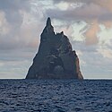
Ball's Pyramid North.jpgBall’s Pyramid562!468.5000005659.100000531° 30′ 00″ S, 159° 06′ 00″ OJohn Seach
oregonstate.edu
oregonstate.edu
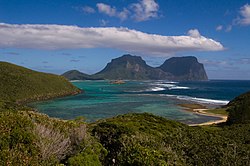
Lord Howe Island from North.jpgMount Gower875!468.5000005659.100000531° 30′ 00″ S, 159° 06′ 00″ O3.200 JahreJohn Seach
oregonstate.edu

Tasman Sea

BildNameHöhe (m)Lage
Geo-Koordinaten
VulkantypLetzte EruptionAnmerkungen
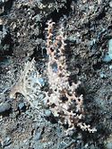
Stony Coral.jpgTasmanian Seamounts!455.7000005647.000000544° 18′ S, 147° 00′ OSubmarine VulkaneJohn Seach
csiro.au
Barcoo Seamount!467.7000005656.300000532° 18′ 00″ S, 156° 18′ 00″ OSubmariner VulkanJohn Seach
Britannia Seamount!472.1000005655.590000527° 54′ 00″ S, 155° 35′ 24″ OSubmariner VulkanJohn Seach
Derwent-Hunter Seamount!472.0100005655.590000527° 59′ 24″ S, 155° 35′ 24″ OSubmariner VulkanJohn Seach
Boozle.com
Gascoyne Seamount!463.3300005656.180000536° 40′ 12″ S, 156° 10′ 48″ OSubmariner VulkanJohn Seach
Heemskirk Seamount!463.7500005659.410000536° 15′ 00″ S, 159° 24′ 36″ OSubmariner VulkanJohn Seach
Queensland Seamount!472.5000005655.100000527° 30′ 00″ S, 155° 06′ 00″ OSubmariner VulkanJohn Seach
Soela SeamountJohn Seach
Taupo Seamount!467.8000005656.170000532° 12′ 00″ S, 156° 10′ 12″ OSubmariner VulkanJohn Seach
Zeehan Seamount!463.7500005659.911000536° 15′ 00″ S, 159° 54′ 40″ OSubmariner VulkanJohn Seach

Sonstige

BildNameHöhe (m)Lage
Geo-Koordinaten
VulkantypLetzte EruptionAnmerkungen
MacquarieIsland7.JPGMacquarie Island433!445.5000005658.950000554° 30′ 00″ S, 158° 57′ 00″ O10 Millionen JahreJohn Seach
Norfolk Island Captain Cook lookout.jpgNorfolk Island315!471.0000005668.000000529° 00′ 00″ S, 168° 00′ 00″ O2.4 Millionen Jahre
Murray Islands (Landsat).pngMurray Island200

!490.0000005644.000000510° 00′ 00″ S, 144° 00′ 00″ O

Schildvulkan1 Millionen JahreJohn Seach

Siehe auch

Weblinks

Einzelnachweise

  1. volcanodiscovery.com: Was ist der Unterschied in der Definition aktiver, schlafender, ausgelöschter Vulkan? Abgerufen am 15. Januar 2012

Auf dieser Seite verwendete Medien

Crater-Hypipamee.JPG
(c) ​English language Wikipedia Benutzer Peter Ellis, CC-BY-SA-3.0
The Crater - Hypipamee National Park, Atherton Tableland, Queensland, Australia This is the surface crater of a volcanic pipe or diatreme about 100m across. Its sheer walls have a water pool at the bottom. The pipe turns at a depth of some 80m underwater and tracks towards other volcanic formations in the region.
Crater of Mount Eccles (Victoria).jpg
"The crater itself is one of the most picturesque in Victoria, owing to the irregularity of its structure, the fanciful disposition of the timber on it declivitous slopes, and to the circumstance that a beautiful fresh water lake occupies the concavity in the centre, and the waters are of a brilliant green harmonizing with the hue of the surrounding vegetation."
Lake Bullen Merri at Sunset.jpg
Autor/Urheber: AJG061, Lizenz: CC-BY-SA-3.0
Lake Bullen-Merri at Sunset, Camperdown, Western Victoria, Australia
Mount Gambier Blue Lake.jpg
Autor/Urheber: Die Autorenschaft wurde nicht in einer maschinell lesbaren Form angegeben. Es wird Roo72 als Autor angenommen (basierend auf den Rechteinhaber-Angaben)., Lizenz: CC BY-SA 3.0
Mount Gambier - Blue Lake
Glasshouse mountain.jpg
Autor/Urheber: unknown, Lizenz: CC-BY-SA-3.0
Mount Napier.jpg
Mount Napier, Victoria, Australia
Mount Lindesay Queensland.jpg
Mount Lindesay, Queensland, Australia from a light plane
Red rock panorama.jpg
Autor/Urheber: Sean O'Brien, Lizenz: CC BY 2.5
Panorama from Red Rock, Victoria
Mount-howitt-summit.jpg
Autor/Urheber: Alex Cohen, Lizenz: CC BY-SA 3.0
The summit of Mount Howitt taken from West Peak
LakeMoogerah.jpg
Autor/Urheber: unknown, Lizenz: GPL
SnowyMountainsNSWTalbingoDam20050423a.JPG

en:Snowy Mountains Scheme: Talbingo Dam (April 2005)

Public domain Dieses Werk wurde von seinem Urheber AYArktos als gemeinfrei veröffentlicht. Dies gilt weltweit.

In manchen Staaten könnte dies rechtlich nicht möglich sein. Sofern dies der Fall ist:
AYArktos gewährt jedem das bedingungslose Recht, dieses Werk für jedweden Zweck zu nutzen, es sei denn, Bedingungen sind gesetzlich erforderlich.

Yidyam.jpg
Autor/Urheber: Originally uploaded by Bruceanthro (Transferred by rr2000), Lizenz: CC BY-SA 3.0
This is a photo I took in May 2007 from a viewing platform on the lake's edge. Bruceanthro 23:50, 8 November 2007 (UTC)
Mount Elephant.jpg
Autor/Urheber: Savelephant in der Wikipedia auf Englisch, Lizenz: CC0
Subject: Mount Elephant. Updated Photo.

Date: 20.10.10 Photographer: Ivor Coster

Website: http://www.mountelephant.weebly.com
Murrurundi NSW.JPG
Autor/Urheber: Cgoodwin, Lizenz: CC BY-SA 3.0
New England Highway, Murrurundi, NSW, with the Liverpool Range in the background
Warrumbungles view from Split Rock 4.jpg
Autor/Urheber: Diceman, Lizenz: CC BY-SA 3.0
Warrumbungle National Park panorama created with Autopano.
Mount fox 01-10-06.jpg
Autor/Urheber: Originally uploaded by Bmhcjs (Transferred by rr2000), Lizenz: CC-BY-SA-3.0
Bmhcjs 01:06, 5 November 2006 (UTC)
Mount Kaputar.jpg
Forests on the north west slopes of Mount Kaputar. View of the park from the top of Mount Kaputar, oriented approximately west
Gulaga from Montague Island2.jpg
Gulaga Mountain from Kato 3, near Montague Island
AthertonTableland.jpg
Autor/Urheber: Mike Lehmann, Lizenz: CC-BY-SA-3.0
McHugh lookout, Atherton Tableland, Queensland, Australia
Heard.jpg
Heard Island
Ball's Pyramid North.jpg
Autor/Urheber: Fanny Schertzer, Lizenz: CC BY-SA 4.0
Ball’s Pyramid, 13 miles South of Lord Howe Island.
Mount Buninyong.jpg
(c) Photograph by Longhair, CC BY 2.5
en:Mount Buninyong, en:Victoria, Australia. Photograph taken by myself.
Argyle Diamond Mine - Worlds largest diamond mine.jpg
Autor/Urheber: Tom Backus, Lizenz: CC BY-SA 2.0
The open pit of the Argyle Diamond Mine near Kununurra, Australia. This is the biggest diamond mine in the world; the dump truck in the foreground is four stories tall.
The Breadknife.jpg
Photo taken February 20, 1995
MarysSlide.jpg
Autor/Urheber: Chris Solnordal, Lizenz: CC-BY-SA-3.0
View of Mt Hotham ski fields after 20 cm fresh snowfall, featuring the notable ski run "Mary's Slide".
Mount Warrenheip Victoria.jpg
Autor/Urheber: Peterdownunder, Lizenz: CC BY-SA 3.0
Mount Warrenheip, an inactive volcano, looking east from Lake Wendouree, Ballarat, Victoria, Australia
Tibrogargan.jpg
Autor/Urheber: Cyron Ray Macey aus Brisbane (-27.470963,153.026505), Australia, Lizenz: CC BY 2.0
A photo of Mount Tibrogargan, taken from a moving train on the way to Australia Zoo
Tibrogargan
MtBarney.jpg
Mount Barney, Queensland, Australia looking towards south west
Mt Burr summit.JPG
Autor/Urheber: Fairv8, Lizenz: CC BY-SA 3.0
The radio, TV, communications and fire watch towers on top of Mount Burr to the east of Millicent, South Australia
Lord Howe Island from North.jpg
Autor/Urheber: Fanny Schertzer, Lizenz: CC BY 2.5
View on Mount Lidgbird and Mount Gower from Mount Eliza.
Mount Canobolas.jpg
Autor/Urheber: w:User:Tirin, Lizenz: CC-BY-SA-3.0

Photo of Mount Canobolas, from the Pinnacles. Photo taken August 2005 by Takver and released under the GNU FDL

Mont Canobolas, en Nouvelle Galles du Sud en Australie
Murray Islands (Landsat).png
Murray Islands, Torres Strait Islands, Queensland, Australia. Islands: Murray Island (north), Dowar Islet (southwest), Wyer Islet (south)
MtCoonowrin.jpg
Autor/Urheber: Felix Andrews, Lizenz: CC-BY-SA-3.0
Mt Coonowrin (Crookneck). Taken from the road in to Mt Beerwah. Glass House Mountains National Park, Queensland, Australia.
Stony Coral.jpg
Stony coral of the species Solenosmilia variabilis.
Mount Fraser panorama.jpg
Autor/Urheber: Peterdownunder, Lizenz: CC BY-SA 3.0
View of Mount Fraser, Victoria. Mount Fraser is an extinct volcano, near Beveridge, Victoria, Australia.