Liste von Vulkanen im Iran
Dies ist eine Liste von Vulkanen im Iran, die während des Quartärs mindestens einmal aktiv waren.
| Bild | Name | Provinz | Vulkantyp | Höhe [m] | Koordinaten | Letzter Ausbruch |
|---|---|---|---|---|---|---|
 | Bazman | Sistan und Belutschistan | Schichtvulkan | 3490 | 28° 4′ N, 60° 0′ O | unbekannt |
 | Damavand | Māzandarān | Schichtvulkan | 5604 | 35° 57′ N, 52° 7′ O | 5350 v. Chr. ± 200 Jahre |
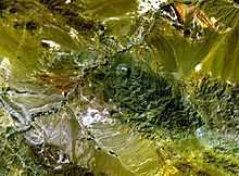
 | Qal'eh Hasan Ali | Kerman (Provinz) | Vulkanfeld | unbekannt | 29° 24′ N, 57° 34′ O | unbekannt |
 | Sabalan | Ardabil (Provinz) | Schichtvulkan | 4811 | 38° 15′ N, 47° 55′ O | Holozän |
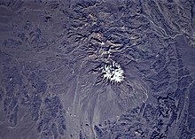
 | Kuh-e Sahand | Ost-Aserbaidschan | Schichtvulkan | 3707 | 37° 45′ N, 46° 26′ O | Holozän |
 | Taftan | Sistan und Belutschistan | Schichtvulkan | 3940 | 28° 36′ N, 61° 8′ O | Holozän |
| (Unbenannt) | West-Aserbaidschan | Vulkanfeld | unbekannt | 39° 15′ N, 45° 10′ O | Holozän | |
| (Unbenannt) | Sistan und Belutschistan | Vulkanfeld | unbekannt | 28° 10′ N, 60° 40′ O | unbekannt |
Siehe auch
Weblinks
Auf dieser Seite verwendete Medien
OOjs UI icon mapPin-progressive.svg
(c) OOjs UI Team and other contributors, MIT
An icon from the OOjs UI MediaWiki lib.
(c) OOjs UI Team and other contributors, MIT
An icon from the OOjs UI MediaWiki lib.
SahandNASA.jpg
NASA Space Shuttle image of Sahand, a massive eroded stratovolcano in northwestern Iran. Top of image is NW.
NASA Space Shuttle image of Sahand, a massive eroded stratovolcano in northwestern Iran. Top of image is NW.
Taftan.jpg
Taftan volcano in eastern Iran.
Taftan volcano in eastern Iran.
BazmanNASA.jpg
NASA Space Shuttle image of Bazman (Kuh-e Bazman), a 3490-m-high stratovolcano in a remote and arid region in SE Iran. A well-preserved, 500-m-wide crater caps the summit of the volcano. Sistan and Baluchestan Province, Iran
NASA Space Shuttle image of Bazman (Kuh-e Bazman), a 3490-m-high stratovolcano in a remote and arid region in SE Iran. A well-preserved, 500-m-wide crater caps the summit of the volcano. Sistan and Baluchestan Province, Iran
Damavand in winter.jpg
Mount Damavand in winter, Iran.
Mount Damavand in winter, Iran.
Qal'eh Hasan Ali.jpg
The circular crater near the center of this NASA Landsat image (with north to the top) is the largest maar of the Qal'eh Hasan Ali volcanic field in SE Iran.
The circular crater near the center of this NASA Landsat image (with north to the top) is the largest maar of the Qal'eh Hasan Ali volcanic field in SE Iran.


