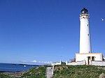
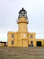
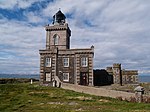
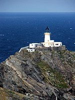
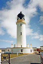
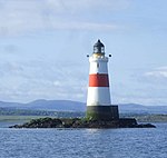
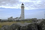
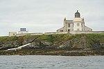
Liste von Leuchttürmen in Schottland
Diese Liste umfasst die aktiven Leuchttürme und Leuchtfeuer in Schottland. Sie werden vom Northern Lighthouse Board verwaltet und betreut, das auch für die Leuchttürme der Isle of Man zuständig ist.
Liste
| Name | Standort | Verwaltungsregion | Bild |
|---|---|---|---|
| Ailsa Craig Lighthouse | Ailsa Craig (55° 15′ 6,8″ N, 5° 6′ 30,3″ W) | South Ayrshire | (c) James T M Towill, CC BY-SA 2.0 |
| An t-Iasgair Lighthouse | An t-Iasgair (57° 41′ 6,5″ N, 6° 25′ 56,8″ W) | Highland | |
| Ardencaple Castle Light | Helensburgh (56° 0′ 32,7″ N, 4° 45′ 25″ W) | Argyll and Bute |  |
| Ardmore Lighthouse | nahe Tobermory (56° 39′ 21,6″ N, 6° 7′ 42,9″ W) | Argyll and Bute | (c) Alan Stewart, CC BY-SA 2.0 |
| Ardnamurchan Lighthouse | Ardnamurchan Point (56° 43′ 37,5″ N, 6° 13′ 33,5″ W) | Highland |  |
| Ardtornish Lighthouse | Sound of Mull (56° 31′ 5,2″ N, 5° 45′ 12,7″ W) | Highland | (c) Peter Bond, CC BY-SA 2.0 |
| Ardtreck Lighthouse | Ardtreck Point (57° 20′ 22,1″ N, 6° 25′ 52,5″ W) | Highland | (c) John Allan, CC BY-SA 2.0 |
| Auskerry Lighthouse | Auskerry (59° 1′ 33,7″ N, 2° 34′ 20,2″ W) | Orkney | (c) Des Colhoun, CC BY-SA 2.0 |
| Bagi Stack Lighthouse | Yell (60° 43′ 29″ N, 1° 7′ 35″ W) | Shetland | (c) Mike Pennington, CC BY-SA 2.0 |
| Barns Ness Lighthouse | nahe Dunbar (55° 59′ 14,1″ N, 2° 26′ 42,8″ W) | East Lothian | (c) Steve F, CC BY-SA 2.0 |
| Barra Head Lighthouse | Barra Head (56° 47′ 7,7″ N, 7° 39′ 12,5″ W) | Äußere Hebriden | (c) Bob Jones, CC BY-SA 2.0 |
| Barrel of Butter Lighthouse | Barrel of Butter (58° 53′ 25,5″ N, 3° 7′ 35,1″ W) | Orkney | (c) George Brown, CC BY-SA 2.0 |
| Bass Rock Lighthouse | Bass Rock (56° 4′ 36,6″ N, 2° 38′ 28,6″ W) | East Lothian | (c) Lisa Jarvis, CC BY-SA 2.0 |
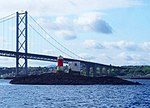
| Beamer Rock Lighthouse | nahe North Queensferry (56° 0′ 16,8″ N, 3° 24′ 44,4″ W) | Fife | (c) Simon Johnston, CC BY-SA 2.0 |
| Bell Rock Lighthouse | Inchcape (56° 26′ 3,1″ N, 2° 23′ 14,3″ W) | Angus | (c) Derek Robertson, CC BY-SA 2.0 |
| Bressay Lighthouse | Kirkabister (60° 7′ 11,8″ N, 1° 7′ 16,9″ W) | Shetland |  |
| Brough of Birsay Lighthouse | Brough of Birsay (59° 8′ 12,8″ N, 3° 20′ 20,7″ W) | Orkney |  |
| Buchan Ness Lighthouse | Boddam (57° 28′ 13,7″ N, 1° 46′ 27,8″ W) | Angus |  |
| Bullia Skerry Lighthouse | Bullia Skerry (60° 6′ 39,2″ N, 1° 21′ 34,2″ W) | Shetland | |
| Butt of Lewis Lighthouse | Butt of Lewis (58° 30′ 56,2″ N, 6° 15′ 40,2″ W) | Äußere Hebriden | (c) Anne Burgess, CC BY-SA 2.0 |
| Cantick Head Lighthouse | nahe Longhope (58° 47′ 13,4″ N, 3° 7′ 52,8″ W) | Orkney | (c) Calum McRoberts, CC BY-SA 2.0 |
| Cape Wrath Lighthouse | Cape Wrath (58° 37′ 31,6″ N, 4° 59′ 55,8″ W) | Highland | (c) Christine Matthews, CC BY-SA 2.0 |
| Chanonry Lighthouse | Fortrose (57° 34′ 26,6″ N, 4° 5′ 33,7″ W) | Highland | (c) Andy Jamieson, CC BY-SA 2.0 |
| Cloch Point Lighthouse | Gourock (55° 56′ 32,5″ N, 4° 52′ 43,3″ W) | Inverclyde | (c) william craig, CC BY-SA 2.0 |
| Copinsay Lighthouse | Copinsay (58° 53′ 46,9″ N, 2° 40′ 19,4″ W) | Orkney | (c) Dave Simpson, CC BY-SA 2.0 |
| Corsewall Lighthouse | Kirkcolm (55° 0′ 27″ N, 5° 9′ 29″ W) | Dumfries and Galloway | (c) wfmillar, CC BY-SA 2.0 |
| Covesea Skerries Lighthouse | Lossiemouth (57° 43′ 27″ N, 3° 20′ 19″ W) | Moray | (c) Phil Williams, CC BY-SA 2.0 |
| Cromarty Lighthouse | Cromarty (57° 40′ 58,9″ N, 4° 2′ 11,3″ W) | Highland | (c) Tom Richardson, CC BY-SA 2.0 |
| Davaar Lighthouse | Davaar (55° 25′ 41,6″ N, 5° 32′ 25,7″ W) | Argyll and Bute | (c) Leslie Barrie, CC BY-SA 2.0 |
| Dubh Artach Lighthouse | Dubh Artach (56° 8′ 0″ N, 6° 38′ 0″ W) | Argyll and Bute | (c) Donald MacDonald, CC BY-SA 2.0 |
| Duncansby Head Lighthouse | Duncansby Head (58° 38′ 38,5″ N, 3° 1′ 30,4″ W) | Highland | (c) Chris Downer, CC BY-SA 2.0 |
| Dunnet Head | Dunnet Head (58° 38′ 38,5″ N, 3° 1′ 30,4″ W) | Highland | (c) Ike Gibson, CC BY-SA 2.0 |
| Dunollie Lighthouse | Oban (56° 25′ 22,5″ N, 5° 29′ 2,8″ W) | Argyll and Bute |  |
| Eilean Glas Lighthouse | Scalpay (57° 51′ 24,8″ N, 6° 38′ 31,4″ W) | Äußere Hebriden | (c) simon stewart, CC BY-SA 2.0 |
| Elie Ness Lighthouse | Elie and Earlsferry (56° 11′ 2,2″ N, 2° 48′ 46″ W) | Fife | (c) Jim Bain, CC BY-SA 2.0 |
| Esha Ness Lighthouse | Northmavine (60° 29′ 21,5″ N, 1° 37′ 38″ W) | Shetland | (c) Robert Sandison, CC BY-SA 2.0 |
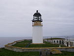
| Fair Isle North | Fair Isle (59° 33′ 7,7″ N, 1° 36′ 34,3″ W) | Shetland | (c) Dave Wheeler, CC BY-SA 2.0 |
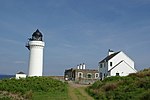
| Fair Isle South | Fair Isle (59° 30′ 50″ N, 1° 39′ 8,8″ W) | Shetland | (c) Ron Ireland, CC BY-SA 2.0 |
| Fidra Lighthouse | Fidra (56° 4′ 23,5″ N, 2° 47′ 6,5″ W) | East Lothian | (c) Richard Webb, CC BY-SA 2.0 |
| Fife Ness Lighthouse | Fife Ness (56° 16′ 43,9″ N, 2° 35′ 9,1″ W) | Fife | (c) Anne Burgess, CC BY-SA 2.0 |
| Flannan Isles Lighthouse | Flannan Isles (58° 17′ 17,1″ N, 7° 35′ 16,5″ W) | Äußere Hebriden | (c) JJM, CC BY-SA 2.0 |
| Foula Lighthouse | Foula (60° 6′ 44,5″ N, 2° 3′ 50,3″ W) | Shetland | (c) Julian Paren, CC BY-SA 2.0 |
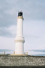
| Girdle Ness Lighthouse | Aberdeen (57° 8′ 20,6″ N, 2° 2′ 54,8″ W) | Aberdeen | (c) Chris Downer, CC BY-SA 2.0 |
| Holburn Head Lighthouse | Scrabster (58° 36′ 52,7″ N, 3° 32′ 21,7″ W) | Highland | 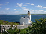 |
| Hoxa Head Lighthouse | nahe Hoxa (58° 49′ 18,7″ N, 3° 2′ 5″ W) | Orkney | (c) Bill Boaden, CC BY-SA 2.0 |
| Hoy Sound High Lighthouse | Graemsay (58° 56′ 8,4″ N, 3° 16′ 23,5″ W) | Orkney |  |
| Hoy Sound Low Lighthouse | Graemsay (58° 56′ 25,4″ N, 3° 18′ 36,1″ W) | Orkney | (c) John Winterbottom, CC BY-SA 2.0 |
| Hyskeir Lighthouse | Hyskeir (56° 58′ 9,7″ N, 6° 40′ 49,6″ W) | Highland | (c) Fin'n'Liz, CC BY-SA 2.0 |
| Inchkeith Lighthouse | Inchkeith (56° 1′ 59,6″ N, 3° 8′ 11,9″ W) | Fife | (c) ronnie leask, CC BY-SA 2.0 |
| Isle of May Lighthouse | Isle of May (56° 11′ 8,3″ N, 2° 33′ 26,9″ W) | Fife | (c) John Clive Nicholson, CC BY-SA 2.0 |
| Killantringan Lighthouse | Portpatrick (54° 51′ 42,6″ N, 5° 8′ 49,1″ W) | Dumfries and Galloway | (c) Paul Jenkins, CC BY-SA 2.0 |
| Kinnaird Head Lighthouse | Fraserburgh (57° 41′ 52,7″ N, 2° 0′ 16″ W) | Aberdeenshire | (c) UK Payphone Directory, CC BY-SA 2.0 |
| Lady Isle Lighthouse | Lady Isle (55° 31′ 38,3″ N, 4° 44′ 2,1″ W) | South Ayrshire | (c) Richard Webb, CC BY-SA 2.0 |
| Lismore Lighthouse | Eilean Musdile (56° 27′ 20″ N, 5° 36′ 26,7″ W) | Argyll and Bute | (c) phil smith, CC BY-SA 2.0 |
| Loch Eriboll Lighthouse | Loch Eriboll (58° 31′ 0,5″ N, 4° 38′ 54,3″ W) | Highland | (c) david glass, CC BY-SA 2.0 |
| Low Light Lighthouse | Isle of May (56° 11′ 8,2″ N, 2° 32′ 59,4″ W) | Fife | (c) John Clive Nicholson, CC BY-SA 2.0 |
| Monach Island Lighthouse | Shillay (57° 31′ 33,2″ N, 7° 41′ 42,2″ W) | Äußere Hebriden | (c) Bob Jones, CC BY-SA 2.0 |
| Muckle Flugga Lighthouse | Muckle Flugga (60° 51′ 19,5″ N, 0° 53′ 7,4″ W) | Shetland | |
| Mull of Galloway Lighthouse | Mull of Galloway (54° 38′ 6″ N, 4° 51′ 26,8″ W) | Dumfries and Galloway | (c) Christine Matthews, CC BY-SA 2.0 |
| Mull of Kintyre Lighthouse | Mull of Kintyre (55° 18′ 37,5″ N, 5° 48′ 11,7″ W) | Argyll and Bute | (c) Patrick Mackie, CC BY-SA 2.0 |
| Neist Point Lighthouse | Neist Point (57° 25′ 24,5″ N, 6° 47′ 17,7″ W) | Highland | (c) Richard Dorrell, CC BY-SA 2.0 |
| Newhaven Lighthouse | Edinburgh (55° 58′ 56,3″ N, 3° 11′ 47,5″ W) | Edinburgh | (c) G Laird, CC BY-SA 2.0 |
| North Ronaldsay Lighthouse | North Ronaldsay (59° 23′ 22,9″ N, 2° 22′ 52,9″ W) | Orkney | (c) Rob Burke, CC BY-SA 2.0 |
| Noss Head Lighthouse | Noss Head (58° 28′ 44,9″ N, 3° 3′ 2,8″ W) | Highland | (c) Sarah Charlesworth, CC BY-SA 2.0 |
| Noup Head Lighthouse | Noup Head (59° 19′ 51,9″ N, 3° 4′ 13,2″ W) | Orkney | (c) John Tustin, CC BY-SA 2.0 |
| Ornsay Lighthouse | Ornsay (57° 8′ 36,3″ N, 5° 46′ 51,7″ W) | Highland | (c) John Allan, CC BY-SA 2.0 |
| Out Skerries Lighthouse | Bound Skerry (60° 25′ 28″ N, 0° 43′ 41,1″ W) | Shetland | (c) joost, CC BY-SA 2.0 |
| Oxcars Lighthouse | Firth of Forth (56° 1′ 20,8″ N, 3° 16′ 48,8″ W) | Fife | (c) Simon Johnston, CC BY-SA 2.0 |
| Pentland Skerries Lighthouse | Muckle Skerry (58° 41′ 24,2″ N, 2° 55′ 28,2″ W) | Orkney | (c) George Brown, CC BY-SA 2.0 |
| Pladda Lighthouse | Pladda (55° 25′ 30″ N, 5° 7′ 5,7″ W) | North Ayrshire | (c) Tony Page, CC BY-SA 2.0 |
| Port Ellen Lighthouse | The Oa (55° 37′ 12,9″ N, 6° 12′ 42,1″ W) | Argyll and Bute |  |
| Rattray Head Lighthouse | nahe Crimond (57° 36′ 36,6″ N, 1° 48′ 58,9″ W) | Aberdeenshire | (c) Anne Burgess, CC BY-SA 2.0 |
| Rhinns of Islay Lighthouse | Orsay (55° 40′ 23″ N, 6° 30′ 47,2″ W) | Argyll and Bute | (c) Thomas Keetley, CC BY-SA 2.0 |
| Rhuvaal Lighthouse | Ruvaal (55° 56′ 10,9″ N, 6° 7′ 24,4″ W) | Argyll and Bute | (c) Tom Richardson, CC BY-SA 2.0 |
| Rona Lighthouse | Rona (57° 34′ 41,3″ N, 5° 57′ 32,6″ W) | Highland | (c) Calum McRoberts, CC BY-SA 2.0 |
| Rua Reidh Lighthouse | nahe Melvaig (57° 34′ 41,3″ N, 5° 57′ 32,6″ W) | Highland |  |
| Saeva Ness Lighthouse | Helliar Holm (59° 1′ 8″ N, 2° 54′ 3,6″ W) | Orkney | (c) Des Colhoun, CC BY-SA 2.0 |
| Sanda Lighthouse | Sanda (55° 16′ 29,5″ N, 5° 34′ 57,8″ W) | Argyll and Bute | (c) David Robson, CC BY-SA 2.0 |
| Scurdie Ness Lighthouse | Montrose (56° 42′ 6,4″ N, 2° 26′ 14,2″ W) | Angus |  |
| Skerryvore Lighthouse | Skerryvore (56° 19′ 4″ N, 7° 6′ 9″ W) | Argyll and Bute | 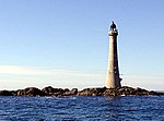 |
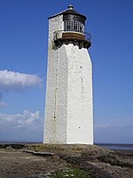
| Southerness Lighthouse | Southerness (54° 52′ 22,2″ N, 3° 35′ 42,1″ W) | Dumfries and Galloway | (c) Arthur Bruce, CC BY-SA 2.0 |
| St Abb’s Head Lighthouse | St Abb’s Head (55° 54′ 58,6″ N, 2° 8′ 19,7″ W) | Scottish Borders | 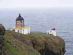 |
| Start Point Lighthouse | Sanday (59° 16′ 38,5″ N, 2° 22′ 33,3″ W) | Orkney | (c) Beth Loft, CC BY-SA 2.0 |
| Stoer Head Lighthouse | nahe Raffin (58° 14′ 24,1″ N, 5° 24′ 9,7″ W) | Highland | (c) Hilmar Ilgenfritz, CC BY-SA 2.0 |
| Strathy Point Lighthouse | Strathy (58° 35′ 56,1″ N, 4° 1′ 6,9″ W) | Highland | (c) Rog Frost, CC BY-SA 2.0 |
| Stroma Lighthouse | Stroma (58° 41′ 45,1″ N, 3° 7′ 0″ W) | Highland | (c) Ron Ireland, CC BY-SA 2.0 |
| Sule Skerry Lighthouse | Sule Skerry (59° 5′ 4,9″ N, 4° 24′ 26,4″ W) | Orkney | (c) Michael Earnshaw, CC BY-SA 2.0 |
| Sumburgh Head Lighthouse | Sumburgh Head (59° 51′ 14,6″ N, 1° 16′ 28,5″ W) | Shetland | (c) Nicholas Mutton, CC BY-SA 2.0 |
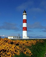
| Tarbat Ness Lighthouse | nahe Portmahomack (57° 51′ 54,3″ N, 3° 46′ 35,5″ W) | Highland | (c) Kirsty Jarman, CC BY-SA 2.0 |
| Tiumpan Head Lighthouse | Tiumpan Head (58° 15′ 39,3″ N, 6° 8′ 20,1″ W) | Äußere Hebriden | (c) Stephen Branley, CC BY-SA 2.0 |
| Tod Head Lighthouse | nahe Kinneff (56° 53′ 1,7″ N, 2° 12′ 55″ W) | Aberdeenshire | (c) Trish Steel, CC BY-SA 2.0 |
| Tor Ness Lighthouse | nahe Melsetter (58° 46′ 41,8″ N, 3° 17′ 47″ W) | Orkney | (c) Calum McRoberts, CC BY-SA 2.0 |
| Turnberry Lighthouse | Turnberry (55° 19′ 33,4″ N, 4° 50′ 39,9″ W) | South Ayrshire | (c) Mary and Angus Hogg, CC BY-SA 2.0 |
| Ushenish Lighthouse | South Uist (57° 17′ 54,3″ N, 7° 11′ 34,2″ W) | Äußere Hebriden | |
| Uyea Sound Lighthouse | Uyeasound (60° 41′ 8,3″ N, 0° 55′ 27″ W) | Shetland | (c) Mike Pennington, CC BY-SA 2.0 |
| Valia Sound Lighthouse | nahe Whiteness (60° 11′ 57,5″ N, 1° 33′ 27,7″ W) | Shetland | |
| Ve Skerries Lighthouse | Ve Skerries (60° 22′ 23,2″ N, 1° 48′ 44,1″ W) | Shetland | |
| Waternish Point Lighthouse | Waternish Point (57° 36′ 27,9″ N, 6° 38′ 2,9″ W) | Highland |  |
| Weavers Point Lighthouse | Weavers Point (57° 36′ 29,5″ N, 7° 5′ 59,3″ W) | Äußere Hebriden | (c) James Allan, CC BY-SA 2.0 |
| Wether Holm Lighthouse | Wether Holm (60° 22′ 20,6″ N, 1° 1′ 19,8″ W) | Shetland | |
| Whitehill Lighthouse | Yell (60° 34′ 47,8″ N, 1° 0′ 12,8″ W) | Shetland | (c) Alan Bowring, CC BY-SA 2.0 |
Weblinks
- Lighthouse Library. Northern Lighthouse Board, abgerufen am 30. September 2014 (englisch).
- Russ Rowlett: The Lighthouse Directory. University of North Carolina at Chapel Hill, abgerufen am 30. September 2014 (englisch).
Auf dieser Seite verwendete Medien
(c) OOjs UI Team and other contributors, MIT
An icon from the OOjs UI MediaWiki lib.
(c) Sarah Charlesworth, CC BY-SA 2.0
Lighthouse at Noss Head over a Caithness Stone Flag Wall
(c) UK Payphone Directory, CC BY-SA 2.0
Kinnaird Head Lighthouse, Fraserburgh, Aberdeenshire
(c) George Brown, CC BY-SA 2.0
Muckle Skerry Lighthouse Muckle Skerry lighthouse seen from the perimeter wall. Completed in 1794, it was the first lighthouse built by Robert Stevenson and T Smith. It originally consisted of two light towers but this was changed to a more powerful single light in 1895. The main lighthouse is 36 metres high. It became automated in 1994.
(c) Smith609 in der Wikipedia auf Englisch, CC BY 2.5
Photograph taken from Unst mainland cliffs by Verisimilus T as per description below.
(c) Anne Burgess, CC BY-SA 2.0
Fife Ness Lighthouse. Located at the easternmost point of Fife, marking the north side of the entrance to the Firth of Forth. An example of a low-rise lighthouse. The dark hut below and to the right is a birdwatching hide. Large numbers of birds pass close by just offshore on migration every spring and autumn.
(c) Kirsty Jarman, CC BY-SA 2.0
Tarbat Ness Lighthouse
(c) Anne Burgess, CC BY-SA 2.0
Rattray Head Lighthouse. The lighthouse and the rocks it stands on are the only land in this square. The GPS told me I was in square when I took the shot, which is just as well because the tide was rising and the rocky causeway is amazingly slippery!
(c) Chris Downer, CC BY-SA 2.0
Duncansby Head: the lighthouse The Pentland Skerries can be seen in the distance.
(c) JJM, CC BY-SA 2.0
St. Flannan's Cell and Flannan Isles Lighthouse. Here is the source of one of the world's great mysteries for at the turn of the century three lightkeepers disappeared without trace.
Autor/Urheber: Kevan Dickin, Lizenz: CC BY-SA 3.0
Scurdie Ness Lighthouse, Montrose Angus, Scotland
(c) william craig, CC BY-SA 2.0
Cloch Lighthouse Showing the old Buildings
Autor/Urheber: Chmee2, Lizenz: CC BY-SA 3.0
Lighthouse on the Isle of Brough of Birsay, Orkney, Scotland
(c) Christine Matthews, CC BY-SA 2.0
Mull of Galloway Lighthouse
Autor/Urheber: Emoscopes, Lizenz: CC BY-SA 3.0
w:St Abb's Head lighthouse
(c) Bob Jones, CC BY-SA 2.0
The lighthouses on Shillay, Monach Islands/Heisgeir.
The old lighthouse became redundant in 1942; the newer light was installed in 1997.(c) Stephen Branley, CC BY-SA 2.0
Tiumpan Head Lighthouse Tiumpan Head Lighthouse sits on the NE tip of the Eye Peninsula on the Isle of Lewis. It was brought into service on 1st December 1900 at a cost of approximately £9000, stands 21m (69') high and was eventually automated in 1985.
(c) Beth Loft, CC BY-SA 2.0
Start Point Lighthouse, en:Sanday, Orkney, taken on the 200th anniversary of the light's commencement of operations.
(c) Michael Earnshaw, CC BY-SA 2.0
The lighthouse on Sule Skerry
Sule Skerry is one of the remotest lighthouses off the north coast of Scotland. It was first operational in 1895.
There is a large bank of solar panels, facing south of course. But I imagine that in these northern locations they provide only a small amount of the energy needed to run the light.(c) Nicholas Mutton, CC BY-SA 2.0
Sumburgh Head lighthouse
(c) Des Colhoun, CC BY-SA 2.0
Saeva Ness lighthouse on Helliar Holm.
(c) Robert Sandison, CC BY-SA 2.0
Eshaness Lighthouse
(c) Bill Boaden, CC BY-SA 2.0
Modern lighthouse and older defences above Scarf Skerry
(c) Mary and Angus Hogg, CC BY-SA 2.0
Turnberry Lighthouse
(c) Dave Wheeler, CC BY-SA 2.0
Fair Isle North Lighthouse. Midsummer midnight. Looking towards the Shetland Mainland from Fair Isle
(c) joost, CC BY-SA 2.0
Bound Skerry Lighthouse The characteristic Out Skerries lighthouse can be seen from almost anywhere on the islands. It is located on a small rocky island named Bound Skerry, the most easterly island of the Skerries.
(c) Calum McRoberts, CC BY-SA 2.0
Cantick Head Lighthouse and cottages A light that was first exhibited on 15th July 1858 and was automated in 1991.
Autor/Urheber:
Der ursprünglich hochladende Benutzer war Stephen Mackenzie in der Wikipedia auf Englisch
A view of the tower of Ardencaple Castle, the former seat of the Clan MacAulay. Now used to house navigation lights for sea vessels.
(c) Steve F, CC BY-SA 2.0
Baroness lighthouse Light established 1901 discontinued 27th October 2005, height 36m.
Autor/Urheber: Richard Harvey, Lizenz: CC BY-SA 3.0
Hoy High Lighthouse, Graemsay, Orkney Islands.
(c) John Winterbottom, CC BY-SA 2.0
Graemsay and Hoy from Hoy Sound. Taken from the ferry in Hoy Sound this shows the Point of Oxan lighthouse on Graemsay with Ward Hill (479m) and Cuilags (433m)on the Hoy skyline.
(c) Mike Pennington, CC BY-SA 2.0
Uyeasound light The small beacon at the west entrance to Uyea Sound.
Autor/Urheber: Andrew, Lizenz: CC BY 2.0
The lighthouse at Waternish Point, Skye, Scotland
(c) John Clive Nicholson, CC BY-SA 2.0
Lighthouse on the Isle of May
(c) Mike Pennington, CC BY-SA 2.0
Coast between Aastack Geo and Bagi Stack The north-west corner of Yell, with the small light on the un-named headland above Bagi stack. The light is misplaced on both 1:50,000 and 1:25,000 maps, but according to Google Earth, magic.gov.uk (and this photo) it is in this square and on this un-named headland. Taken from one of the Yell Sound ferries on a North Isles cruise.
(c) Fin'n'Liz, CC BY-SA 2.0
Oigh Sgier. Island of Hyskeir (Oigh Sgier) showing lighthouse (built in 1904 - by Stevenson family). Basaltic rocks visible in the distance. Island is covered by ground nesting seabirds.
(c) Hilmar Ilgenfritz, CC BY-SA 2.0
Stoer Head Lighthouse in Sutherland. The former keepers' accommodation is now a hostel and a small exhibition.
(c) Andy Jamieson, CC BY-SA 2.0
Chanonry point lighthouse
(c) Rob Burke, CC BY-SA 2.0
North Ronaldsay Lighthouse.
(c) Rog Frost, CC BY-SA 2.0
The Light House at Strathy Point.
(c) John Allan, CC BY-SA 2.0
Ardtreck Point The light on the point is an active aid to shipping at the mouth of Loch Harport. This current light is solar powered and was built in 2002.
Autor/Urheber: Finavon, Lizenz: CC BY 3.0
Rua Reidh Lighthouse near Gairloch, Wester Ross, Scotland
Autor/Urheber: Gestumblindi, Lizenz: CC0
Holburn Head Lighthouse near Scrabster Harbour, Scotland.
(c) Dave Simpson, CC BY-SA 2.0
Copinsay Lighthouse
(c) Richard Webb, CC BY-SA 2.0
Lady Isle Lighthouse. Ayrshire landmark, used whenever The Open is at Troon as a scenic backdrop for the scorecard on television. The island is very small made of a gabbro like igneous rock and is very hard to walk upon. Landing is discouraged for most of the year, by the elements in winter and to protect the nesting birds throughout the summer. In September the remains of the nesting season could be seen along with a big roost of teal. The guano fertilises the soil and the resulting lush vegetation hides the treacherous boulder fields below. Even with the lighthouse, the island still claims shipping, there was the remains of a "gin palace" scattered all over one shore.
(c) Alan Stewart, CC BY-SA 2.0
Ardmore lighthouse. At least partially powered by solar panels, which seems a bit optimistic given Mull's climate. I do admit it looks ok in this picture but about half an hour after this was taken, the heavens opened and it poured for a couple of hours.
(c) Arthur Bruce, CC BY-SA 2.0
Southerness Lighthouse.
(c) Simon Johnston, CC BY-SA 2.0
Beamer Rock Navigation marker and light on Beamer Rock. The strata of this rocky Dolerite outcrop may one day hold one of the stanchions of the proposed new bridge over the Forth.
http://www.lighthousedepot.com/lite_explorer.asp?action=display_details&LighthouseID=4026
As viewed from the bridge https://www.geograph.org.uk/photo/1296517 at high tide although this rock isn't always covered and at low tide one can expect a completely different appearance and a fuller figure http://maps.live.com/default.aspx?v=2&FORM=LMLTCP&cp=tb0q71gqg3q1&style=b&lvl=2&tilt=-90&dir=0&alt=-1000&phx=0&phy=0&phscl=1&scene=28417241&encType=1Author: Ron Steenvoorden. I made this picture from the Port Ellen Lighthouse in 2004. The original can be found here: http://www.islayinfo.com/islaywallpaper/portellenlighthouse.html
(c) G Laird, CC BY-SA 2.0
Newhaven Lighthouse The entrance to Newhaven harbour is just to the left of the lighthouse.
(c) Trish Steel, CC BY-SA 2.0
Tod Head Lighthouse The light was first exhibited on 20 December 1897 and the fog signal came into operation on 28 April 1898. Tod Head was permanently discontinued with effect from 11 July 2007.
(c) Chris Downer, CC BY-SA 2.0
Girdle Ness lighthouse
(c) Phil Williams, CC BY-SA 2.0
Heather at Covesea Lighthouse A view looking to the west over heather in the grounds of Covesea lighthouse.
(c) Donald MacDonald, CC BY-SA 2.0
Dubh Artach Lighthouse
(c) Alan Bowring, CC BY-SA 2.0
Whitehill Lighthouse This low light stands about 70ft above the sea and looks north to Hascosay and east to Fetlar.
Autor/Urheber: Jim Anderson, Chairman, West Lothian SAC, Lizenz: CC BY-SA 3.0
Skerryvore lighthouse
(c) Richard Dorrell, CC BY-SA 2.0
Neist Point lighthouse The building contractor for the lighthouse and dwellings was W. Hugh MacDonald from Oban. The building cost was £4,350.
The lantern was made by Dove & Co., costing £1,100 and the lightroom machine, made by Milne & Co.,cost £418. The light tower is 43 metres tall, and the light can be seen from 16 miles distance. The light began operation on 1st November 1909 but the fog signal, which has since been discontinued, was not completed until 25th June 1910. The station was converted to automatic operation in 1990 and the lightkeepers withdrawn.
The lightkeepers accommodation is now offered as self catering holiday accommodation.(c) Ike Gibson, CC BY-SA 2.0
Dunnet Head Lighthouse
(c) simon stewart, CC BY-SA 2.0
Eilean Glas lighthouse Scalpay.
(c) Lisa Jarvis, CC BY-SA 2.0
Bass Rock lighthouse, Firth of Forth, Scotland
(c) Derek Robertson, CC BY-SA 2.0
Bell Rock Lighthouse. Situated 11 miles out from Arbroath the lighthouse was built by Robert Stevenson in 1811, upon the infamous Inchcape reef. At high water the reef is hidden about 12 foot below the water level, at low water it is 4 foot above the sea.
(c) George Brown, CC BY-SA 2.0
Navigation Light, Barrel of Butter, Scapa Flow. Common and Atlantic Grey seals can be spotted on this rocky skerry.
(c) Calum McRoberts, CC BY-SA 2.0
Tor Ness Lighthouse (A3600) Looking over a memorial cross from a narrow spit of land with an exposed drop on either side. The light was built in 1937.
(c) Ron Ireland, CC BY-SA 2.0
Stroma Lighthouse (or Swilkie Point lighthouse) with Pentland Firth & Orkney in distance. Stroma, Pentland Firth, Scotland
(c) Ron Ireland, CC BY-SA 2.0
Fair Isle South light Note the German bomb crater on right of picture, it was the third of a stick of four, the fourth hit the lighthouse accommodation killing one of the keepers wife. Still visible today.
(c) Bob Jones, CC BY-SA 2.0
Entrance to Dun Sron an Duin, Berneray
Autor/Urheber: Mkonikkara, Lizenz: CC BY-SA 3.0
Buchan Ness lighthouse
(c) Anne Burgess, CC BY-SA 2.0
Butt of Lewis Lighthouse The lighthouse buildings are instantly recognisable, being in the standard style used all over Scotland by the Commissioners of Northern Lights. They are always whitewashed with the window surrounds picked out in yellow.
(c) Tom Richardson, CC BY-SA 2.0
Cromarty Lighthouse
(c) Patrick Mackie, CC BY-SA 2.0
Mull of Kintyre Lighthouse. The stone-walled structure, "Harvey's Acres", shelters the crops and keeps sheep out of the keeper's vegetable garden.
(c) John Tustin, CC BY-SA 2.0
Noup Head Lighthouse Solar panels are clearly visible and there is plenty of sunshine today.
(c) wfmillar, CC BY-SA 2.0
Corsewall Hotel, The Rhins
Autor/Urheber: Grynneman, Lizenz: CC BY 2.0
Ardnamurchan Point Lighthouse built in an egyptian style by Robert Louis Stephensons father.
(c) david glass, CC BY-SA 2.0
Loch Eriboll Lighthouse The small lighthouse on the East side of Loch Eriboll.
(c) Richard Webb, CC BY-SA 2.0
Fidra Lighthouse Surrounded by herring gulls and their young, this was one of the first lighthouses to be automated in 1971.
(c) phil smith, CC BY-SA 2.0
Lismore Lighthouse. The lighthouse at the southwest end of Lismore actually stands on the islet Eilean Musdile. It marks the southern entrance to the Sound of Mull.
Autor/Urheber: Hajotthu at de.wikipedia, Lizenz: CC BY 3.0
Bressay Lighthouse, Shetland Islands, Scotland
(c) ronnie leask, CC BY-SA 2.0
Inchkeith Lighthouse, Firth of Forth Inchkeith Lighthouse was erected by Thomas Smith & lighted on 14th September 1804. Thomas Smith was step father of Robert Stevenson, founder of the famous family of lighthouse builders, and grandfather of Robert Louis Stevenson.
(c) Calum McRoberts, CC BY-SA 2.0
Lighthouse, South Rona
Sign of lighthouse to use in map's legend
(c) Simon Johnston, CC BY-SA 2.0
Oxcars Lighthouse. At high tide these rocks are covered. 118759
(c) Peter Bond, CC BY-SA 2.0
Lighthouse, Ardtonish Point This is how it looked in 1996.
(c) Tom Richardson, CC BY-SA 2.0
Rhuvaal Lighthouse
(c) James T M Towill, CC BY-SA 2.0
Ailsa Craig Lighthouse
(c) James Allan, CC BY-SA 2.0
Weavers Point Lighthouse on Rubha an Fhigheadair, North Uist, with a small islet, Madadh Beag in the foreground
(c) David Robson, CC BY-SA 2.0
Sanda Island Lighthouse. Sand Island lighthouse standing on a rocky promontory known as the ship, on the south side of Sanda at a height of 50 metres.
